We lay in bed in our camper listening to the sounds of a waking world: the tap tap tap of spoons on cereal bowls, the street sweeper out on the street and the local pigeons singing their repetitive song.
Once we were clear to go inside and not interrupt the morning routine we headed in for showers, breakfast and a cuppa before heading onwards.
We stopped at the local camping shop to fill our empty gas bottle and take a look at a fire pit for sale there-one that Matt has been involved in making. It even has marlin vents in the base! Then a quick scenic tour of the centre of town and out to the highway. Our fellow campers will be just meeting at Port Wakefield.
We know how to take a long time to get not very far. Who could resist a very long jetty and super-clear water on a hot day? The people of Port Germein have put in great signage to read and interesting historical objects.these included a giant clock face that used to indicate depth in the channel at Port Pirie.
We walked out as far as allowed (the last little bit is closed off). We had a good chat with some kids and their Dad enjoying the good life-jumping off the jetty and catching crabs. The kids wanted to tell us all about it.
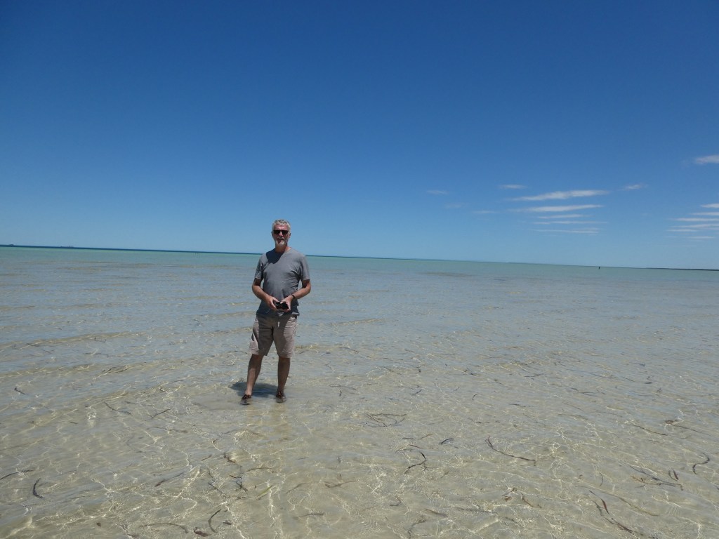
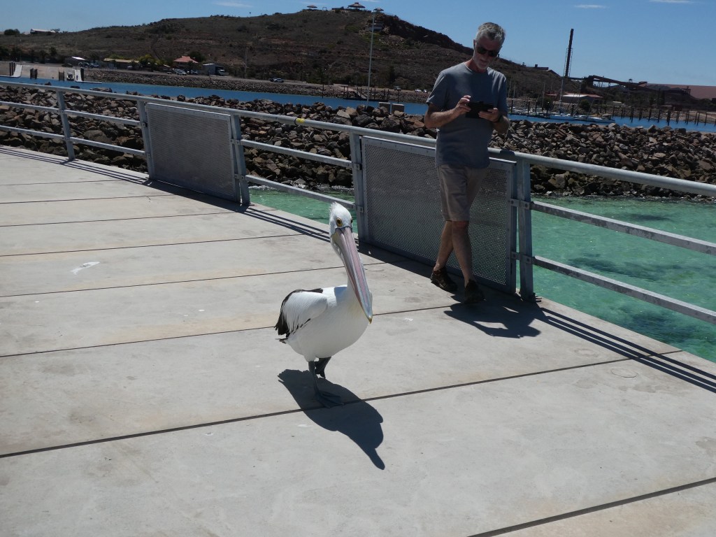
By 3 pm we were pulling out of Whyalla, having had a paddle in the shallow water and another jetty stroll ( this time on the new circular jetty). The tide was well out and the water was beautiful. A pelican got close and personal.
This rig had us feeling very small and basic. I bet they have room galore in their fridge.
The last jetty walk for the day was at Cowell. Their sparkling new marina has 2 boats currently berthed. There is a fantastic public water park including a giant tipping cup,water slide and a bouncy cushion.
We sat under the verandah at the pub sipping on cold drinks and catching up on the day’s news before investigating the Main Street and catching up with the other four, who had arrived in town.
After a pub meal together we wandered back to their digs and took them up on their kind offer of a bedroom for the night. The temp was still pretty warm and sleeping in the van wasn’t going to be much fun so this seemed a much better option. Tomorrow night should be much cooler.
It’s been a while since we’ve had a chance to take off in the camper. Have we forgotten how to do it?
I have certainly forgotten how little I can fit in a 42 litre fridge.
After a final goodbye to part of the family we were on the road just before 1pm and heading north.
The first stop was Vili’s on Main North Road. That’s goodbye to the healthy diet already. (although I did resist Trev’s kind invitation to share his chocolate doughnut)
Next was a stop for cheaper fuel at Virginia where we added 60 litres of fuel before continuing north via Mallala and Balaklava. The burnt trees from the pinery fire are still visible but now less obvious eight years on.
We glimpsed the bright blue of the Owen silo art as we drove on by.
With the BOM telling us the temp was 36.1 and the sun blazing in through the window we made a cuppa stop under the shade of the big pine trees at Red Hill. That poor farmer is still trying to get the work finished with his horse!
And then just a bit later we rolled in to Port Pirie where we will stay with good friends for the night.
The weather forecast is looking good. It will be hot tomorrow as we travel but then it looks like it will be cooler.
We had a lovely night sitting chewing the fat with good friends and keeping them from their work and sleep.
I think he’s a rock star. But he looks a bit suspect up against the board at the old Port Adelaide Police station at the start of a history tour of Port Adelaide. I look worse though – dressed in the gear of the time.
We started our tour at the information centre on Commercial Rd. (the site of the original police station) and the old cells are still out the back. Five old cells, still with the old metal doors and wooden benches to sleep on. Boy they look uncomfortable.
We browsed the art exhibition by De Greer-Yindimincarlie while we waited to start the walk.
We headed out with our guide, Tracey, hoping that the rain would hold off for the walk. She took us around the local vicinity. We started at the workers memorial statue – a memorial to activists who have made a difference to conditions over the years. Names only get added after someone has died, but recognise those still, who have fitted that picture over the years.
Did you know that the water level here used to be much higher? Actually the land level used to be much lower. The land has been built up over the years so that there is no longer a canal at the end of Commercial road like in this old map.
You can see the canal at the start of Commercial Rd in this picture. This is all now land. A small bridge used to span the canal at the far (river) end
You can see how the idea of a canal into the city would have seemed a natural progression- hence the extra wide Port Road. People used to have to wade across the mud flats from the boats at Port Adelaide to get to land. When you look at some of the old buildings you can see the lower level is half below street level due to the built up level of the roads. Half doors and windows are visible. Pulleys were used to hoist loads to the upper levels of this bond building.
This old building also shows the wooden uprights by the front door to stop the carts from backing up to the stone itself.
There were many artworks around the place, including a very permanent sign showing the way to the information centre! Some of them actually move if you use a certain app!
A number of buildings had large decorative corner stones like the ones below. They reminded me of the stipple quilting you sometimes see on large patches of background on a quilt.
A number of the buildings also have these signs way up on the walls. They are to remind cart and carriage drivers that they need to get off and walk their carriage around the corner to avoid trampling pedestrians.
The lighthouse used to be one of two situated at the end of the river (sea end) and was then used on Neptune Island for many years. It was purchased by the maritime museum and placed to its current position. The lamp floats on mercury.
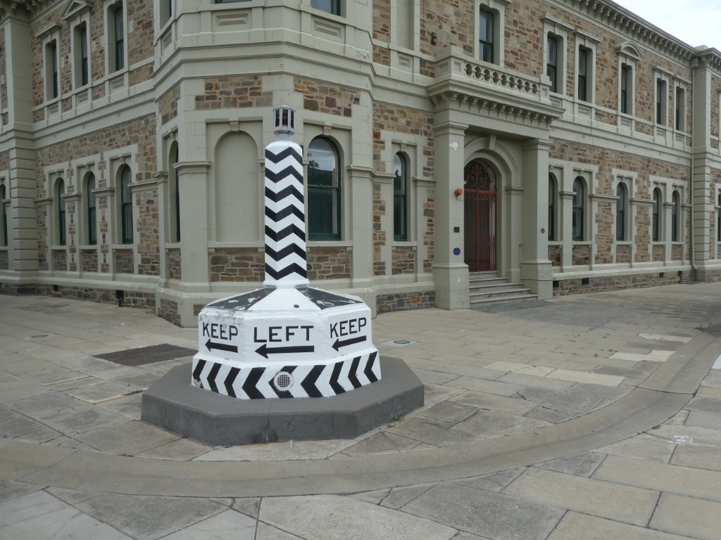
The old “silent cop” roundabout that originally stood in the middle of Black Diamond corner is now a little further up the road. I loved this photo of the chaos on the corner. It doesn’t look like it worked very well.
Black Diamond corner was called that because the coal carts would rush around here and coal would fall off as they did so. The people who could not afford to buy coal could go there and pick some up if they were lucky. They call this black diamonds.
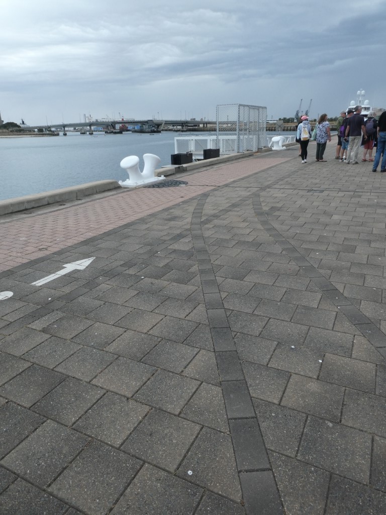
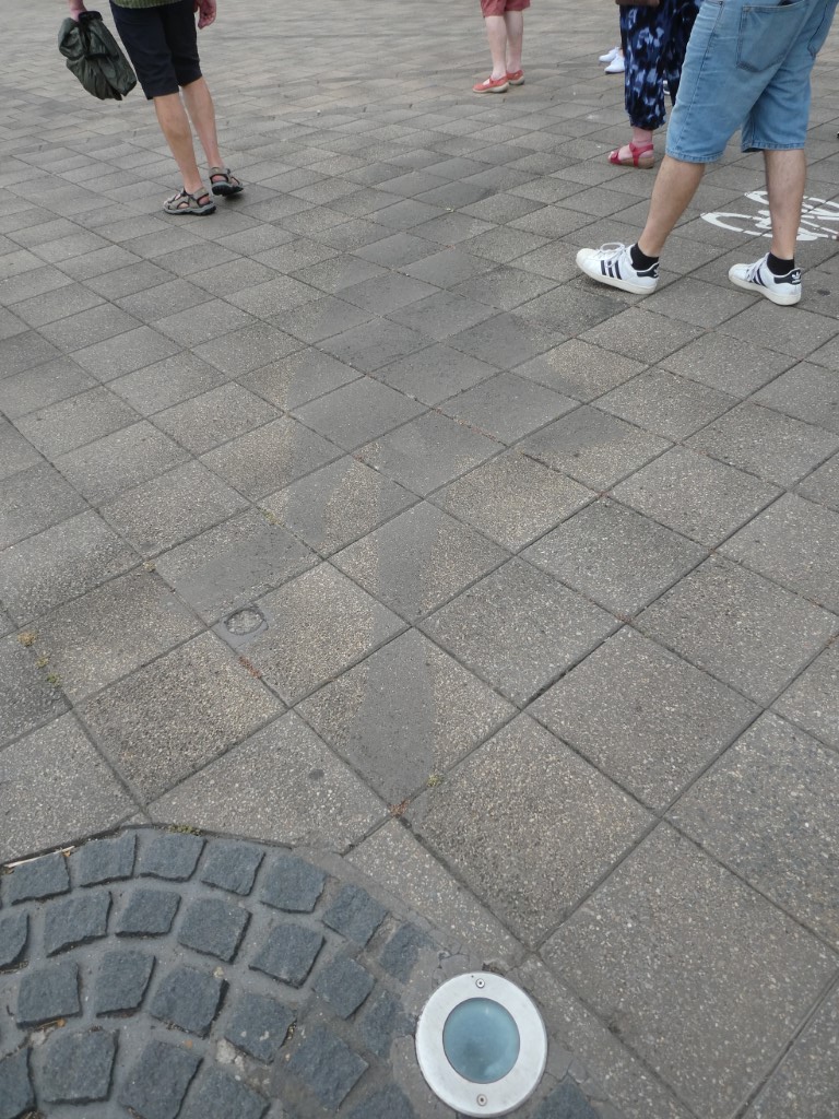
The paving along the side of the river has some sweet nods to the past if you know where to look. The old rail tracks are echoed in the paving and there are also some silhouettes of people. A lady waving goodbye with her handkerchief is possibly the easiest to see. Can you make these out in the pictures?
There was a very fancy yacht berthed just up a little way. Apparently there is very tight security around who owns it but it is rumoured to be Jay Alix , and American billionaire. It is supposed to be worth $110 million. I would hate to have people standing and staring at my floating home all the time.
The empty space on the wharves still has hoarding up around it advertising that the Rydges hotel will be opening in 2022. I doubt that this will happen as there is no sign of any action at present and it is almost December 2022!
Further down Lipson street we stopped to look at the site that used to be the railway station but is now the new police station. The old water fountain still stands outside it.
Here the first female police officers in the Commonwealth were employed (at wages equal to men’s) including Annie Ross and Kate Cocks. They had to wear their own clothes (no uniforms) and to work 10 hour shifts 7 days a week. A whole female police force was later formed. Kate is the grey haired lady in the front centre of the photo below and was famous for her work with unmarried mothers and their children. The Kate Cocks Babies Home was named in her honour.
We finished our little adventure with a visit to the historic Mayfair bakery for a pie before heading on home again.
This was an interesting little walk , not strenuous at all and we learned a bit too. Thanks to Tracey, our guide, for your time and effort in sharing your knowledge with us.
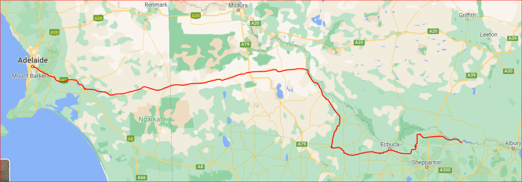
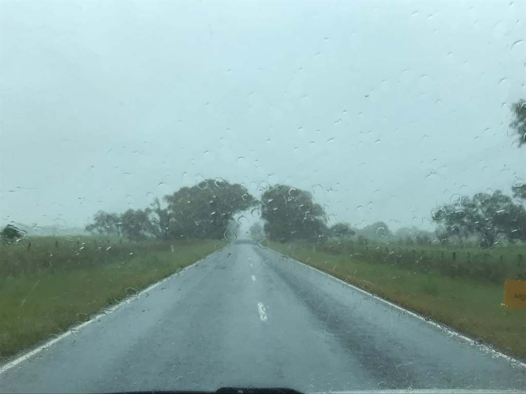
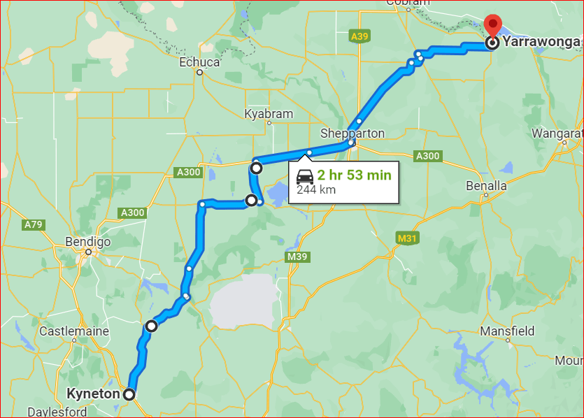
Little did either of us realise what a long day it was going to be as we set off from Yarrawonga at about 9.30am. There had been plenty of predictions of heavy rain in the last day or so, so we were aware that we would have wet roads and prepared to take it as easy as we needed to, and to stop if required. We figured we would play it by ear, but took the thermos filled and the remaining food with us, and we had a full container of water in the back of the Prado, so we knew we could keep ourselves going fine for a few days if we happened to get stranded somewhere. It was a bit of a pity about that broken shovel.
We took the Murray Valley Highway to Cobram (following the Murray River) and then, since we intended to hopefully drop in at our relatives, near Bordertown , on the way home, we headed to Echuca and then west from there instead of staying along the river. All this way we had rain. We had packed up in the rain, and the radar was showing that we had plenty to come, but were, at present, in a lighter patch of rain than the areas around us. Sadly, the areas we were heading for had already received some huge dumpings and there was much more to come.
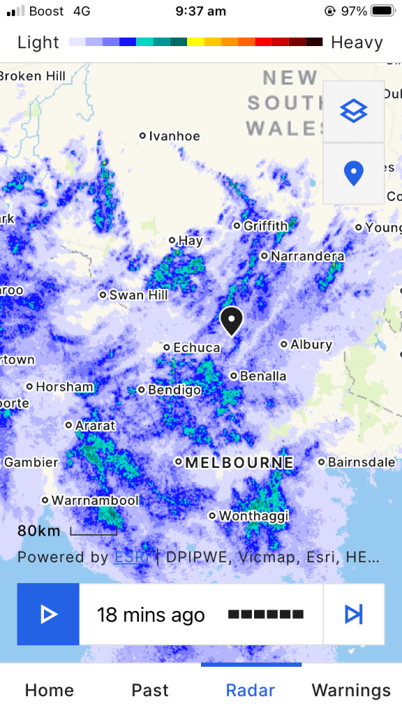
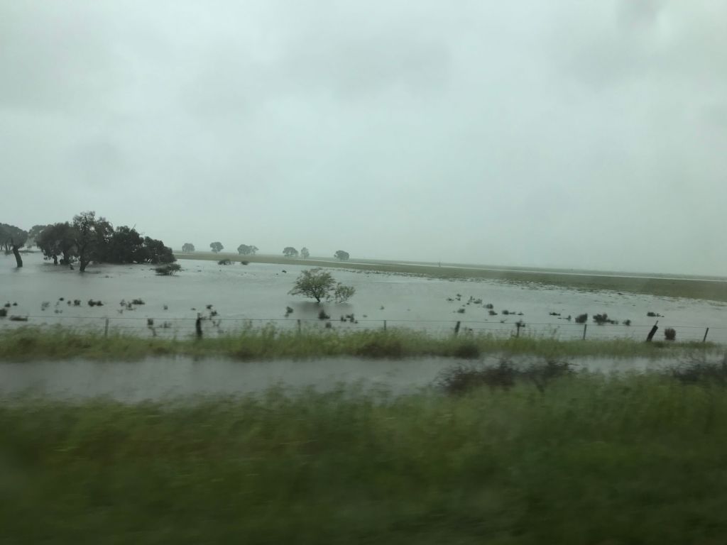
As we headed across from Echuca on the C334 and then on to Boort (where we stopped for lunch) we started to see more and more water on the road and on the sides of the road. Sometimes the paddocks looked like lakes. They certainly weren’t needing their irrigation flowing from the Murray at the moment. We drove past ducks, a turtle and, (something we don’t remember seeing before) frogs(!!!) jumping across the road. Apologies for poor quality photos taken through wet car window on phone as we moved along.
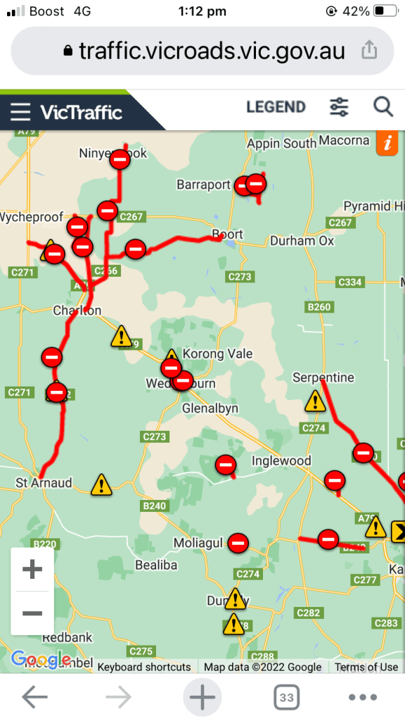
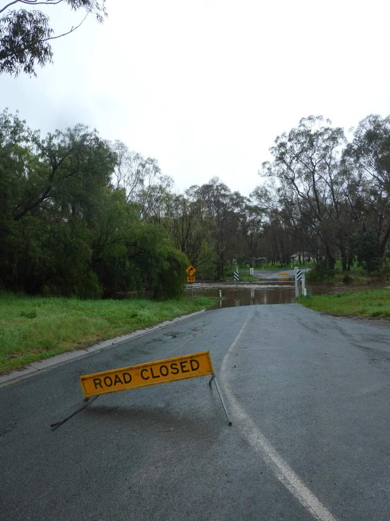
We looked for a bakery in Boort for lunch but the only thing that looked promising was a cafe, so we made a mad dash from the car to the shelter of the verandah and past the rubber boots and work boots which had been left outside the door and made our way into a warm and welcoming spot called “Audrey’s of Boort”. The ladies here fed us a delicious lunch but also warned us of local road closures, showed us the Vic Traffic page (which we used after that) and advised that the best strategy to get home was probably to head up to Kerang.
very useful Vic Roads site showing that the road from Boort to Wedderburn is closed, road to Charlton(our intended route) is closed and road across to Wycheproof is also closed.
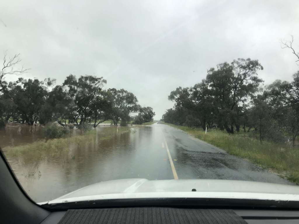
Taking their excellent advice we headed north, and could see on the Vic Traffic page that even heading west a little higher up there were floods near Sealake, so we took the prudent way and sucked up a few more km for the sake of safety, scrapping the idea of visiting the rellies this trip. In actual fact, the route up to Kerang and then on to Swan Hill was quite interesting and bears a revisit at some stage. There is a string of lakes in this area and a string of forest/park areas as well. There is an Ibis Rookery that you can take a look at and it appears to be quite a holiday destination. We must investigate more closely at some stage. We also crossed our longest section of water across the road here (note water almost up to fence height) and saw a policeman trying to unblock a drain on the side of the road in the pouring rain at one point.
We turned west at Piangil and took the long, wet road to Ouyen. It was still raining, but the roads were not so wet. We pulled in at Ouyen to make a cuppa and use the local loos before deciding to go on. By this stage I was thinking we could stop for the night, but Trevor was feeling fine and it was only another 373km to home so we travelled onwards.
As we came towards the SA border, finally, we glimpsed light patches on the horizon, and then (just before 5pm) we were reaching for the sunglasses as we emerged into bright sunshine. Seven-plus hours of rain with reduced visibility and noisy rattling on roof and windows was more than enough. The fruit fly check found no problems with our small stock of food (no fresh fruit and veg on board because we had eaten our remaining baby tomatoes as a snack earlier) and waved us on after a cursory check of fridge and car. In Pinnaroo the road was actually dry as we drove through.
We waved at the red thino at Tailem Bend as we sailed past and admired the Murray as we came over the bridge at Murray Bridge, before hitting another rainstorm as we made our way home through the Adelaide Hills.
Trevor had one more surprise in store for me: Instead of trying to find something for tea at home, he pulled into a park at our local Thai place, trudged inside and ordered my favourite meal. (Crispy Garlic Beef). It was Trevor that deserved the reward, so I shared mine with him.
A well-earned glass of red to go with dinner
Then the last 1km to home. We had passed a number of big things on the way (Big Strawberry, Cherry, Murray Cod and Olive) and covered 875km in one very wet day. It was good to be home in our own beds in our own house.
We spend $511.30 on fuel and drove 2666km on this trip and the Prado didn’t miss a beat.
I think we were in need of a rest. We had a lovely sleep in, then caught up with our friend Maurice for a few hours. This was a much better chat than we had managed at the sprint event a few days prior. It was unlucky for him that he had to make another trip to Bendigo from ACT due to car troubles the previous weekend, but every cloud has a silver lining and this was the lining for us.
Trevor still got stir crazy and needed to go out for a walk, so I sent him out on his own to explore some more on the 10th. He did another 6km walk, crossing the weir to NSW, cutting through the club grounds and coming back across the main bridge. He even spotted a delightful pub for us to visit later.
We had a good chat with our lovely niece Kate (can’t believe she is 17) for her birthday as we sat in the sunshine, sipping red wine and eating cheese and crackers.
We have eaten cooked breakfast twice while we have been here – once pancakes and once eggs and bacon cooked by the staff here at the resort. We had to set our alarms to get to breakfast by 9am as we seem to have developed even worse sleeping habits while away. Maybe getting home to our normal routine will fix that.
We caught up with Kaye (an old school friend of Erica’s) for lunch one day and had a really good catch up on what we have been doing with our lives in the 40 or so years since we were at school together. (but forgot to take a photo)
One of our fellow residents came knocking on the door to let us know that he had backed into us in the carpark, but there seems to be damage to his car and not ours. His wife wasn’t too happy with him.
The rain is back and is predicted to be plentiful tomorrow as we head for home, so we are hoping that we manage to miss the worse of it as we drive. It might be a slow and careful drive and I doubt that we will use the swags on the way home.
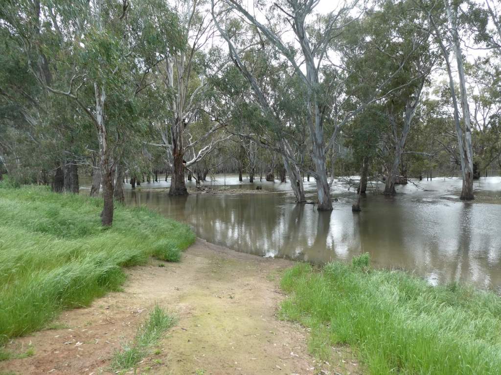
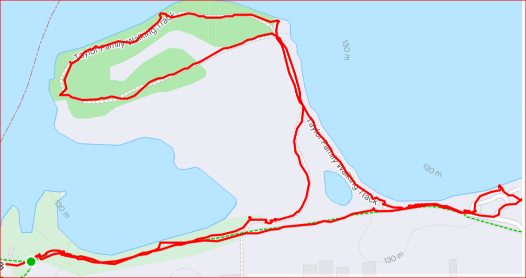
Every picture tells a story. Looking at the map above you can see where we hoped to walk (all the tracks shown) and where we managed to get to.
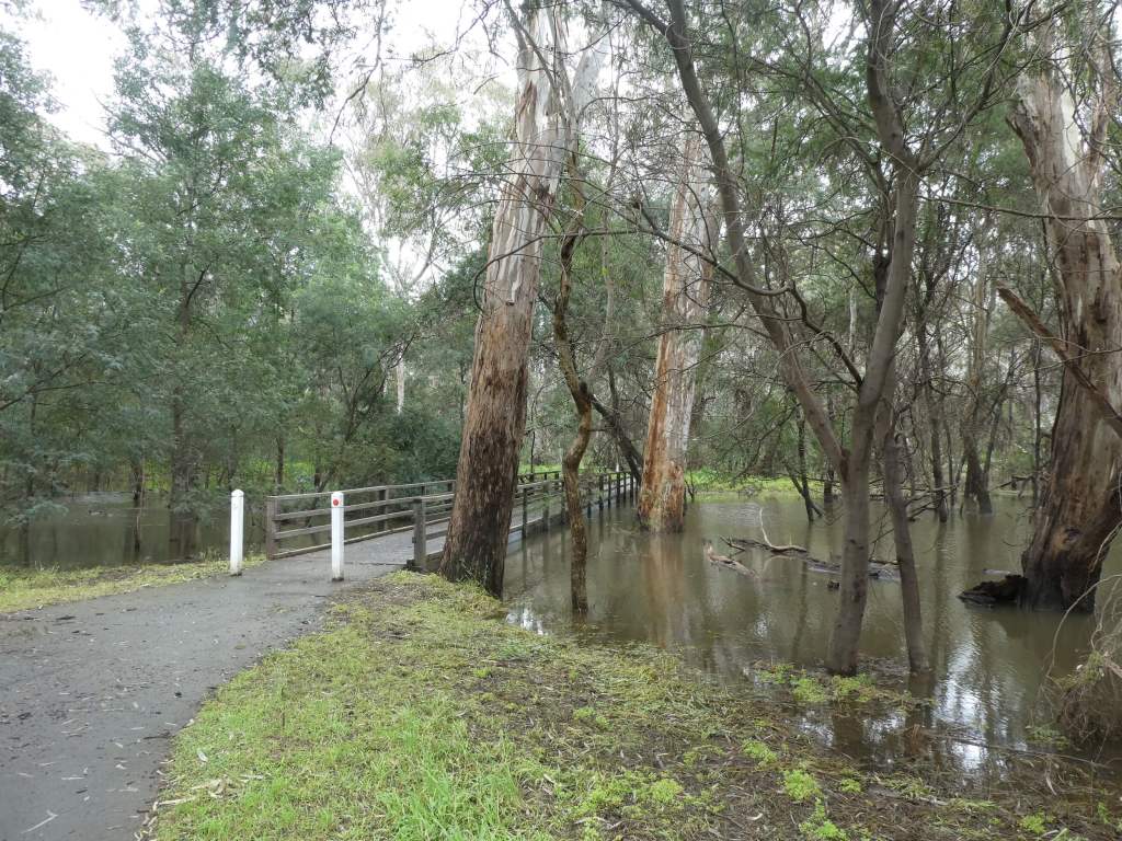
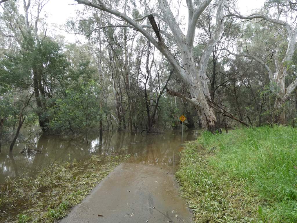
We parked the car and walked in OK from the end of the road, but every track we tried ended up in the water.
It was interesting to get a close up view of Vetch growing supported by Canola.
There were also some pretty river views when we were near enough to admire them.
There were also some very clear roo tracks in the soft ground for us to discuss.
In normal times there might be some very good camping down here, but at the moment you can’t even get to the campsites as far as we could see (except maybe by boat).
If you managed it , there were some pretty clear instruction about the fire building rules.
We gave up on this area for a walk and decided to come back some other time when the river is not so high.
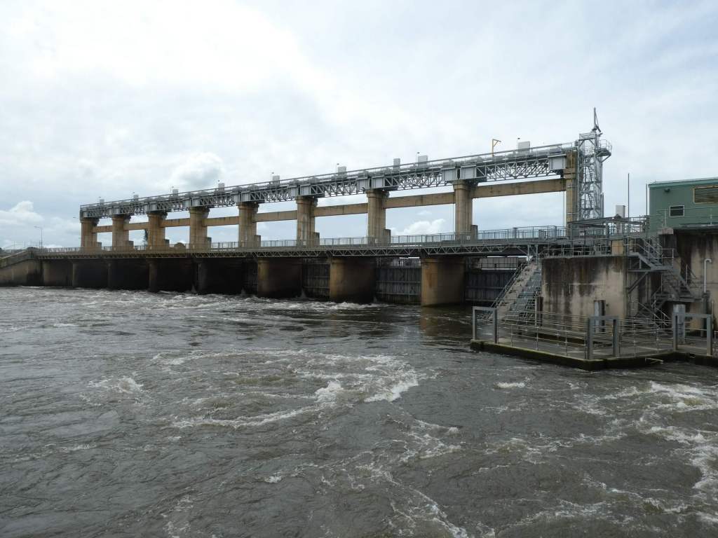
The Yarrawonga Weir was constructed between 1935 and 1939 and formed Lake Mulwala. The twin towns of Yarrawonga (on the Victorian side of the River Murray) and Mulwala (on the NSW side) are linked by a narrow bridge. Most of the facilities are on the Victorian side of the river. You can just imagine what it must have been like for towns like these when the borders were closed due to Covid.
In 1994 a fish elevator was also constructed here and, for the first time in 60 years, fish could again travel upstream from this point. This is electronically controlled.
The hydro-electric power station here (built in 1992) is unmanned and controlled remotely by staff at the AGL Hydro Mount Beauty control centre. It generates about 9 MegaWatts of power to the Victorian Grid.
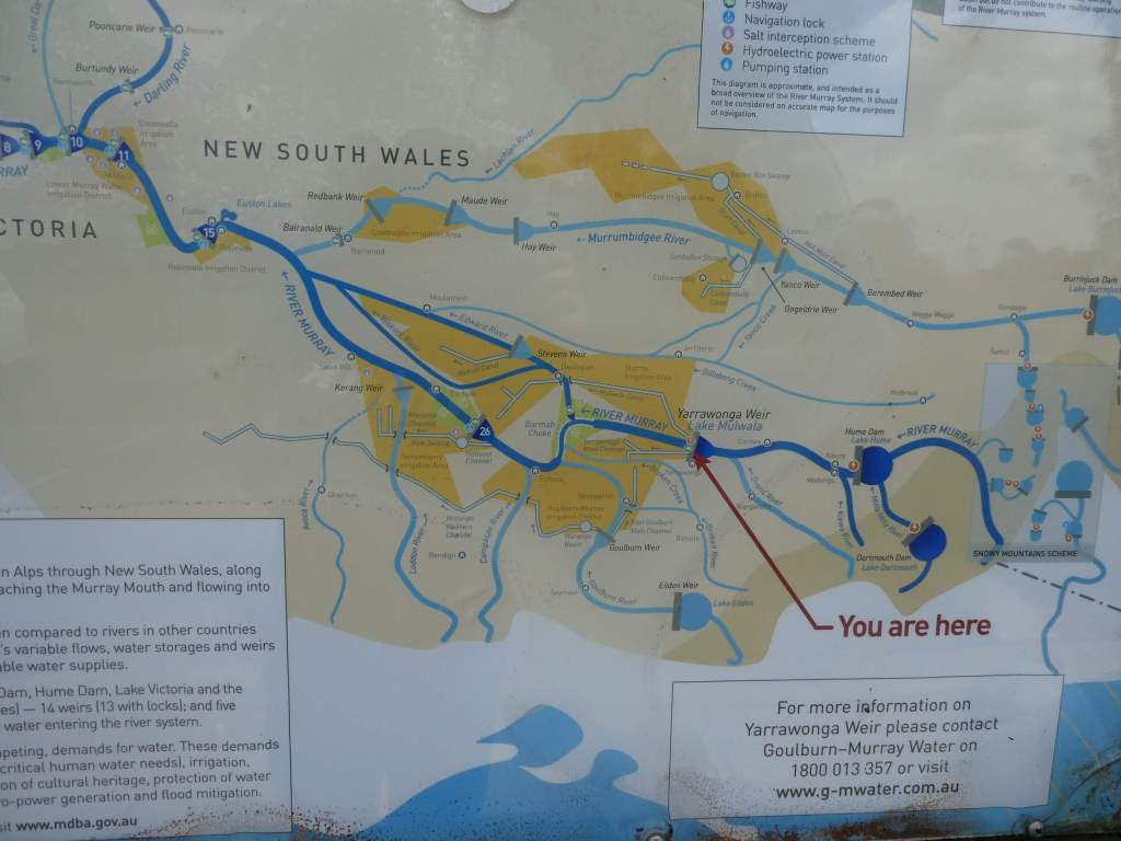
17% of the Murray River’s annual flow is diverted from Lake Mulwala above the weir and flows into the Yarrawonga Main Channel and the Mulwala Canal. The weir can be used to control water releases and thus reduce the chance of flooding. The Mulwala Canal (constructed between 1935 and 1942) is the largest in the Southern Hemisphere (156km long) and carries water for irrigation across the Southern Riverina to the Edward River at Deniliquin. There is a hydro electricity station on this irrigation canal (the first one on an irrigation channel in Australia) near Berrigan that generates 2.5MW of power. That shows just how much water is going out of the river along this channel.
As you can see from the table below a large amount of irrigation goes to Pasture (mainly for dairy industry) but the next highest is to Cereals. This is largely rice irrigation in the NSW Murray Valley. Around a third of the volume pumped to the Mulwala Canal alone finally makes it to SA!
You can’t walk downstream on the Victorian side of the river, but you can cross the weir on foot or bike (it is closed to motor vehicles) and walk on the other side of the river. Since we had had little luck finding a decent walk in Victoria , we thought we would try interstate. It was a good choice. We walked over the weir, with the water surging and crashing noisily beneath our feet, and came out on the other side to a road. A short walk brought us to Gorman Park. This area of 110 Acres was purchased in the 1920s by a community group, and paths and tracks were put in only in 2014.
My knee was starting to give me trouble so I left Trevor to investigate the joys to come alone and turned back to slowly enjoy the vegetation and other views on my way back.
I took quite a while looking over the infrastructure and trying to figure out where the fish lift was and how it worked while I waited for Trevor to return. He ended up doing about 5km to my 2km, and found some delightful tracks to follow.
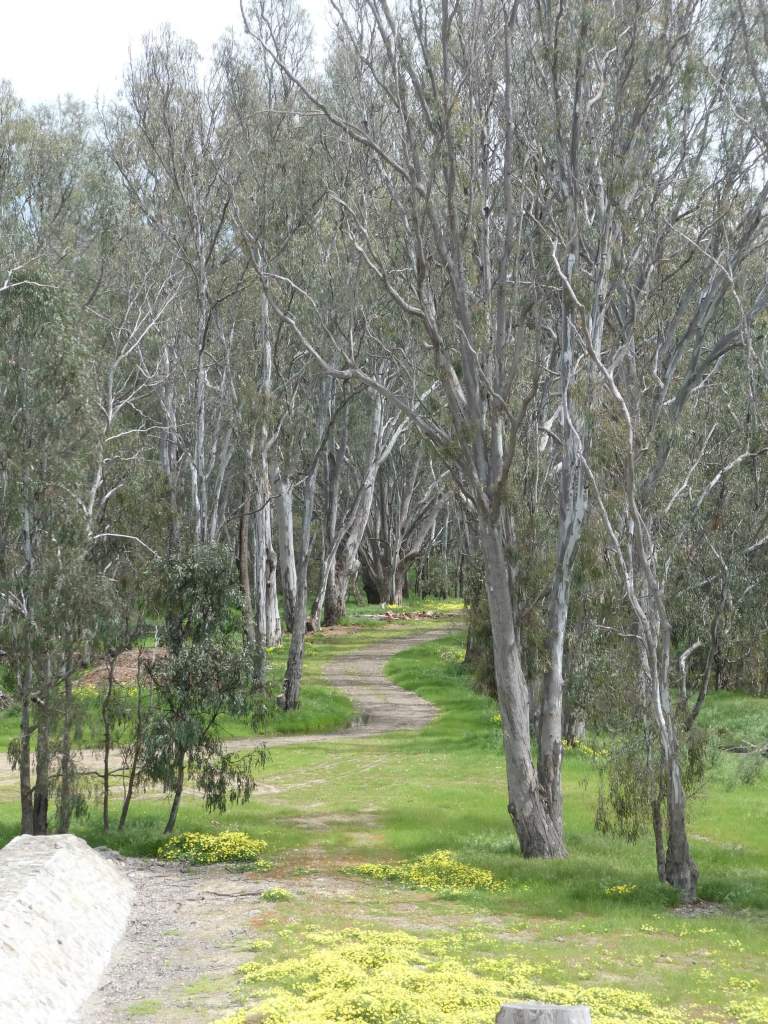
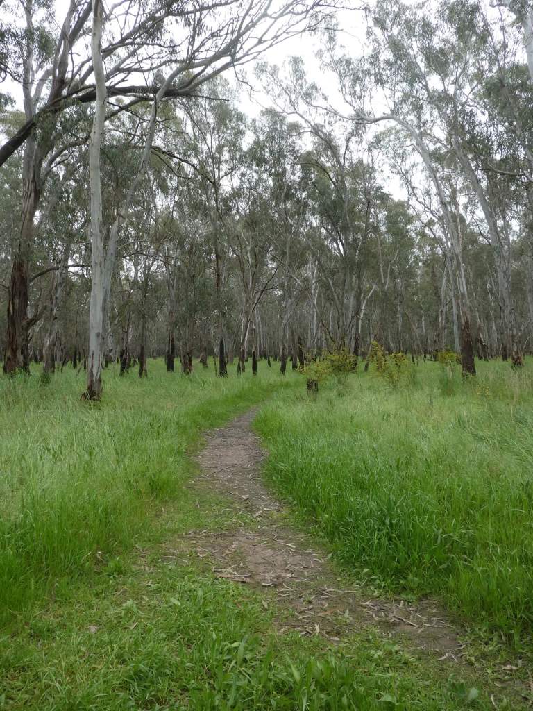
Our first walk in Yarrawonga was to a spot called Chinaman’s Island. This is not really an island, but is almost one. It is land set aside as a nature reserve and has a lovely path to follow with some great views. The area was used as market garden, pig farm and pastoral farm for many years, until the Lake Mulwala was formed by the building of the weir in 1939. It spent 50 years as waste land, and was proposed as a possible site for a Casino before the local residents and Rotary club rallied and campaigned to keep it natural. Apparently there was a chinaman called Jimmy who worked at the market Gorden and they seem to think that this is where the name came from. Over 2000 tress have been planted here by local community members since the regeneration work started in 1989.
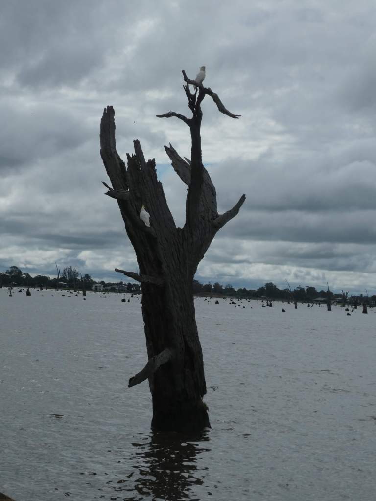
We parked by the yacht club and walked from there. We were treated to lovely views over the lake. The views always leave me feeling a bit sad, as there are many dead trees protruding from the lake – the results of drowning when the lake was formed. In some ways it is a bit like looking at headstones in a cemetery.
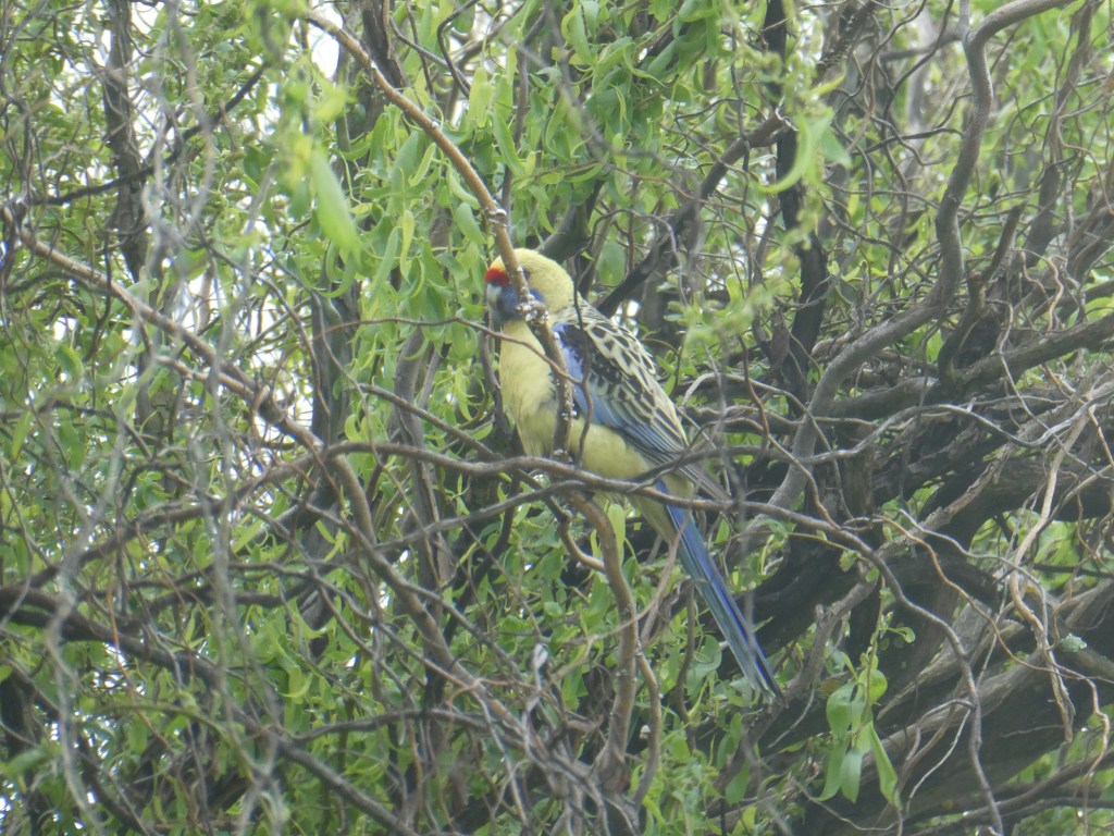
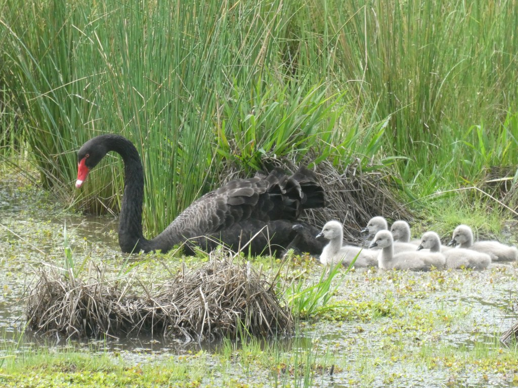
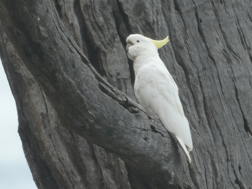
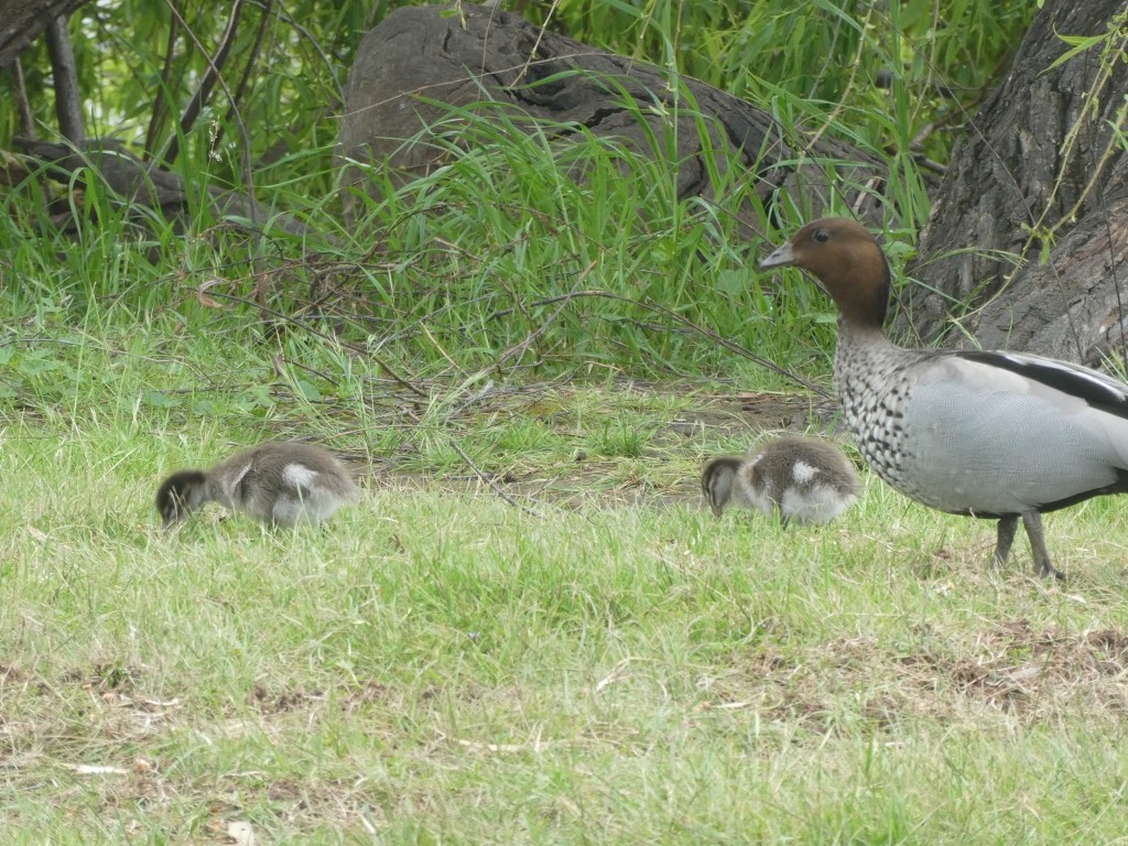
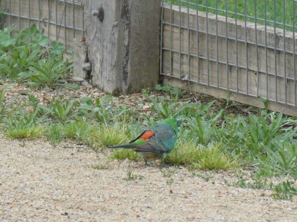
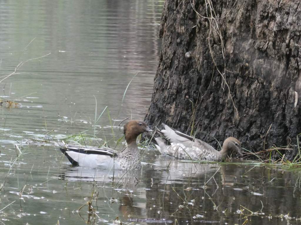
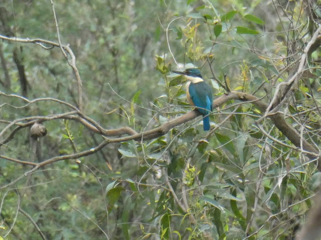
We enjoyed glimpses of a number of different birds, and heard calls from many others which we were not able to identify.
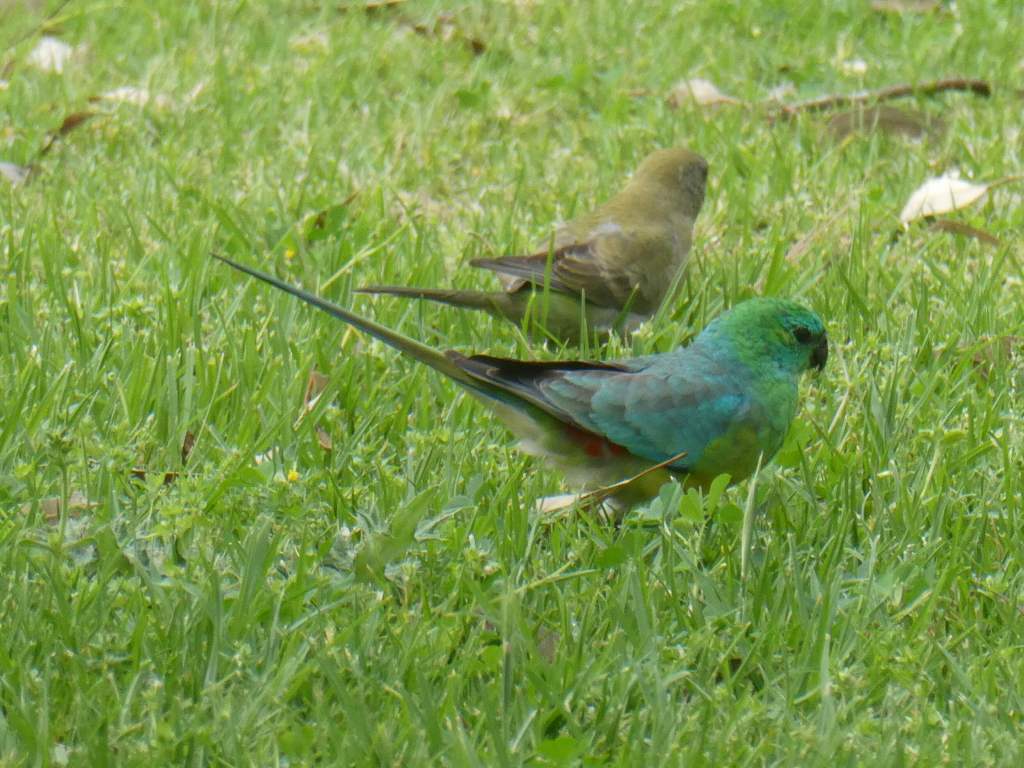
The red-rumped parrots were showing off their pretty red rears and we saw the yellow version of the crimson rosella.
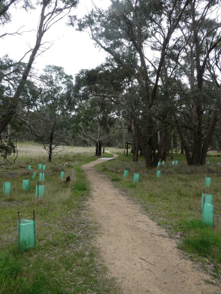
The paths were easy to follow and new plantings of grasses and ground covers seem to be thriving inside their brown cardboard surrounds. (so much more environmentally friendly than the plastic ones).
Some of the native plants are in flower and looking very attractive.
We meandered our way home and stopped at the weir to have a bit of a look. We planned to come back here and have a better look later on in the week.
We were glad that it wasn’t as rainy as the previous day, but it was still a bit limiting for us as far as taking a look on our way.
At Heathcote we found our way around one blocked waterway (river over road) only to find that the track we hoped to take to the lookout was a dirt one and probably too wet to be a good idea. The lookout would have been pretty useless anyway if we got there, because the cloud was so low that the visibility woudl have been limited. We decided jsut to move on instead.
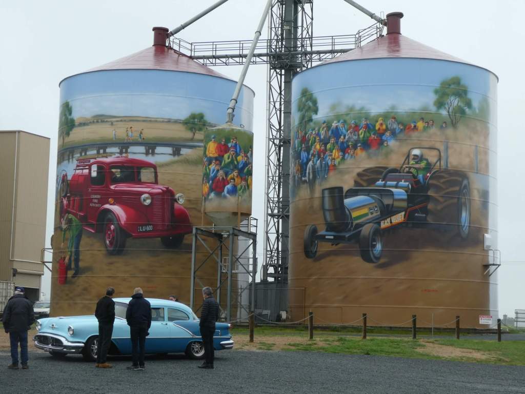
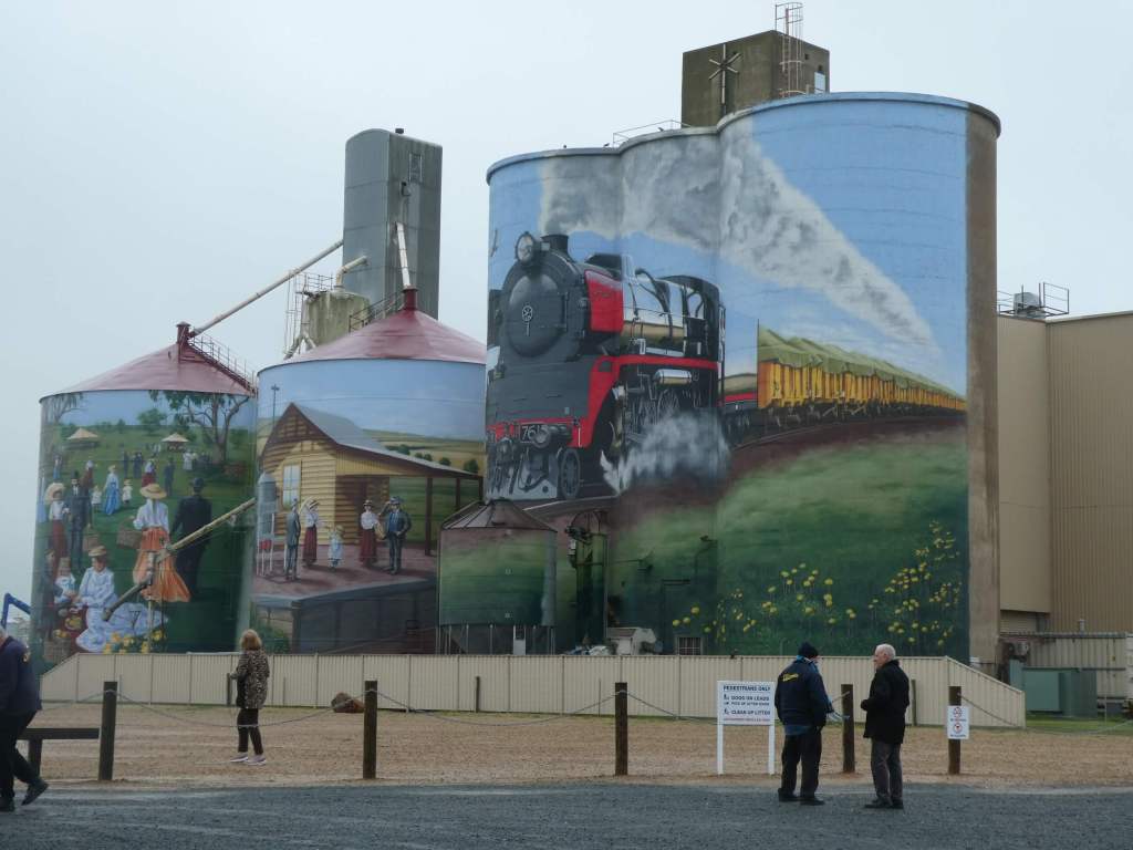
We stopped to view the brightly painted silos at Colbinabbin alongside a bus full of Oldsmobile enthusiasts.
We navigated the back roads and found the right place to see cousin Daryl and wife Katie on the dairy farm near Stanhope, enjoying some excellent chat and a cuppa before moving on again.
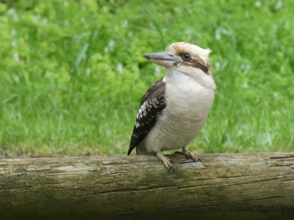
Then to the bakery at Shepparton to buy lunch and took it off to a parking spot beside the river, watching a laughing kookaburra through the car window as we ate.
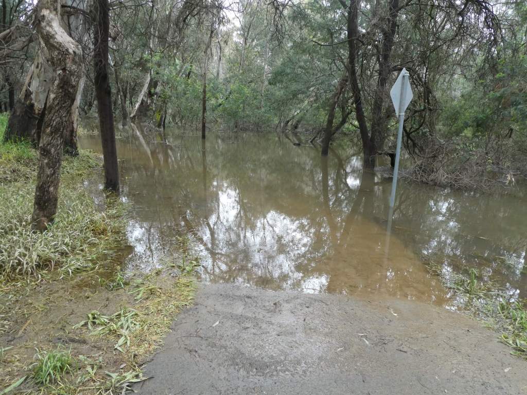
Then, since we had a break in rain we decided to make the most of it and see what was down the path. “More Water” was the answer. We had to leave the track to make it through and to be very careful where and how we walked to stay upright. The river is way up and the lagoon next to the main river is very high.
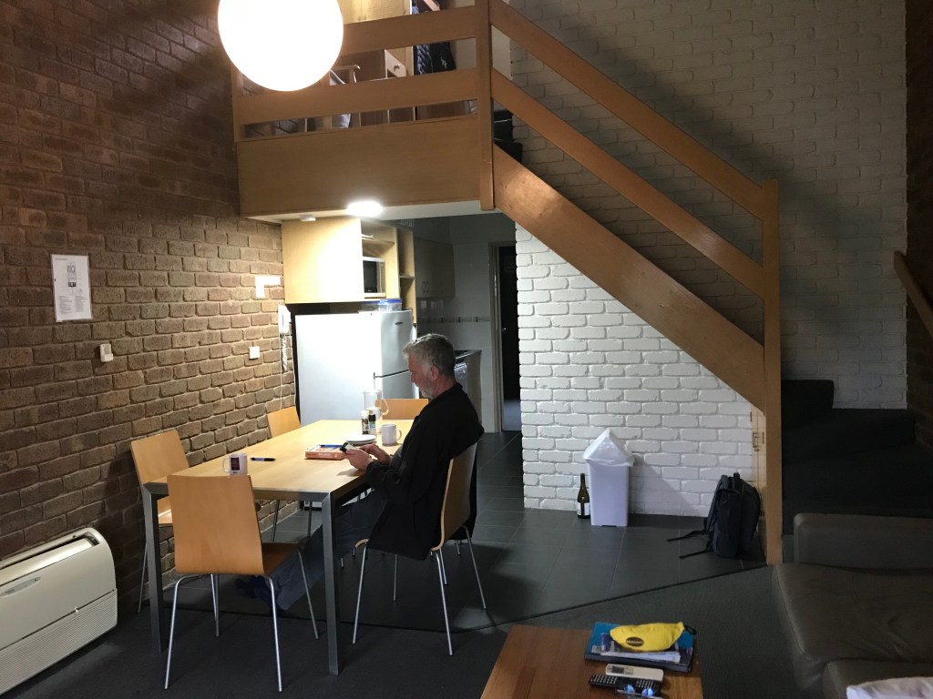
Then it was onwards again, to Yarrawonga, where we checked into our home for the next week. We have a mezzanine bedroom for Erica!
We took a little drive around town to remind ourselves of the lay of the land and found some food at one of the Chinese restaurants (Mulwala Club) before heading home to recover from the trip.
After a late start we headed out to take a look at a couple of parks near our current home base.
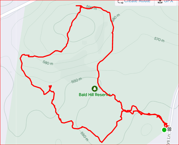
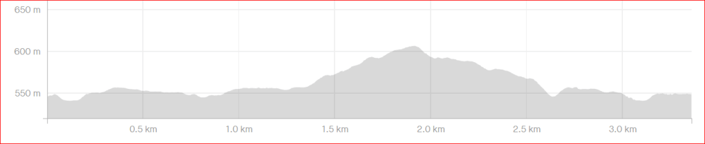
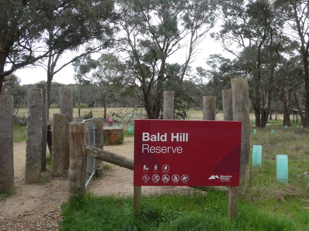
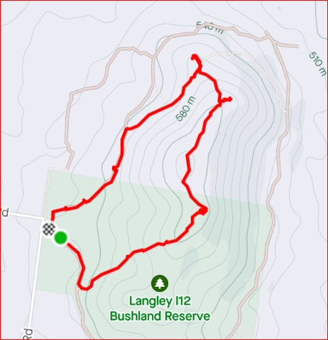
Bald Hills Reserve
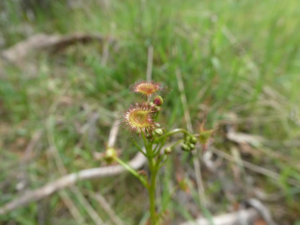
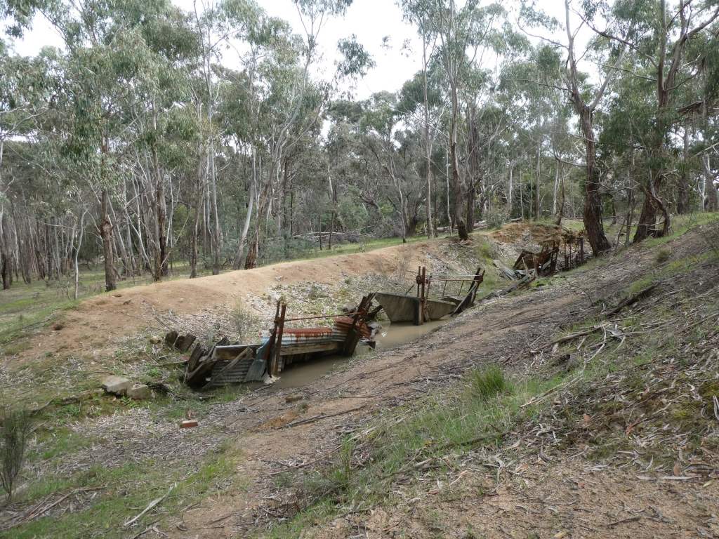
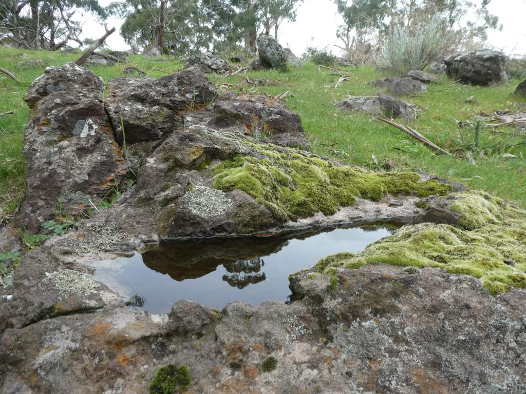
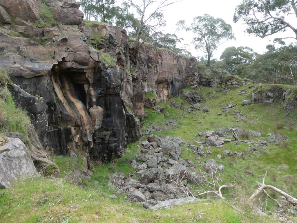
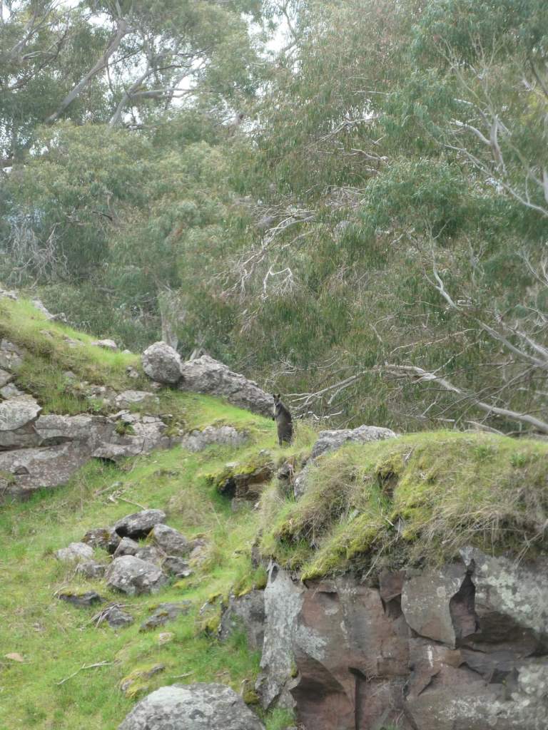
Bald Hill Reserve is only a few km the other side of Kyneton from us. There isn’t much information about the place and we couldn’t access any map on the web at all, so it was a case of driving to the car park by the gate and seeing how we went. In the end we spent some time on tracks and some walking in the general direction that we thought we wanted, including making our way to the highest point (presumably Bald Hill) and finding a pretty impressive quarry.
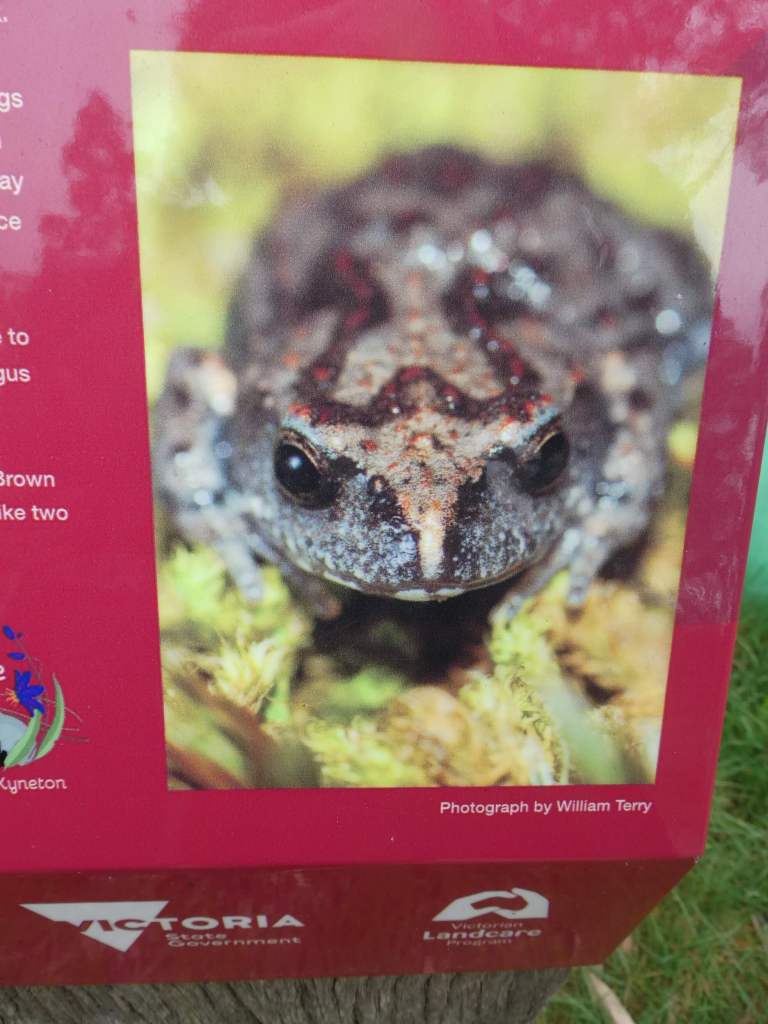
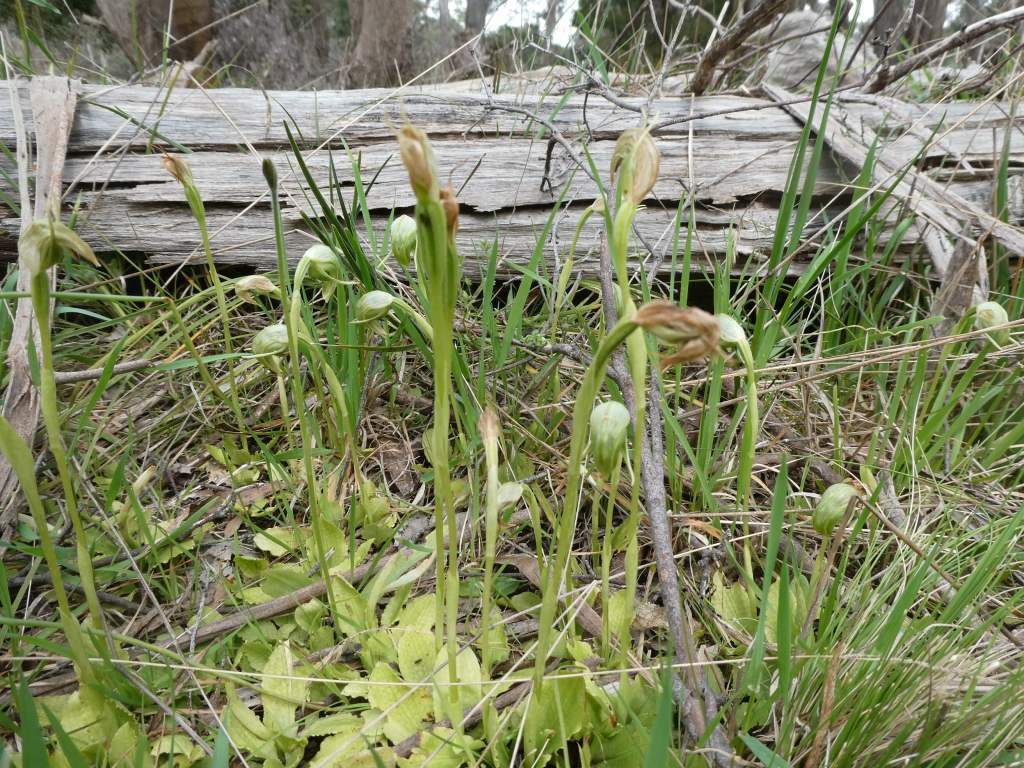
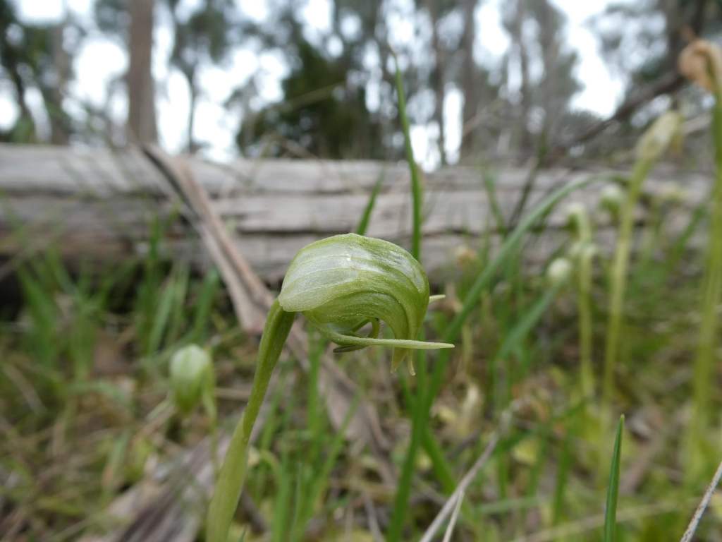
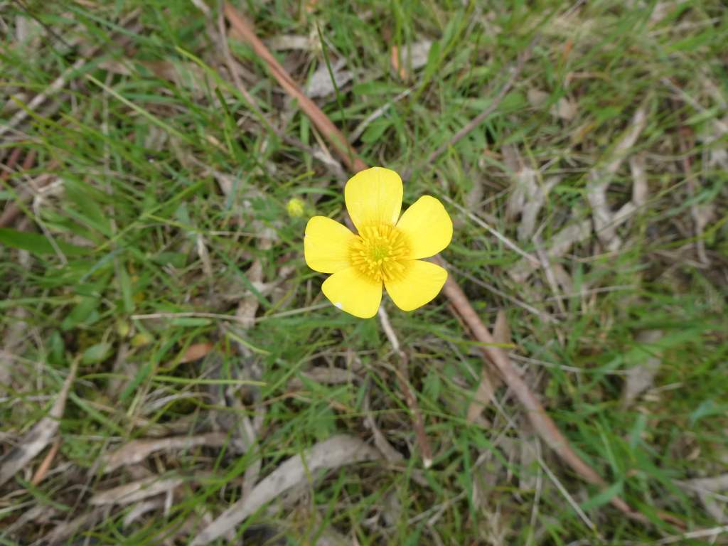
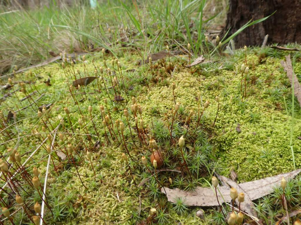
Endangered Bibron’s ToadletTwo greenhoods together.Early NancyNatural Birdbathto allow us to sit and listen to many many frogs.
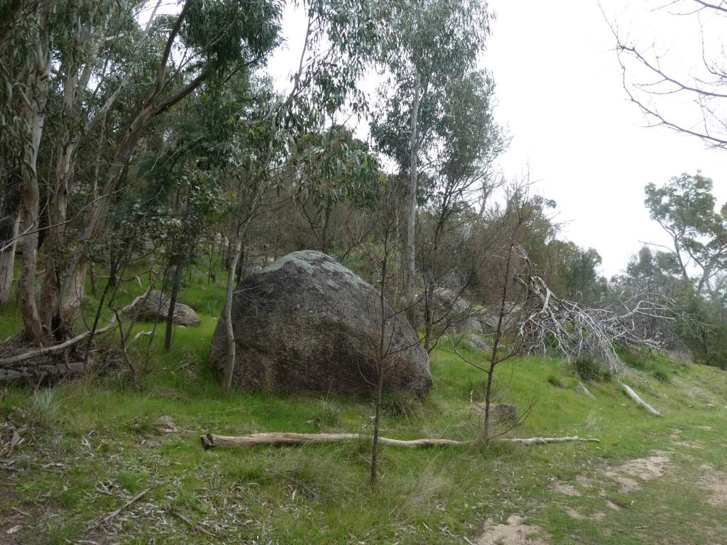
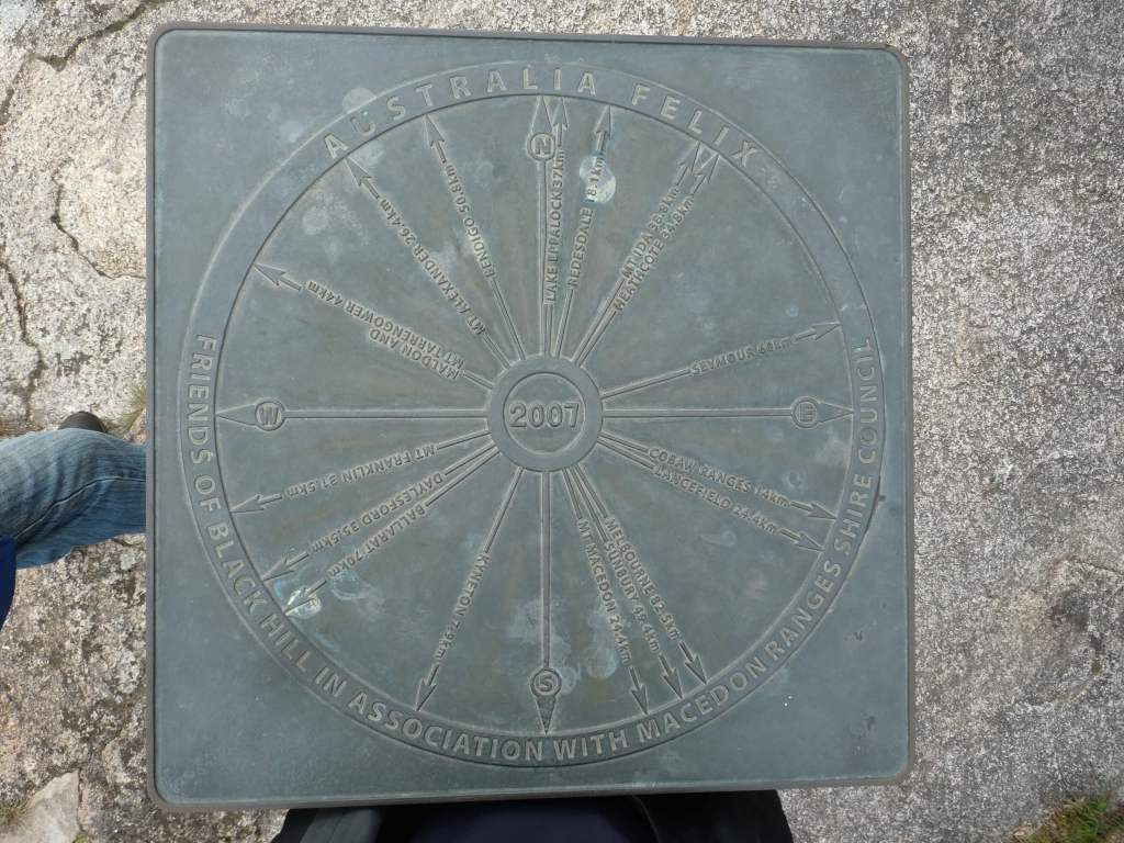
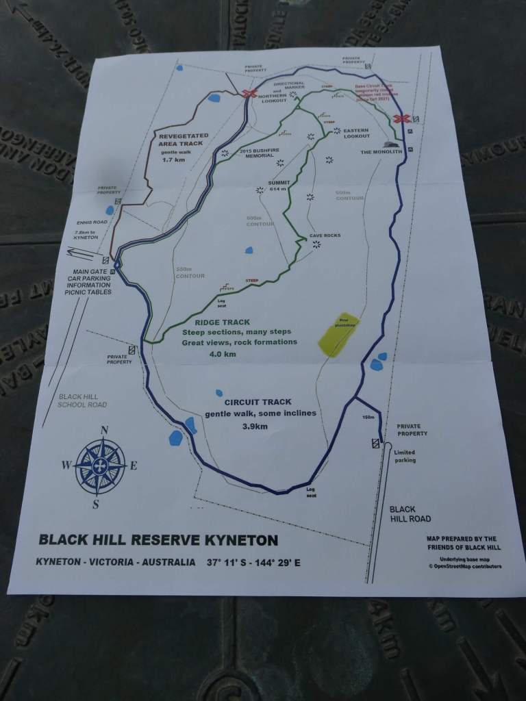
Black Hill Reserve
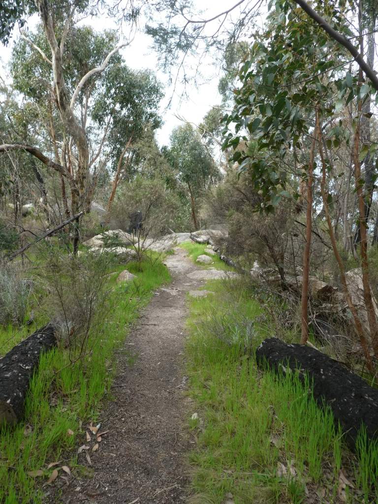
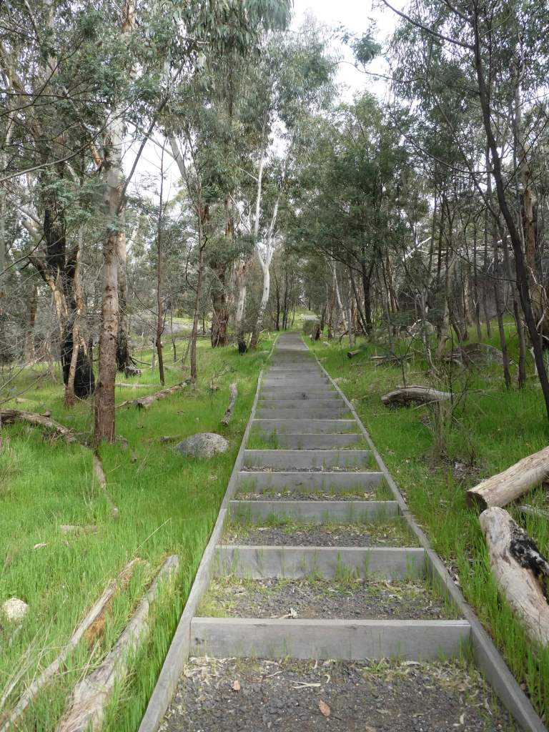
Black Hill reserve is the opposite direction to where we are staying, and since the rain still hadn’t arrived we thought we would stretch our luck and take a look there too.
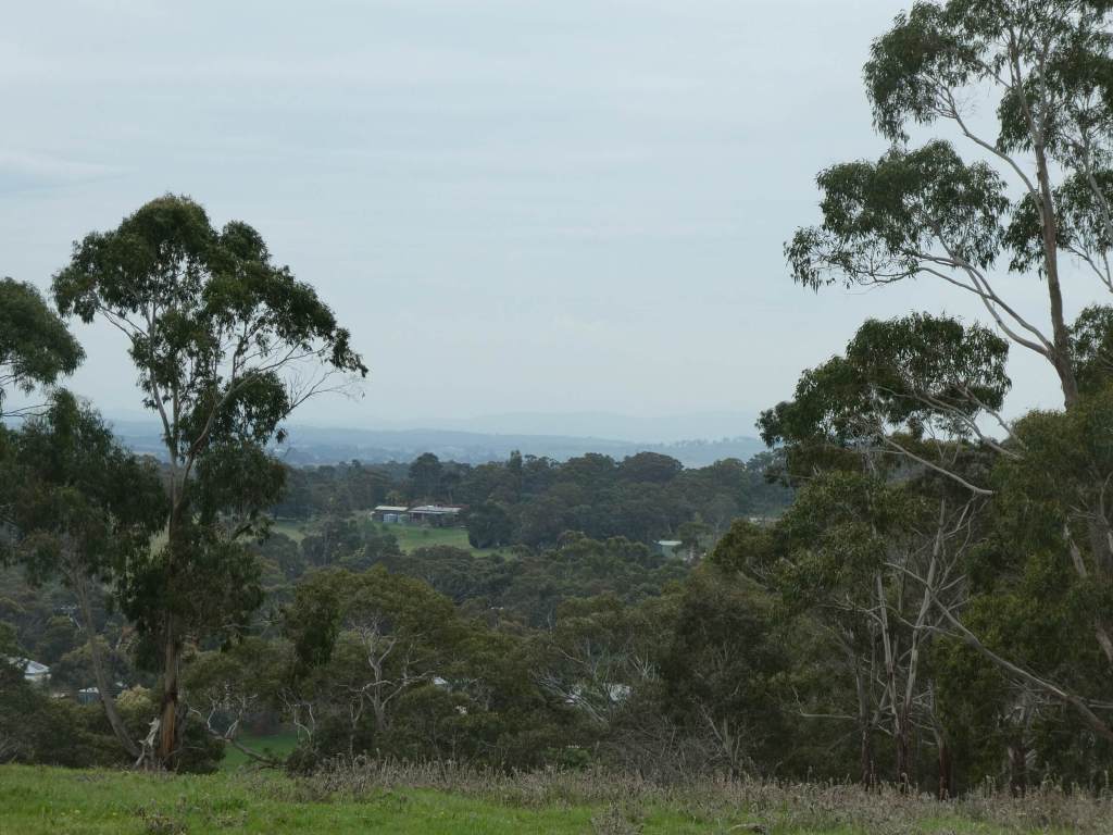
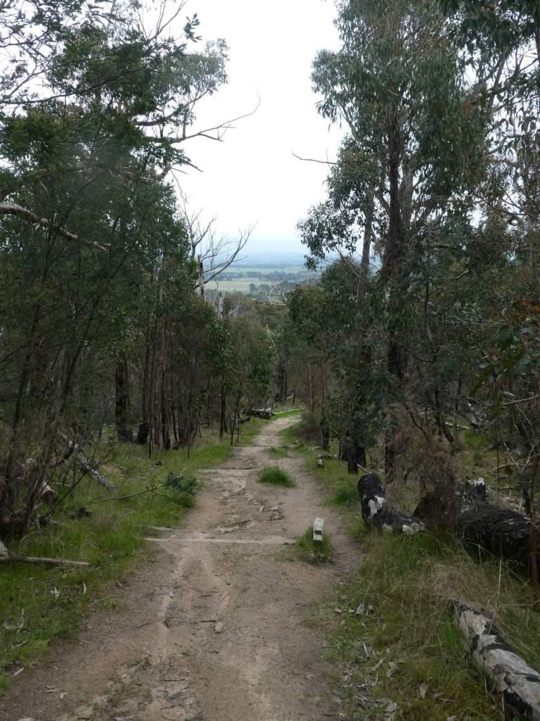
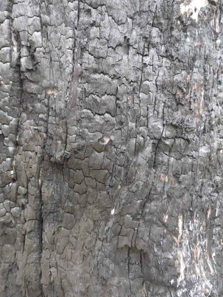
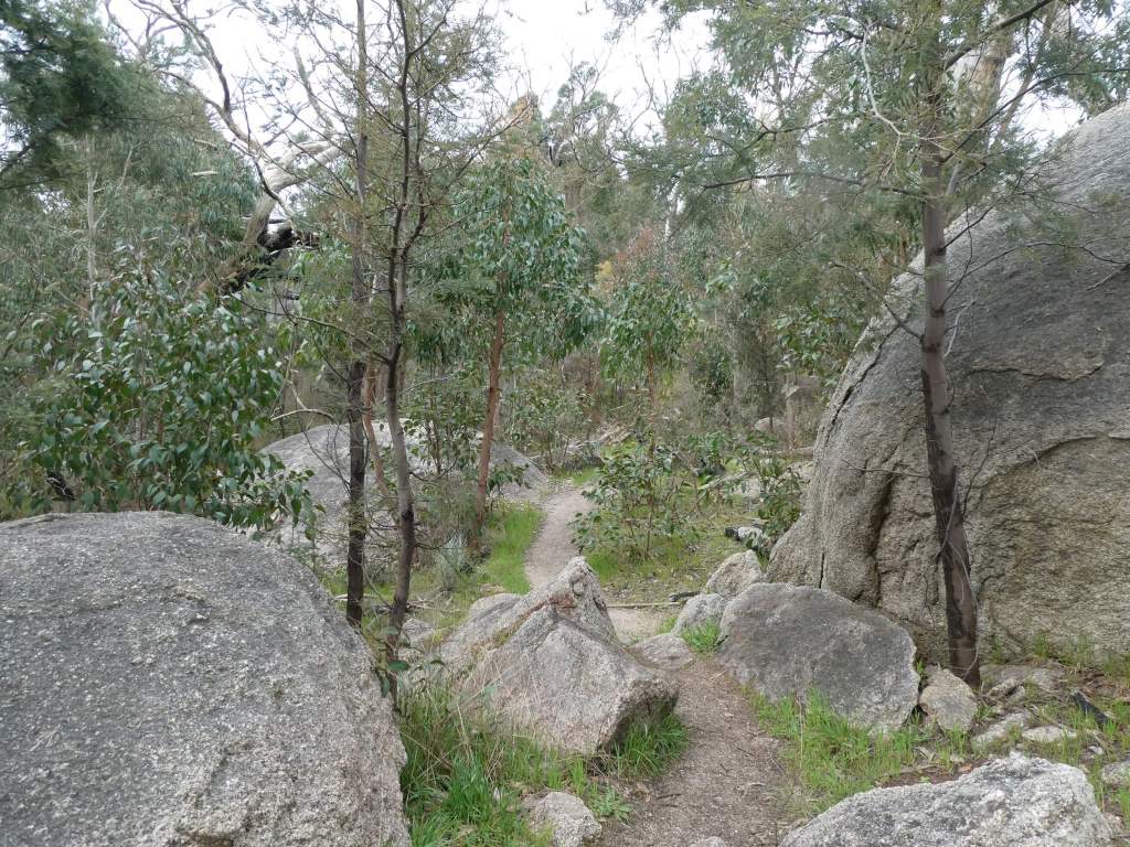
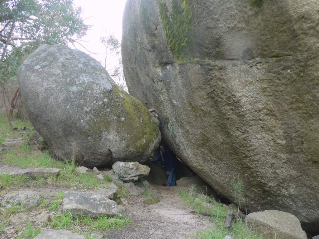
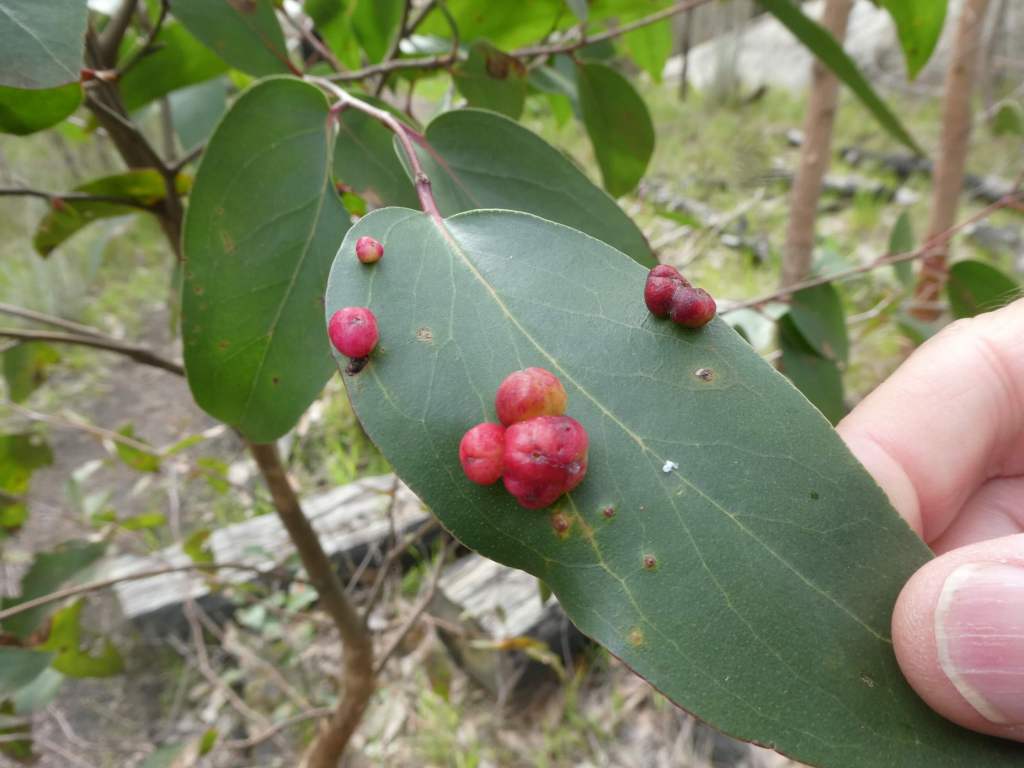
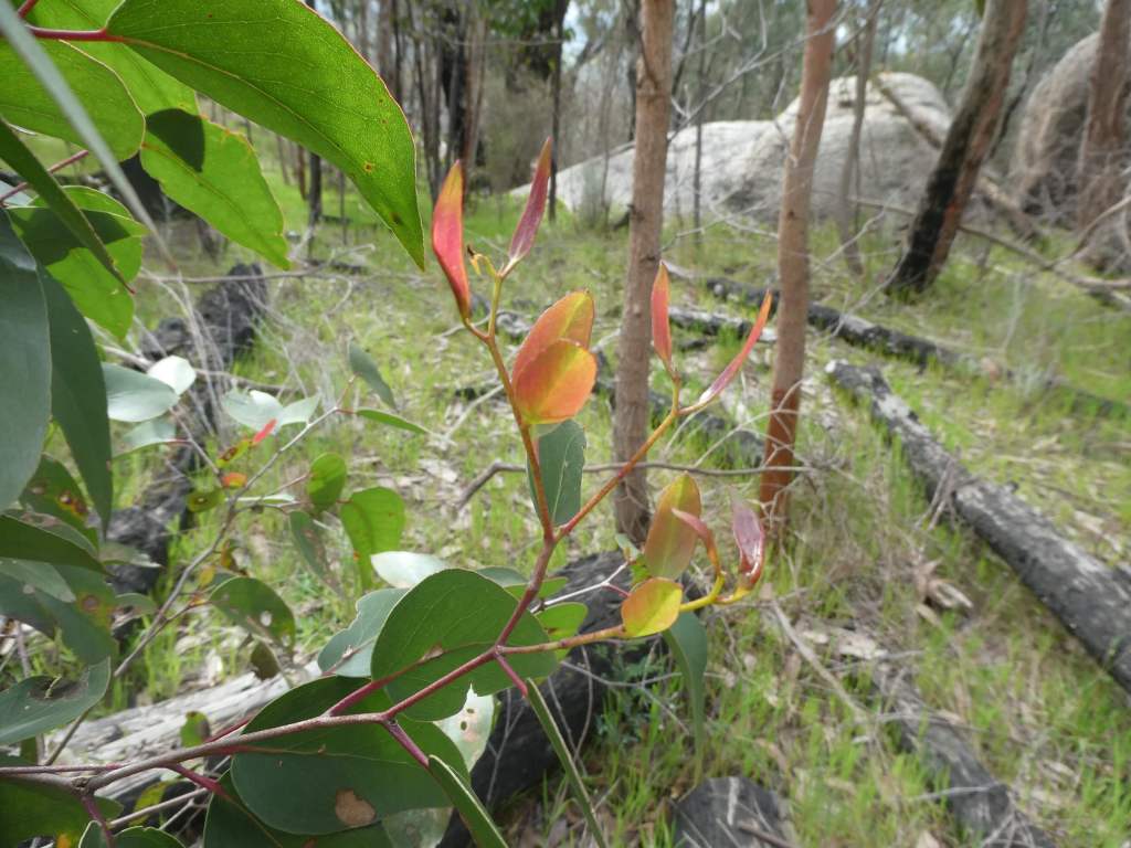
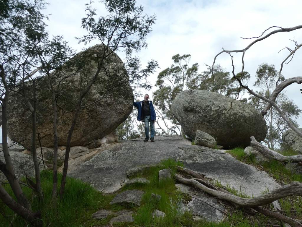
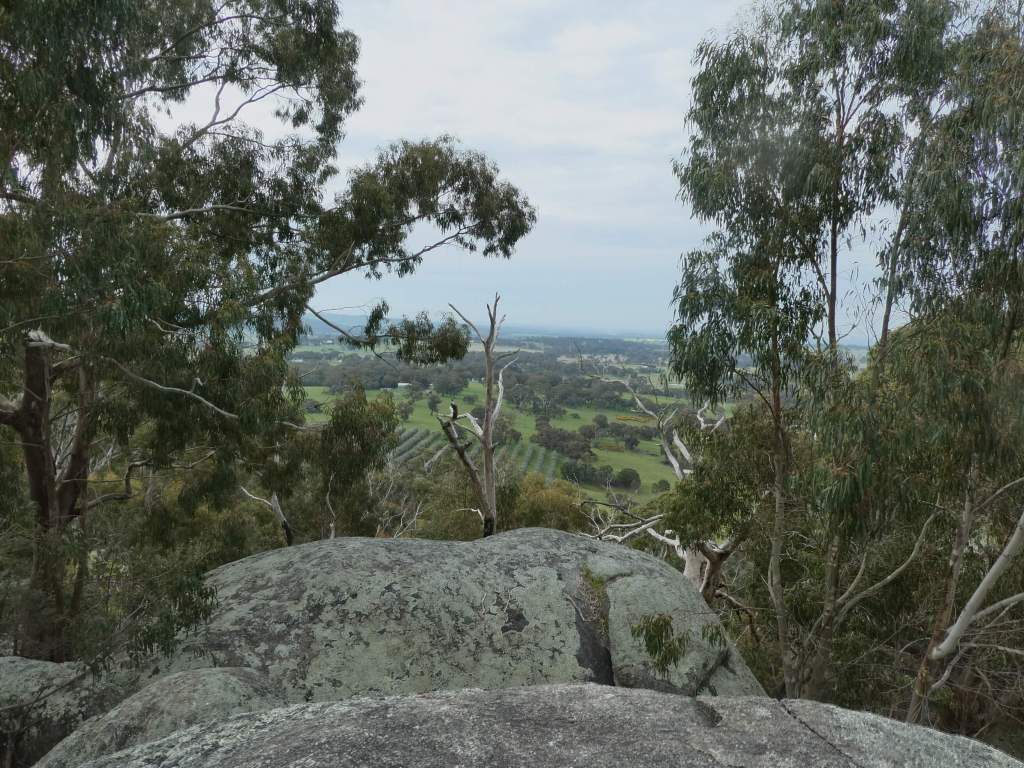
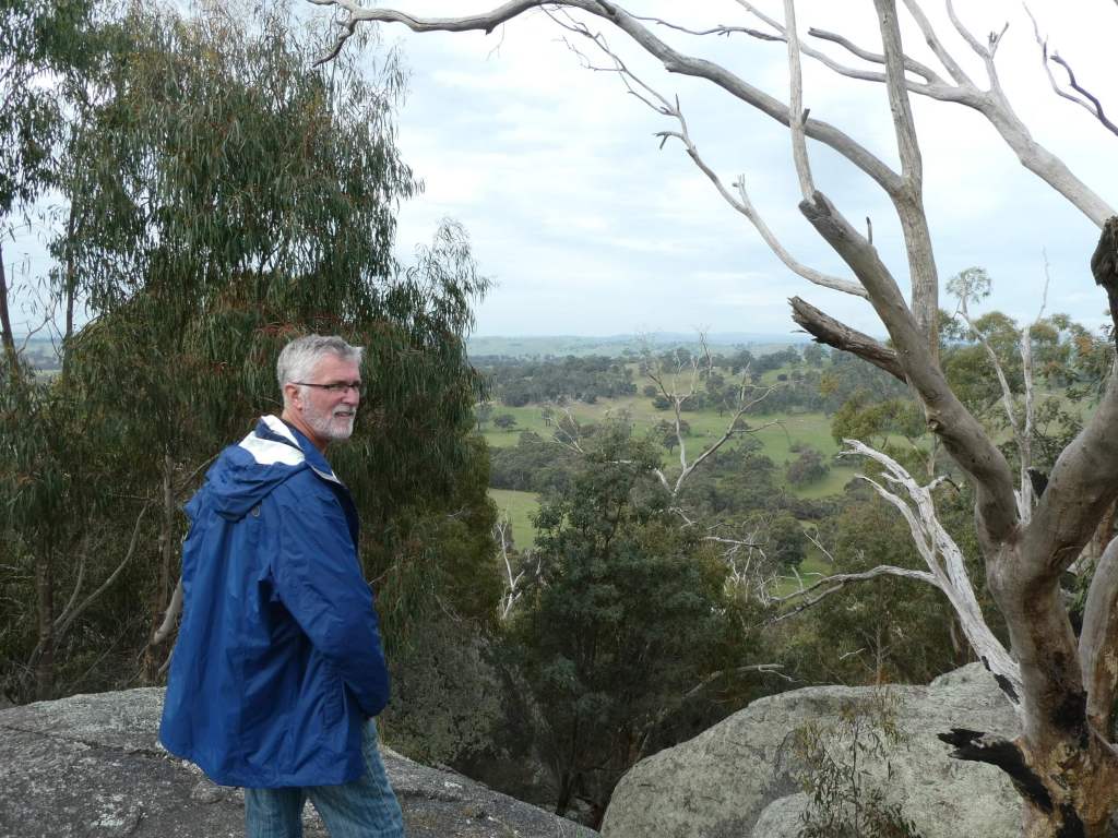
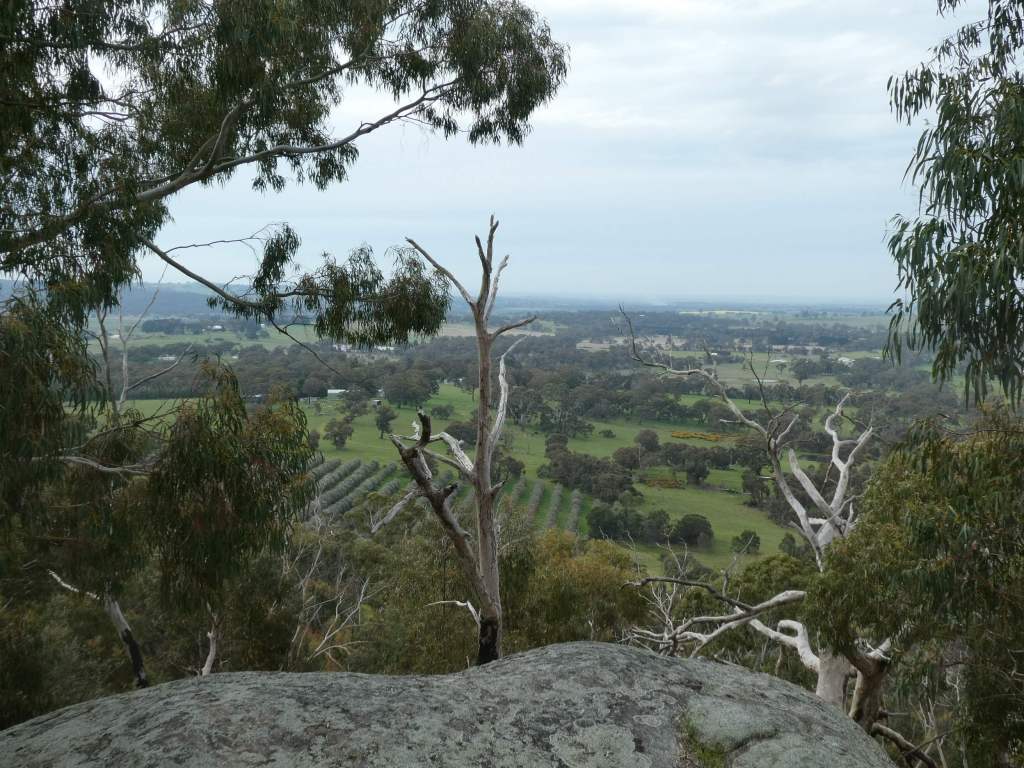
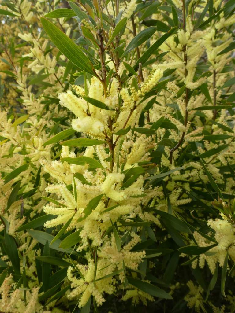
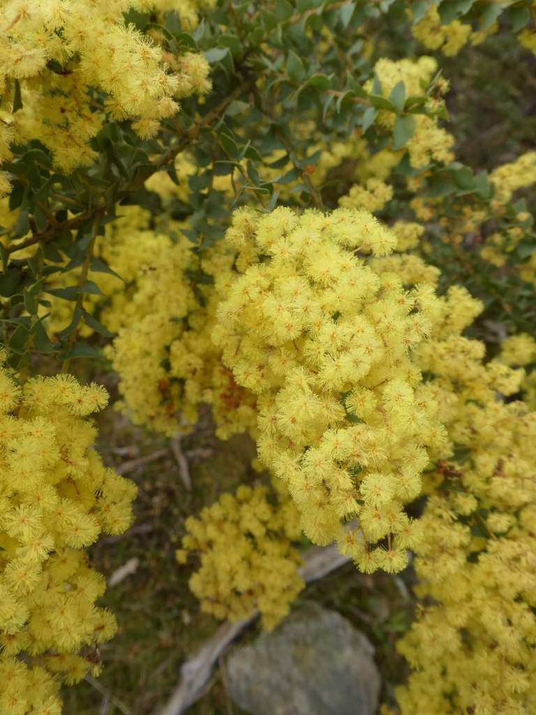
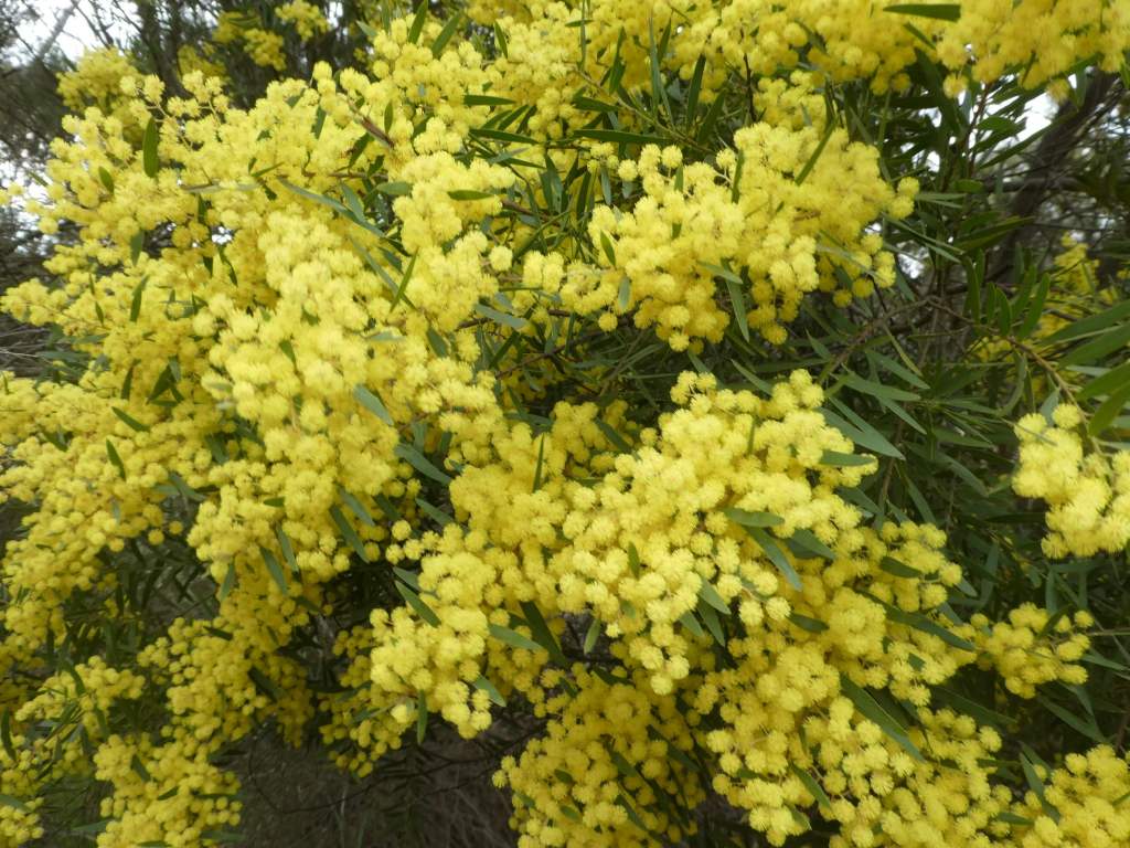
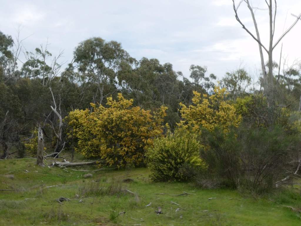
There was a major fire here in 2015, with a lot of damage. The bush is now regenerating pretty well. There are lots of huge granite rocks with the path winding around and between them. We chose to walk the track that followed the ridge across the summit and enjoyed some excellent views..
The wattle was really impressive and a number of different kinds on display.