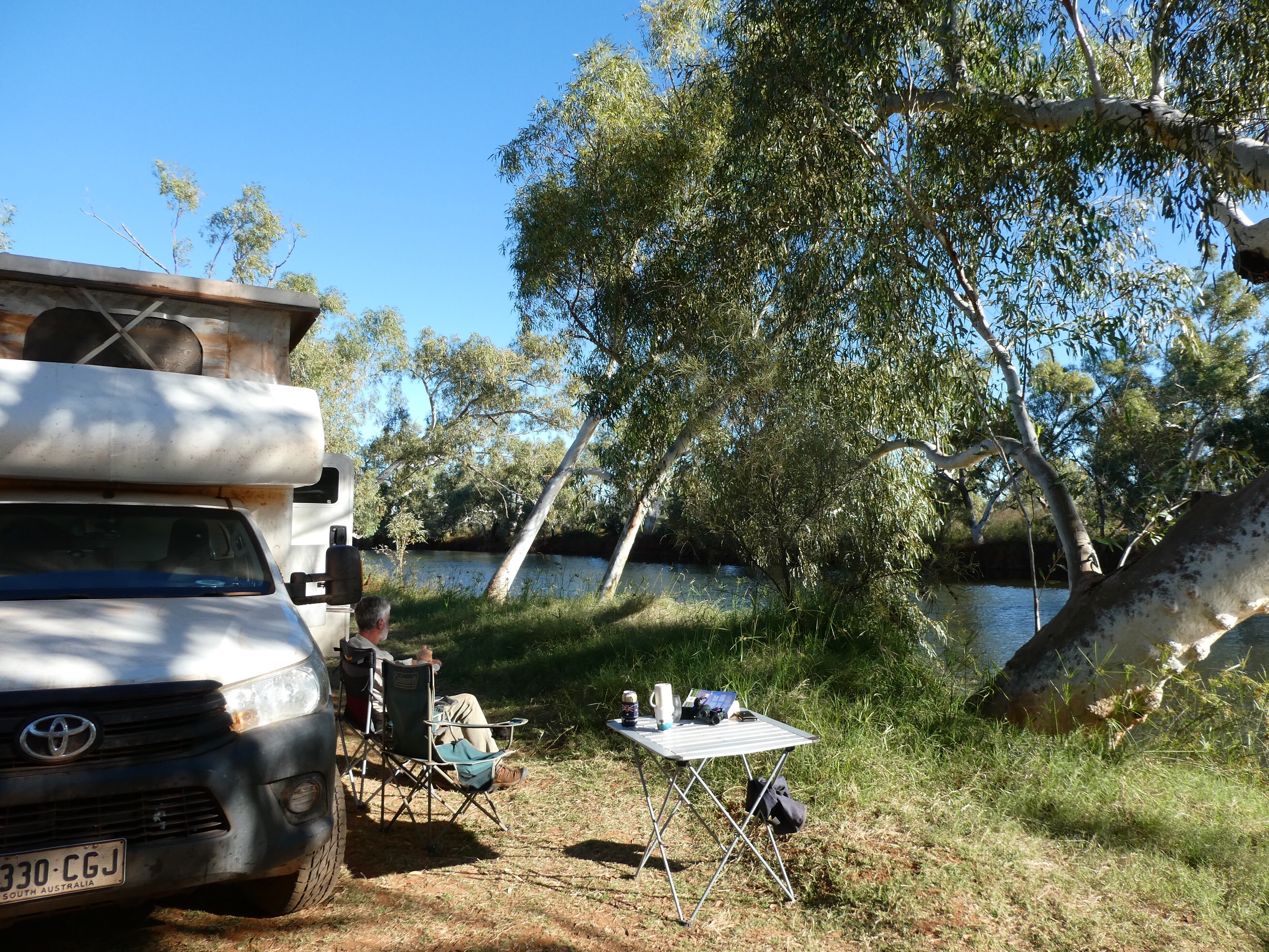
We spent a lazy morning by the river, enjoying our peaceful spot and knowing that we would not be able to check in to the caravan park in Exmouth until after 2 pm.
We headed out of the station by a different way, but soon joined up with the main highway, following along towards Exmouth.
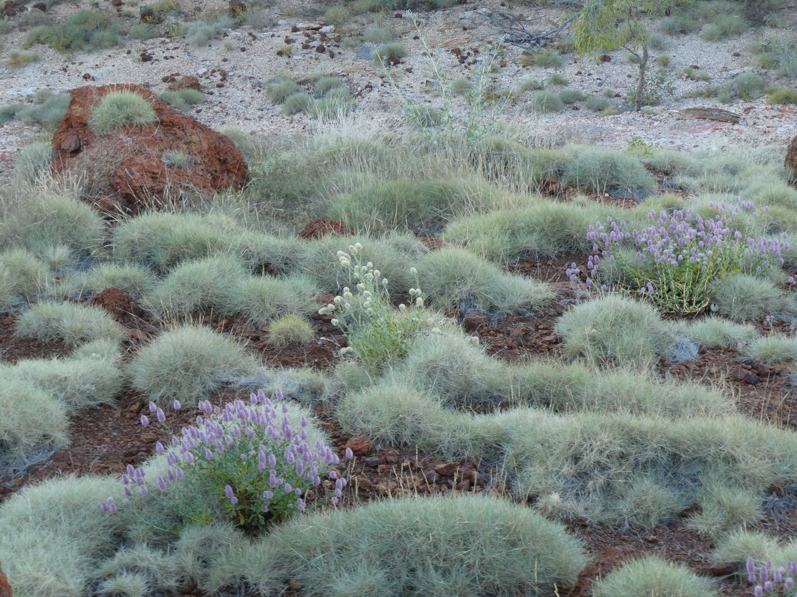
There were drifts of prostrate mulla mulla which looks like white cotton balls have been dumped and overflowed down the road verges and on to the sides of the road.
We found the best bakery in Exmouth (the Ningaloo Bakehouse) and had delicious pepper pies and then followed them with delicious treats.
There were a couple of very brown corella in the mall. With feathers missing and very dirty they reminded me of old drunks sleeping rough.
Then we headed for the caravan park and put on a load of clothes to wash ASAP. These dried before dark.
The park has over 300 sites and is full. There is an amazing camp kitchen with ovens, hot plates, microwaves , toasters and kettles. There are even a row of bbqs and an emu that walks through the campground stealing food at about 3 pm each day!
There is also a TV in the camp kitchen so I can steal a glimpse at the Olympic every now and then.
We agreed to go across the road and up a bit to “Cadillacs” , an American country music themed bar and grill , where we hoped to catch up with Tarn Soden, who is currently working there. Unfortunately Tarn was on a night off, but the food was pretty good.
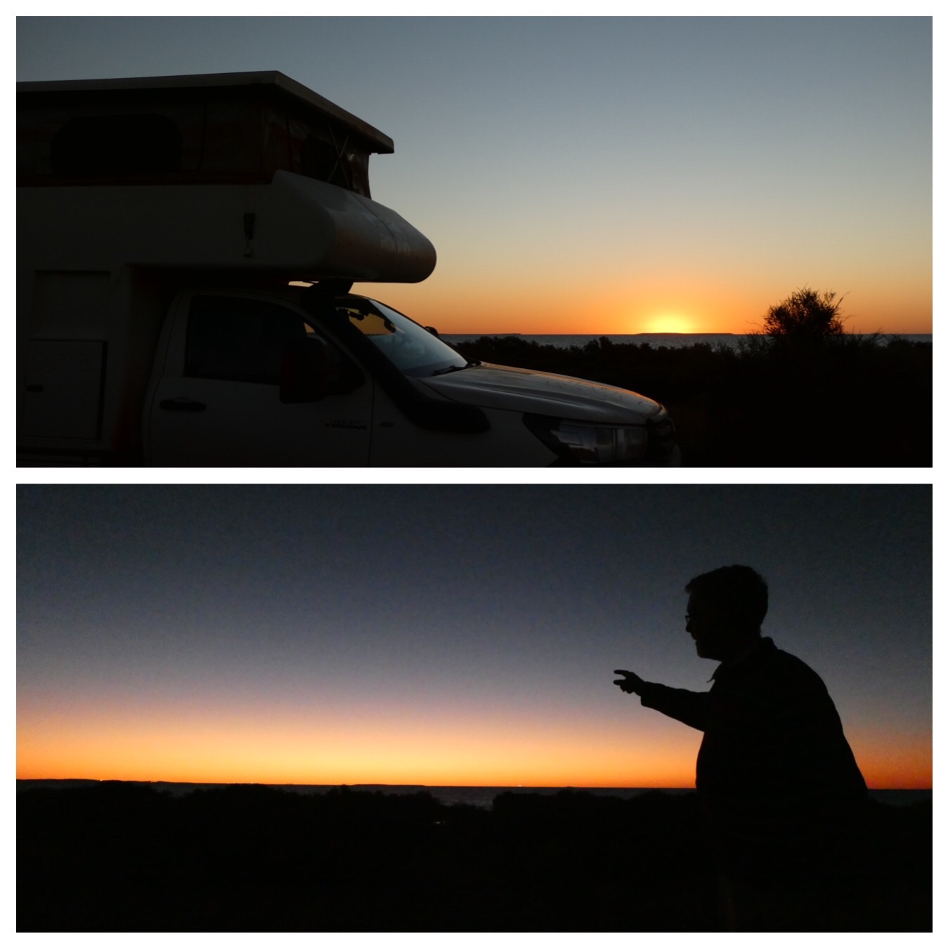
It was pretty much 10 am before we moved on out of camp. The tide hadn’t moved much in the whole time we were here, and we enjoyed a fairly windy night with the sounds of the waves.
After a luxurious lie in and egg and bacon breakfast we dropped off our recycling (for the RFDS) and our rubbish before heading on out.
We don’t have far to go today and don’t expect too much sightseeing will hold us up in our mission to get to Emu Creek Station today. Hopefully we will be left with lots of time for enjoying a spot by the river when we arrive.
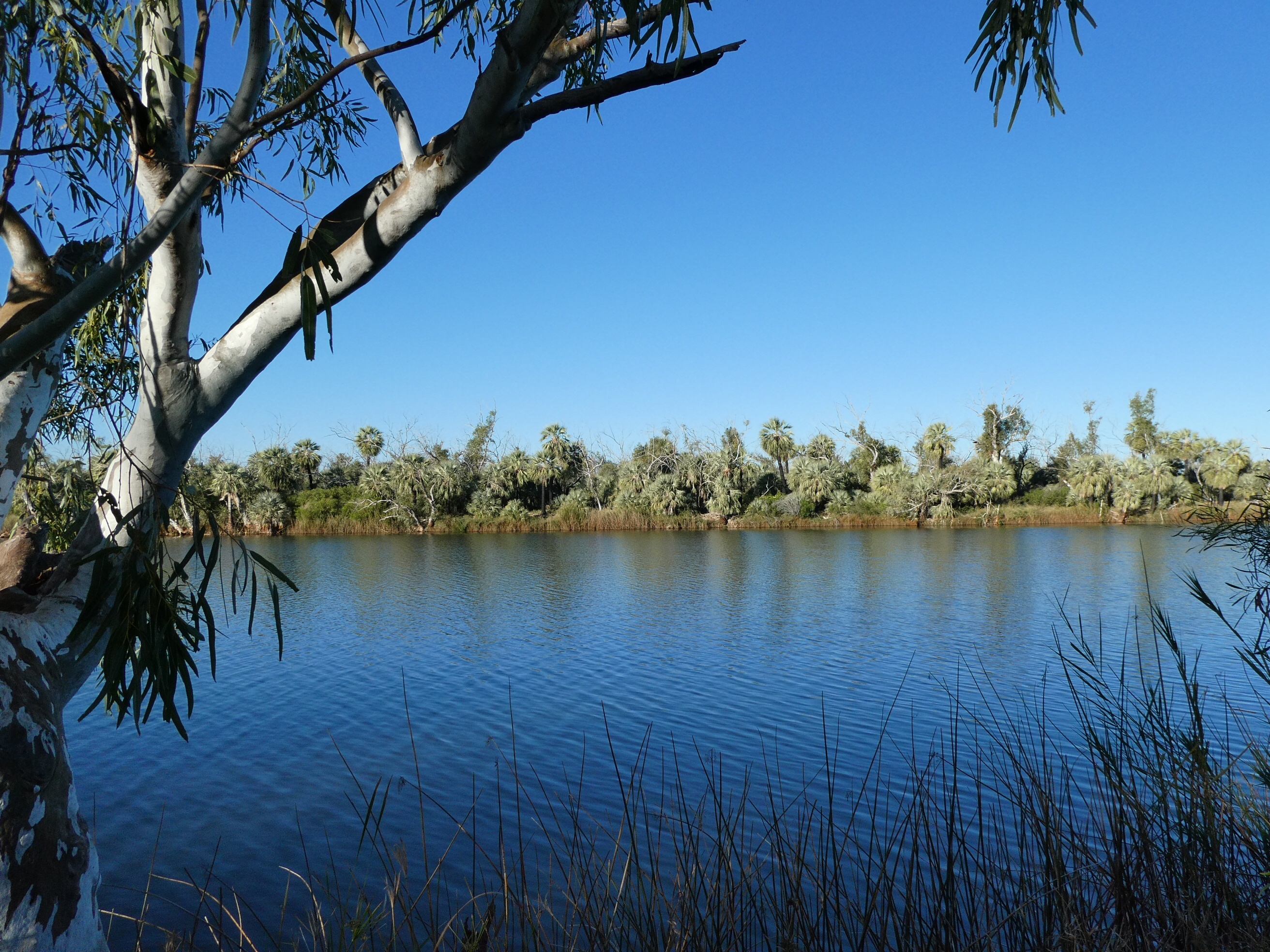
We found nowhere to stop for lunch on the way, so just kept on driving the 340km to Emu Creek. We came in the gate right behind Craig and Ev and were met with a warm, chatty welcome. We found a shady, flat spot beside the river big enough for the 3 of us.
There is a little rock and galvanised iron ablutions block with two rustic rooms, each contains a flushing toilet and shower, with a donkey hot water heater. Very cute and very appreciated. We were all starting to feel a bit gritty and dirty after so many days without a shower, even though there have been swims in there and the weather hasn’t been too warm.
The river was flowing past our camp strongly and it was great to be camped in a relatively grassy spot in a lovely setting beside the water.
Al and Zita arrived much later due to a detour back to Karratha. Their oil light came on, so they had to go and find some oil. (probably added at least a couple of hours driving to the day). they were looking pretty “over it” when they arrived, but after a bit of a relax with friends and communal tea they were ok by the time bedtime came.
Despite being quite close to others it was a pretty good sleep for us.
By the time we were up Thom and Laura would have had Australia in view.
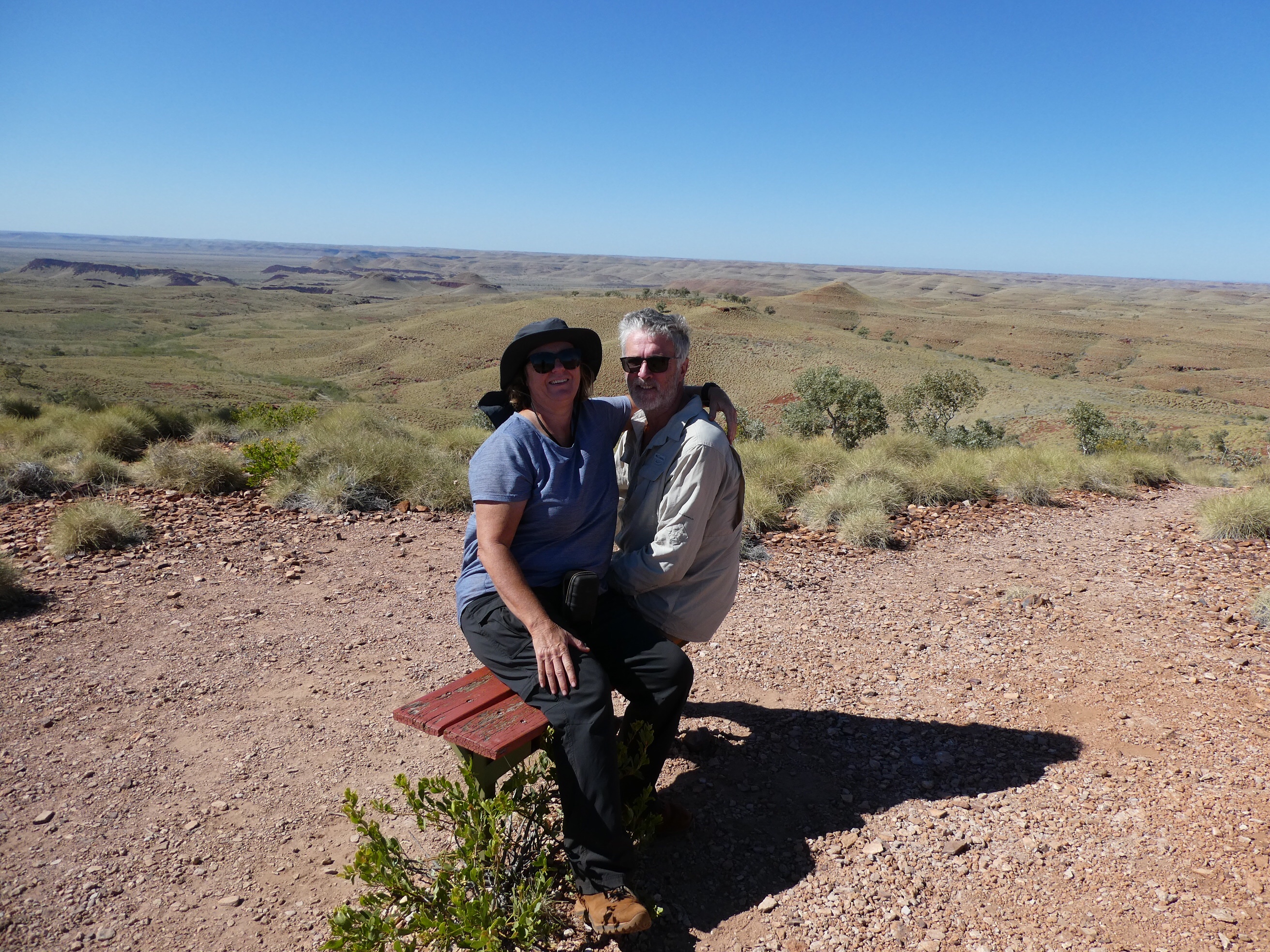
After moving out of the campground we took a brief detour along Snappy Gum Drive across a narrow causeway which crosses the Fortescue River. Unfortunately the road was closed and we had to turn around and retrace our drive, leaving the area the same way we had arrived. After a fairly rough (3/10 according to the camp host) drive studded with beautiful wildflowers,including Sturt Desert Pea standing up a metre above the ground(!) , we arrived at our first planned stop at Mt Herbert. There are two ways to access the top. One is gentler and longer, curving around and up. The other is shorter with some steeper rocky areas and much more direct. We took the longer route and found another new plant on the way.
At the top of Mt Herbert there was an incredible panoramic view of the Pilbara country laid out before us.
There was also phone reception and we were able to confirm that Thom and Laura’s flight had, indeed, landed in Darwin. (Hooray).
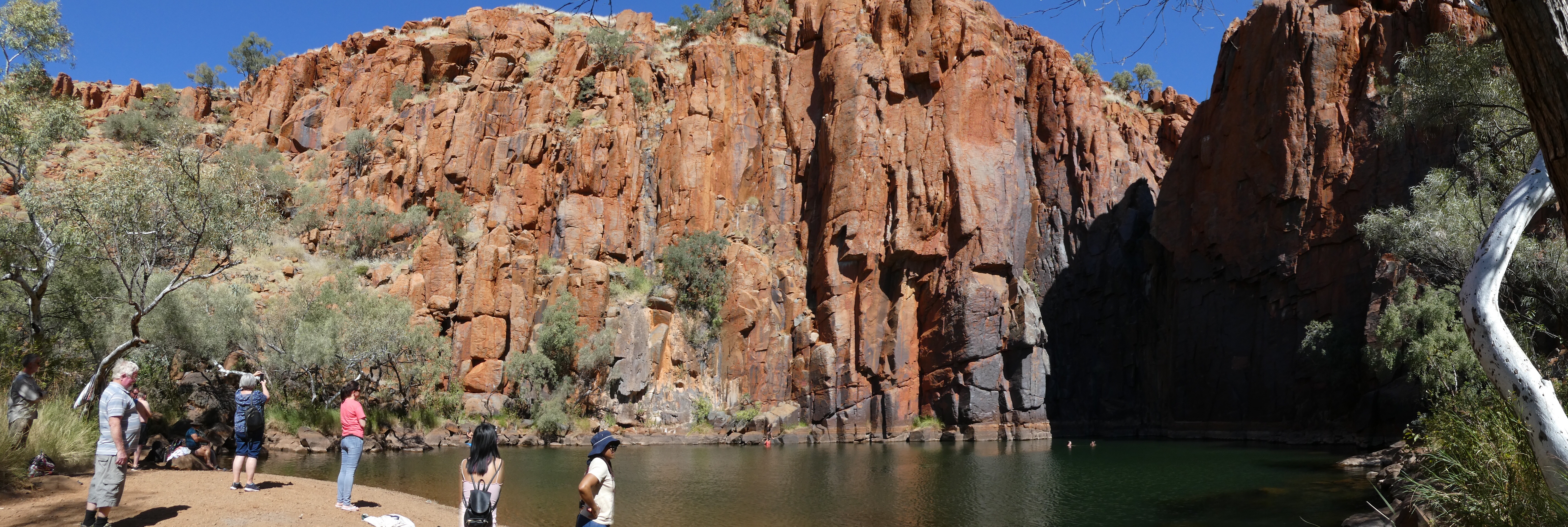
Our next stop was the famous Python Pool, where red rock pillars stretch high above a clear green pool, cradling it in a semicircle of impressive dimensions.
We admired the pool but didn’t swim. We might need that time later in the day. More lovely flowers along the path here too.
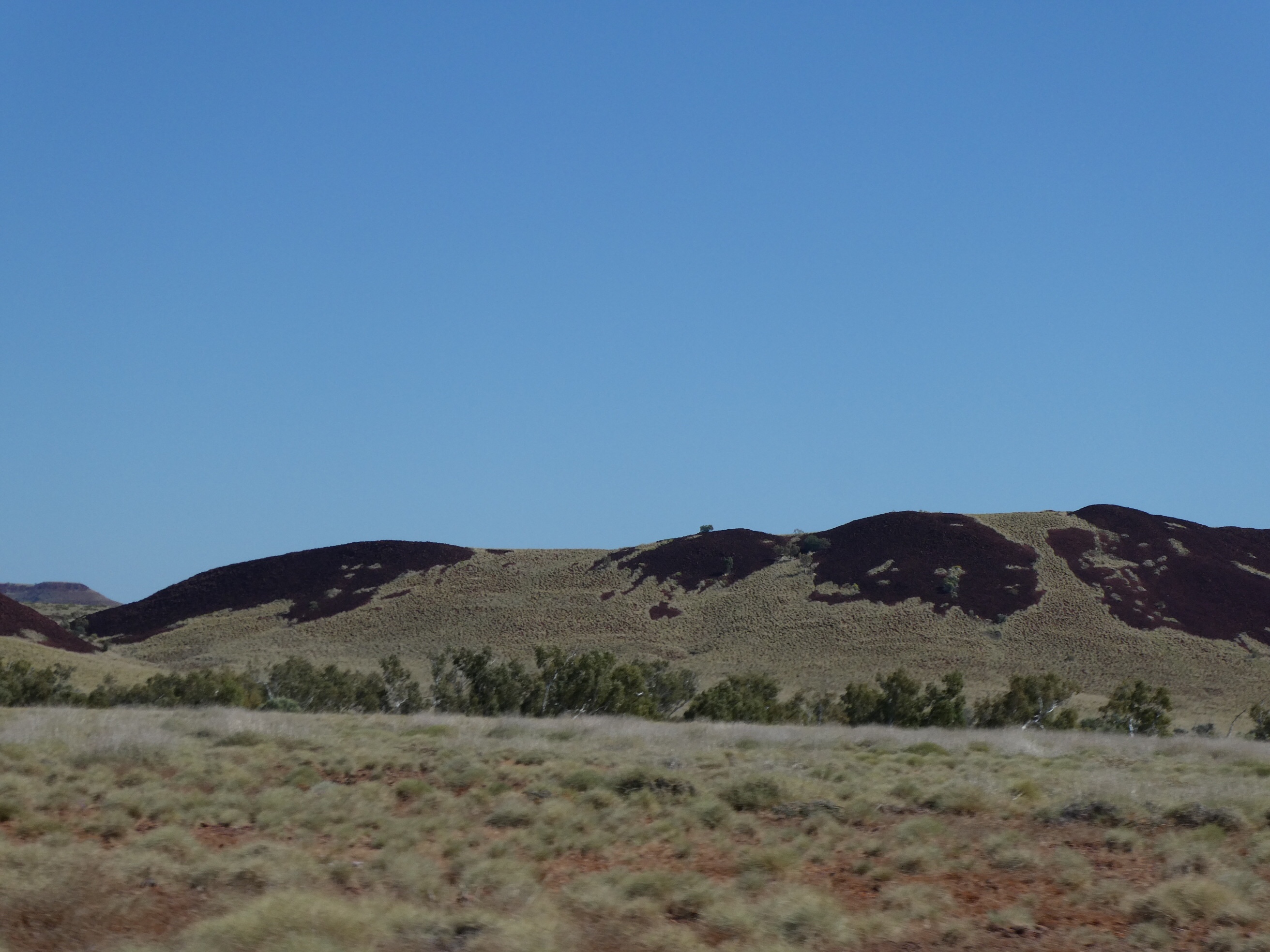
We headed on towards the highway, passing Pyramid Hill and Mt Dick as the road headed through the Pilbara and the wildflower treats gave way to grass and termite mounds.
The growth of spinifex on the hills looked like melting snow.
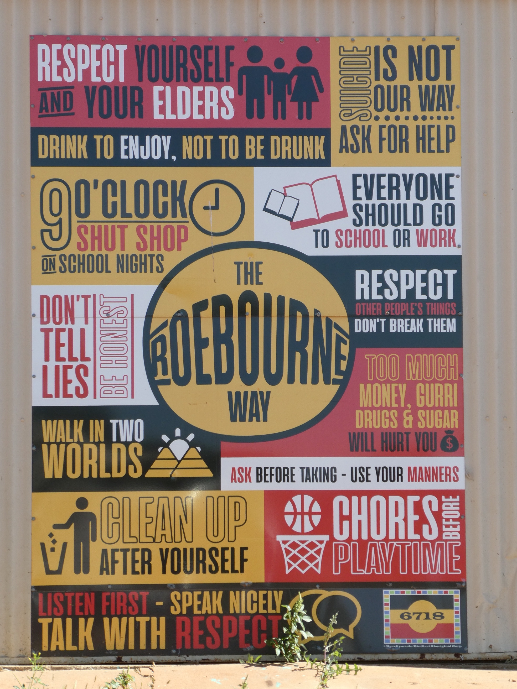
We turned left on the highway and a little later were heading through the town of Roeburn. Interesting artwork on show in the town.
Karratha was next. We had a pie for lunch at the local shopping centre, took a quick tour of town and went on our way to Dampier.
Dampier got the same treatment. We admired the red dog statue, laughed at the quirky art work on the salt pans, had a quick drive around the esplanade, admired the water and turned back.
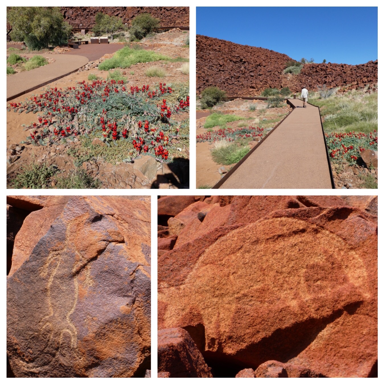
We diverted off to the side to visit Murujuga National Park to see the rock art (etchings) there and then stopped in at Hearsons Cove where we admired the beach, gaped at the multi-flamed stacks at the nearby Dampier Hamersley power station and used the public loos.
Then we were in our way again. 123 litres of diesel later we pulled out of the service station and were headed for our chosen camp spot.
As we turned on to 40 mike road we passed the Santos devil creek gas plant on the corner. This part of the country are sure working on using the natural resources up.
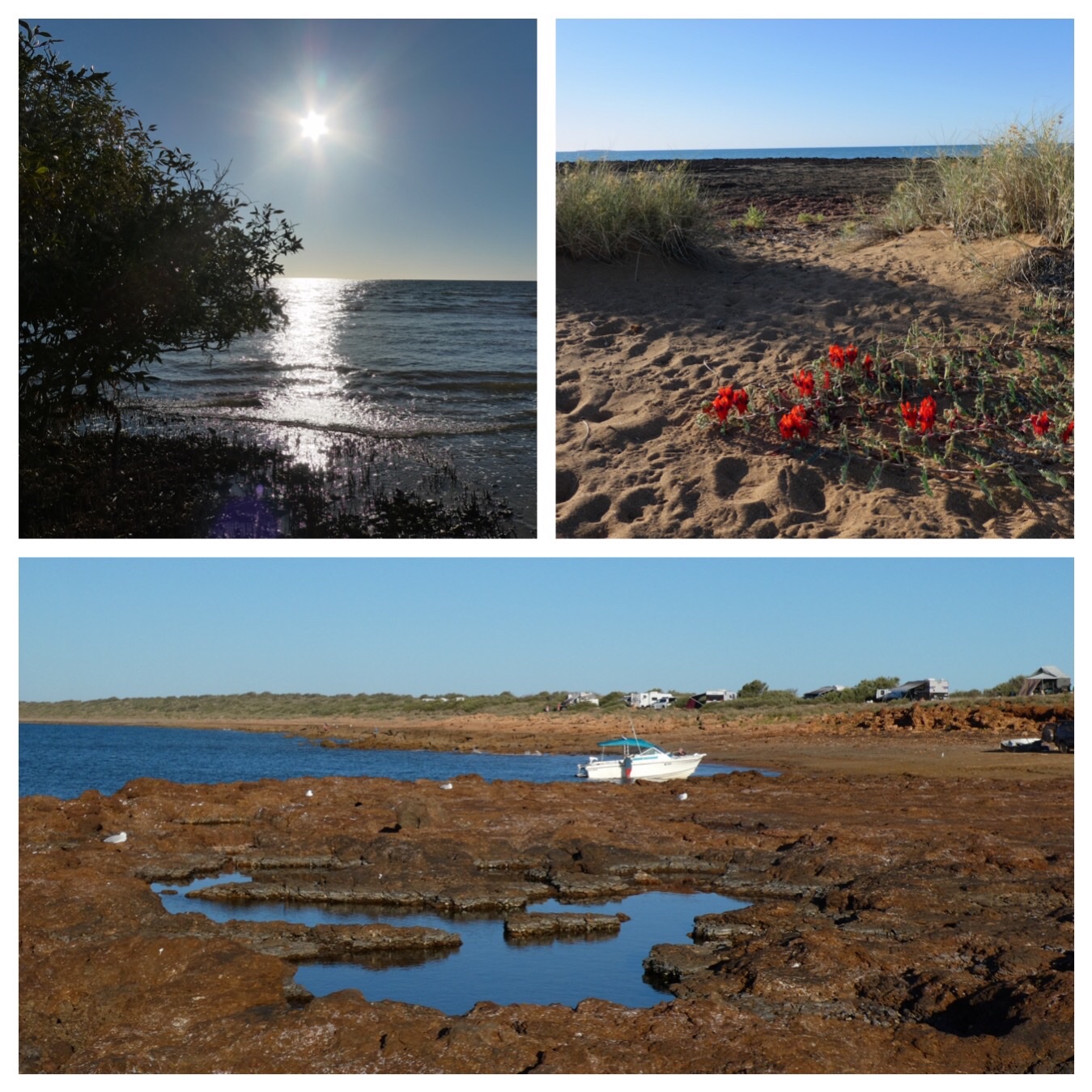
As we turned the corner towards Gnoorea Point, where the camping is, we were met with the sight of a wall of vans packed in tightly and issued a synchronised groan. Not quite the beach camping we were hoping for. We stopped to talk to the caretaker and discovered that he had 10 spaces of his 110 and was happy to have our group of three use two of these. We paid online to the council ($16) and he directed us along a track to a spot on our own about 700 meters away from all the crowds. We were looking out over a few mangroves to the west with plenty of space for us all.
We took the opportunity to enjoy the spot, walking out to the water through the mangroves and then along and around the point to the boat ramp, investigating the rocky pools as we went.
The sunset was a beauty, and the colours afterwards were stunning. As the lights came out we realised that the huge SINO magnetite iron mine is just across the water from us.
By then both of our travelling partners were in place and we could happily settle down to a night of peaceful sleep as we listened to the water gently lapping and the wind gently blowing.
Pink hock flowers and purple mulla mulla decorated our travel from Karijini to Tom Price. On the advice of the girl in the Karijini visitor centre we had changed our plans about how we would get to Millstream.
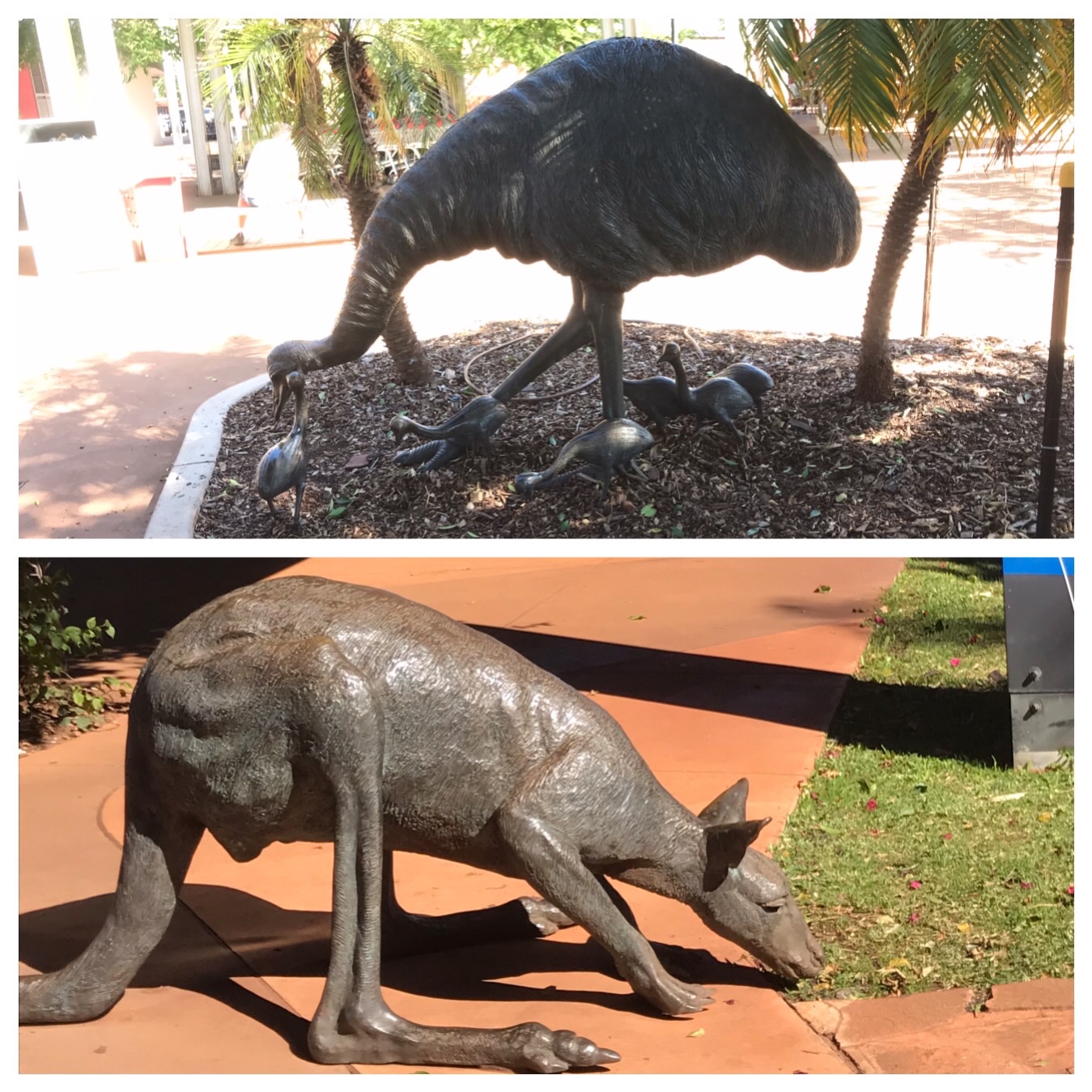
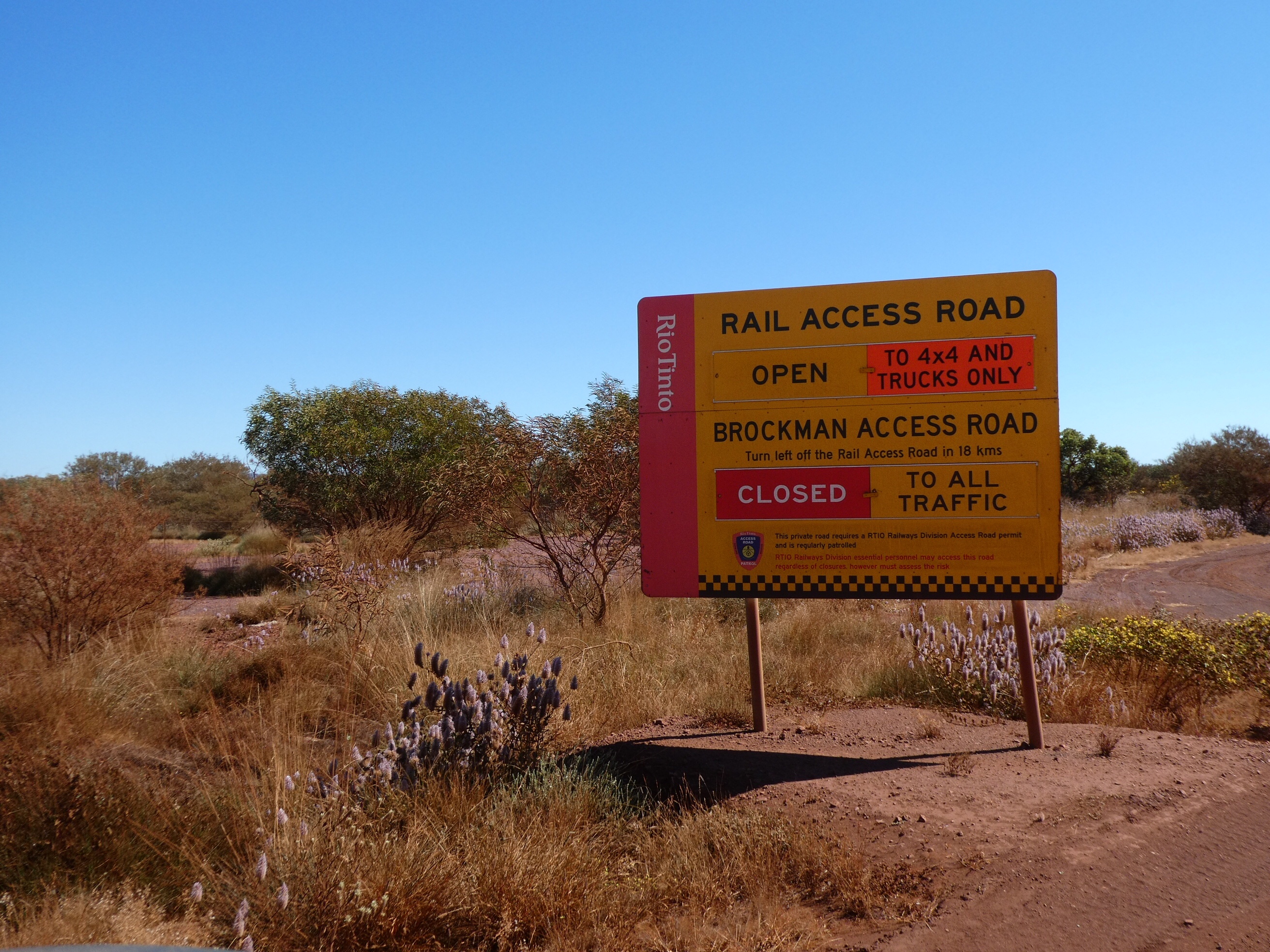
At the Tom Price visitor centre we waited our turn to watch the 20 minute induction video about travelling on Rio Tinto’s private railway access road which would allow us to travel on the road. Having duly completed our training and with permit in hand we completed a loo stop, made a brief shopping visit to the Coles across the road, admired the animal statues and left our rubbish in the conveniently located bins. Then we drove to the local oval where we stopped for a cuppa before tackling the road.
Reportedly this road is much better than the public road. The locals use it for their travel to Karratha. The road speed limit is 80 for normal vehicles but much of it is reduced from that for various reasons ( worksites, intersections, curves, creek crossings etc). For all trucks the limit is 60 and they are restricted to only 2 trailers!!! If caught speeding twice drivers are banned (or “terminated” by Rio Tinto) and blood alcohol level allowed is 0.00 for all occupants of vehicles. They have their own speed detection, breath testing and road marshalls.
Naturally, the road is alongside the railway line and the trains are frequent and LONG. We counted the trucks on one as we slowly overtook it( just in time to cross the railway crossing before the level crossing activated). There were 233 trucks and 3 locos at the front pulling the whole lot. These trains are about 2 km long. The train was doing about 70km/hr and we were doing 80 ( except when restricted to lower). I had to count backwards a little bit when the train gained on us.
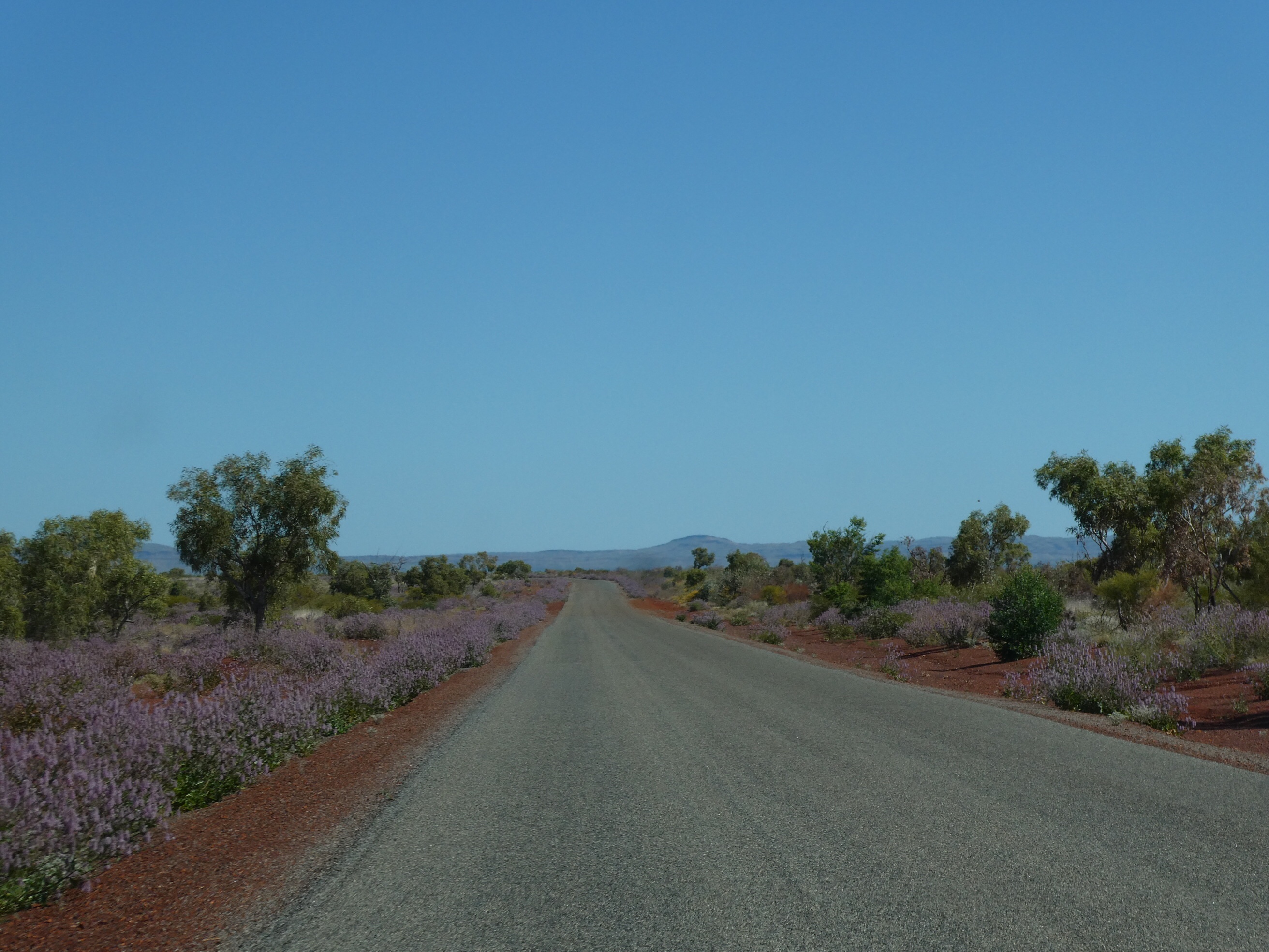
The road is gradually being replaced/upgraded by national roads with a new “Red Dog Highway” which will connect Karratha and Tom Price. Meanwhile sections are in poor repair. Some spots are like a flower garden on either side.
We were able to follow this road in for most of the way to the Millstream Chichester National Park and then turned on to corrugated dirt.
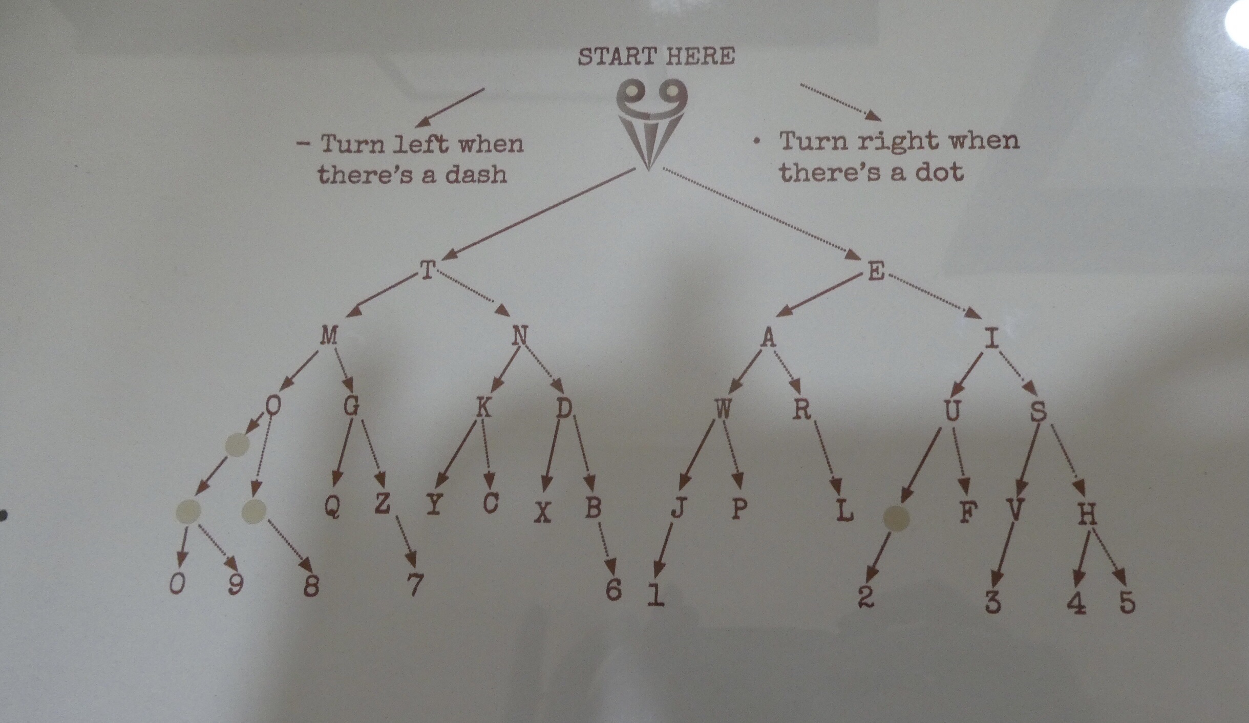
The rangers office is in behind the old Millstream Homestead. You could walk through the homestead and read what life was like in the past. They had a good map for using Morse code which really simplified it. If you have a dot take the right choice. If you have a dash take the left choice.
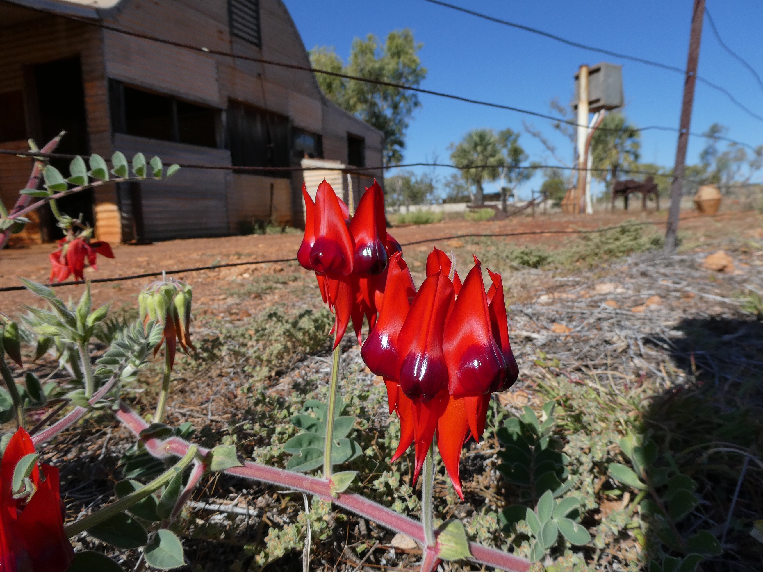
Millstream homestead has stacks of Sturt peas growing and flowering in profusion. What a sight!!! Stunning healthy specimens all over the place. In fact the park has offered us more views of Sturt Peas in the wild than ever before. Stunning. They just grow like weds along the roads and tracks, delighting us every time we see them.
We were looking forward to spotting birds along the wetland walk, but were disappointed to find it closed due to water damage. So we walked part of the Warrungunha trail looking for birds we could hear but not see. We didn’t see them!
The cliff top walk gave good views of how large the Fortescue river is, with various views down to the river flowing along below and beautiful sides of the hills down to the water covered with spinifex in flower and other flowers.
. The Deep Reach pool was actually a huge stretch of the river with steps going down to it in two different places and with numerous tables and bbqs.
We camped at Stargazers campground , where the volunteer campground host made us very welcome and made use of the bbq, hot plate and water provided.
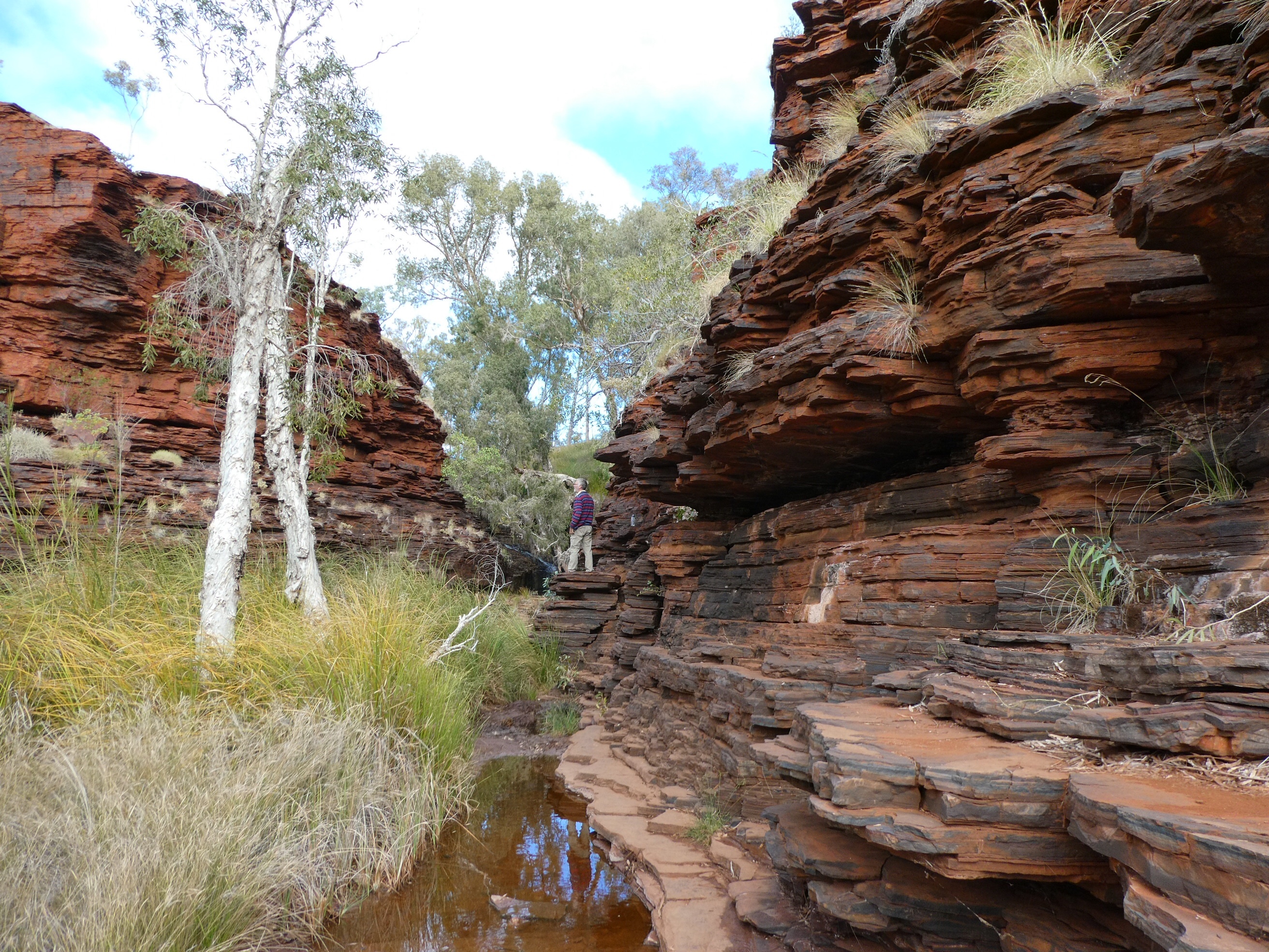
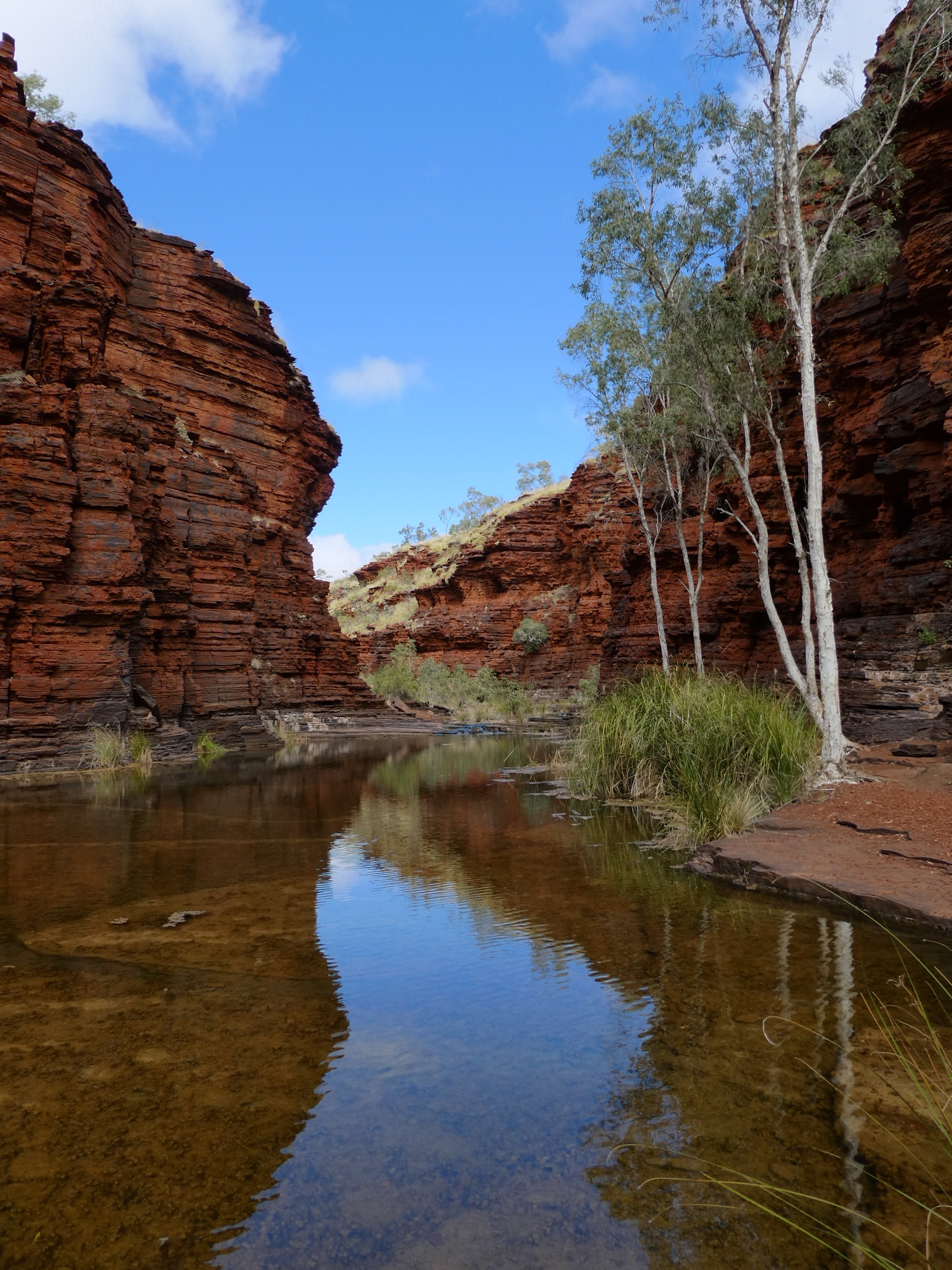
We had a much quieter and lazier day today. We once more drove the corrugated dirt road to the west, but not for so long. We stopped at Kalamina Gorge, where we spent a relaxed and enjoyable time.
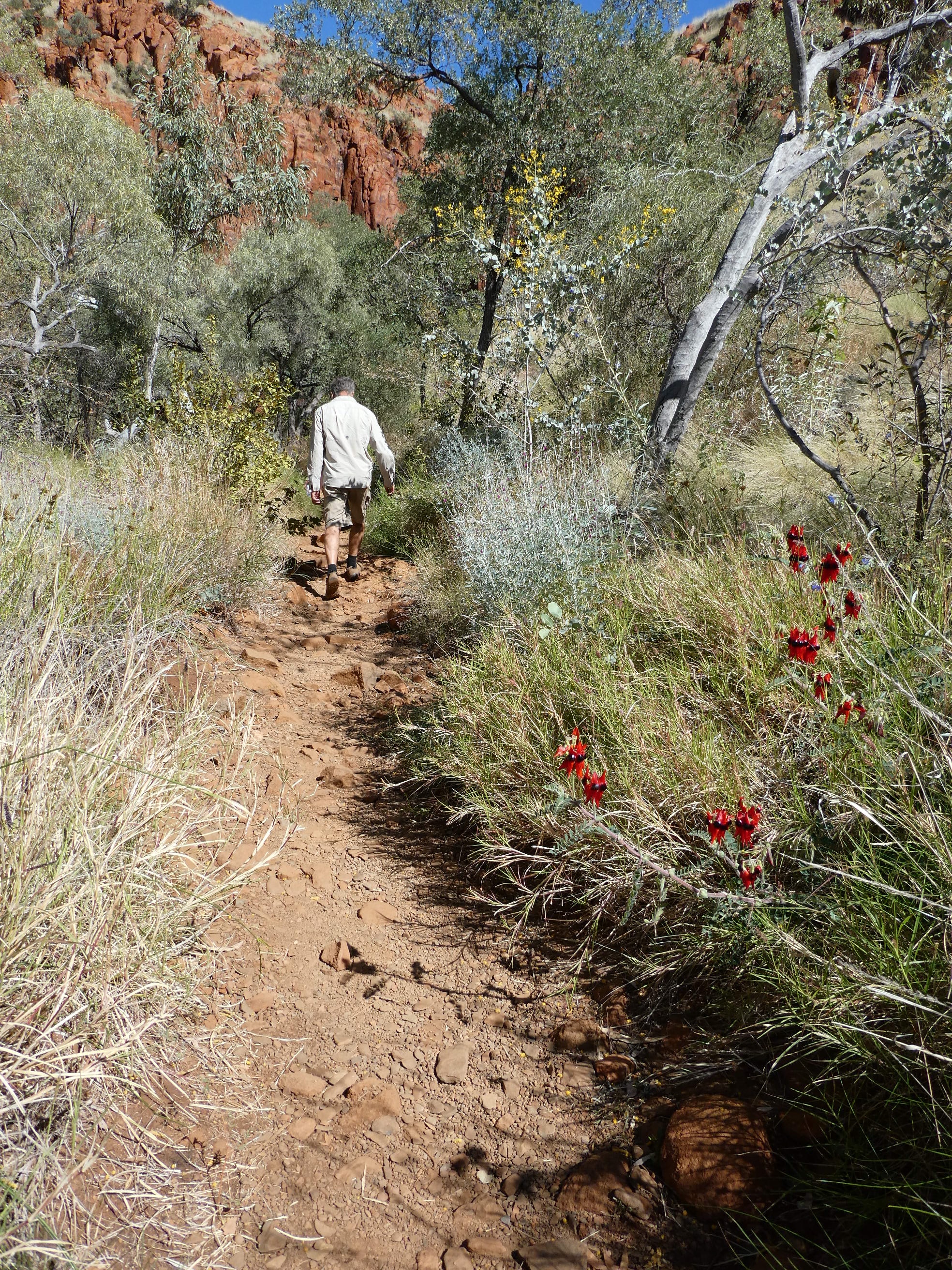
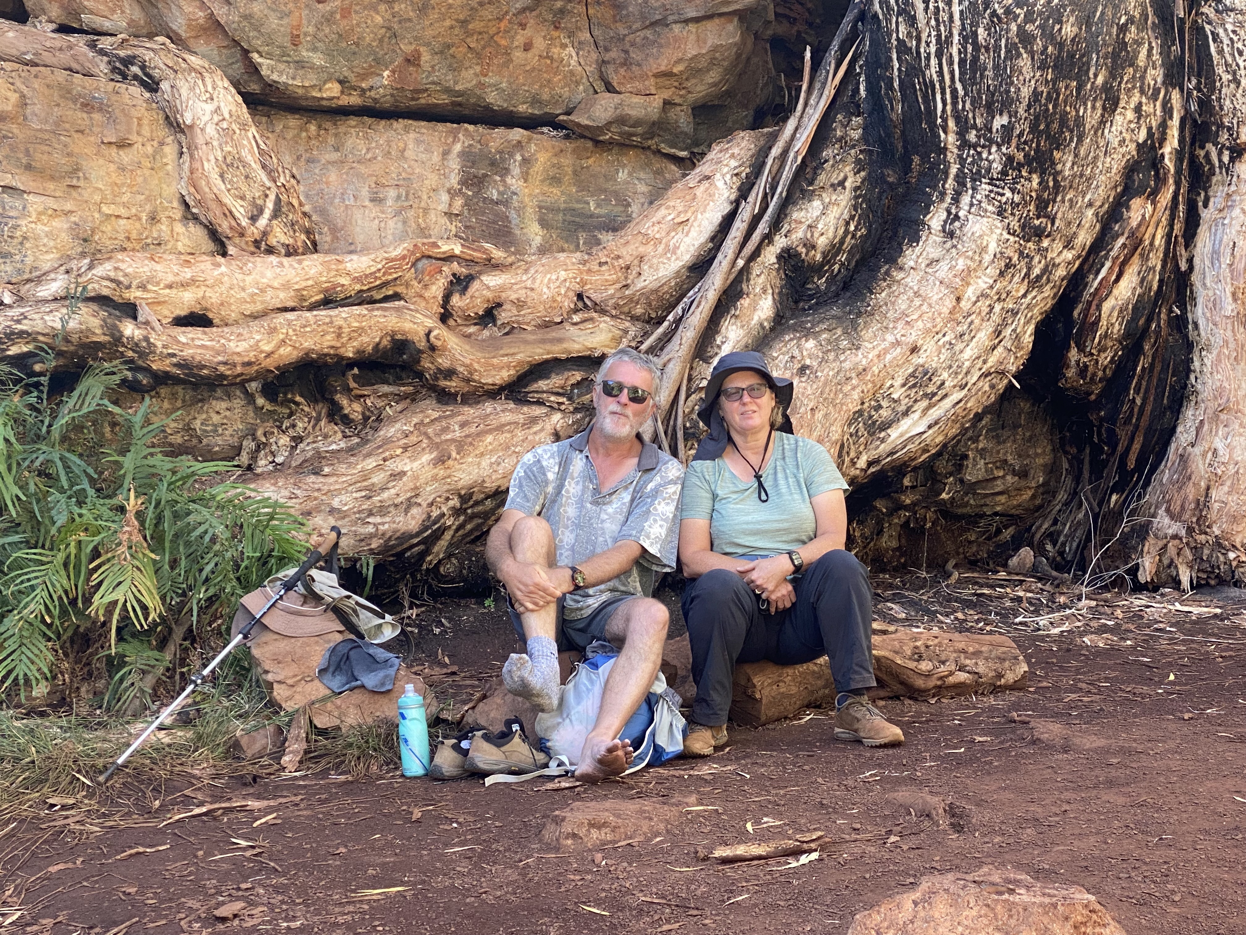
After the rocky climb down into the gorge we first turned to the right and, after a bit of rock climbing,
Trevor is about to turn the corner into the waterfall.
arrived near a small waterfall. Retracing our steps and then continuing in we found beautiful still water and rock or many colours and shapes. It was a beautiful walk of discovery which ended by the Rock Arch pool,where you can look up above you to the opposite side of the pool and up quite a distance, to the arch above.
I took lots of photos. Here are just a few.
We again met Al and Zita walking in as we were walking out. They recommended the display at the Visitor Centre, which we had mot yet looked at due yo always arriving there just on closing time.
We decided we had had enough gorgeous gorges for the moment, and headed back to the visitors centre, where Trevor paid for a shower which turned out to be cold. Erica had had a full on wash with warm water ( including hair wash) the previous afternoon.
We had visitors ( Ian and Judy?) who were keen to find out about our camper as they are interested in getting something similar.
It came in much cooler, so after dinner it was a relatively quick pow-wow at the Colwell’s shelter to plan the day ahead before we headed off to a much chillier night without much sleep for either of us.
There was a notice up at the information board telling us that the Uniting Church patrol padre was running a service in the campground the next afternoon. By then we would be in a different national park
As we drove the very corrugated road across to our next day of Karijini adventure we admired the beautiful purple Mulla Mullas so beautifully arranged on the road verges and the striking white trunks of snappy gums against the red of the rock and pale green of the spinifex.
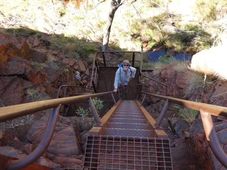
Hancock gorge was our first target for the day. It is the gorge that visitors rave about. It is classed as a Class 5 walk- for agile and experienced bush walkers only. (possibly we do not fit the picture) and we found out why.
The descent to the gorge floor is via rocks used as steps and via ladders.
There were rocks to hop on, and then pools which extended to one side from the other. This forced you to either climb on the walls of the gorge or Ford the water, no matter how cold and deep.
I opted for the safer but chillier option. Trevor stayed warmer.
After a series of pools ( progressively deeper and colder) we came to a rocky amphitheatre area where the sun was shining down on the red rocks. After a brief warm up we tackled the last narrow passageway through to Kermit’s pool ( a small, deep, super-chilly pool). This afforded its own challenges. Slippery, wet, narrow rock base or put one foot on either side and straddle the gap as best you can.
At the other side of Kermit’s pool is the rope to say that you have come to the end. No further please. Later in the day the ranger was down there trying to get some hurt hikers out who had ventured past this point. We do not have photos of these last areas as cameras were put away into the wet bag for safety.
We retraced our steps after another warming rest in the amphitheatre, meeting Al and Zita coming in just after completing that icy exit swim.
We were glad to reach the car park and our dry clothes. We sat and had a warm cuppa and our lunch after changing and hanging out wet clothes on the nearby bushes to dry out.
Once we had recharged we headed for the lookout. Junction lookout is currently closed due to unstable footings- we could get to the entrance of the lookout platform and hear the sounds of the pool below, but couldn’t see the water. There is a Celtic cross memorial here to a rescuer who lost his life trying to effect a rescue at 4am as a flash flood came down the gorge.
Only a short distance away, at the Oxer lookout we were able to look down in wonder to the gorge floor far below us and around at those dark red cliffs.
Retracing our steps just a little, we then headed downhill into Weano Gorge-once again using rock steps of uneven heights but quite manageable. At the bottom of the steps was the sign telling us that we could not go to the right. Handrail pool and the walk leading to it are currently closed. They had a number of falls in April and one death last year and decided that enough was enough. Until some more safety structure is in place (hopefully in September) the trail will remain closed. The ranger was coming out along the closed path. He had been in there checking that no-one was disobeying the rules. The ranger was later seen by Al and Zita in virtually the same spot (this time escorting a young couple out of the gorge from along that path)
Weano gorge was a much quieter walk. It is not one of the most popular gorges. There were quiet pools of water and mostly the walking was on flattish rocks or on formed paths.
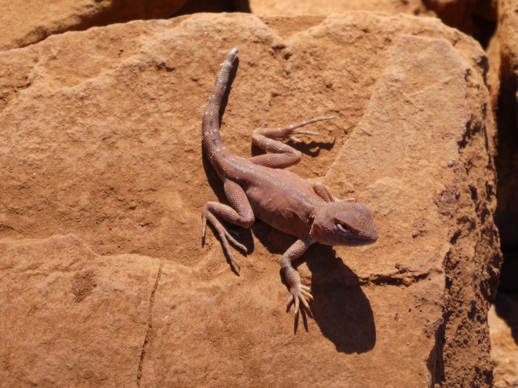
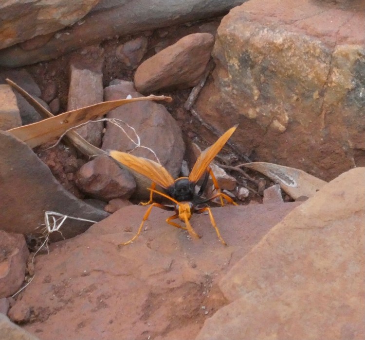
We enjoyed looking at some plants and critters at our own pace.
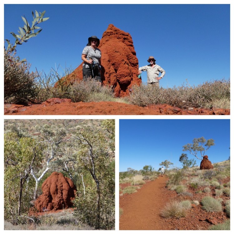
After following along the gorge, the path slopes out gently, saving a steep climb out. The ever-present termite mounds (we have called them “Termundes”) we’re here in abundance.
Termundes

Termundes watching everywhere
Round the bend and over there.
Amongst the rocks, behind the tree.
I think those things are looking at me.

Standing guard so silently.
Watching oh so patiently.
Do they move when we’re not aware?
Termite mounds are everywhere!

Red and brown and grey and white.
Was that one there the other night?
Are these mounds a friend or foe?
I think that we will never know.
We returned to the camper in the car park to find Al and Zita defrosting from their visit to Hancock Gorge and enjoyed a chat while they ate their lunch.
There is an Eco Retreat at Karinjini that we had not been aware of. They offer a range of accommodation. Including lots of the safari tents with and without bathrooms, as dorms and with different bed configurations. They also had a restaurant and a bar. Even in the associated campground there were showers (unlike at Dales, where we need to pay $4 at the visitors centre for a solar heated shower if we want one). We took a drive around this area before we headed off to take a look at Joffre lookout on our way back to camp. Sadly the pool at Joffrey Gorge was in deep shadow, but we could see the various steps and ladders needed to get down into the gorge and the swim, wade or rock climb required to get to the pool at the end, where a waterfall currently struggles feebly down a wide expanse of black rock. It would be a spectacular fall to see in the wet. Apparently some of these stairs and ladders have only recently been added, but it still looks like the rock bit would be pretty challenging. The platform of the lookout has a gate section. Maybe so that it can be used for rescuing fallen hikers?
Back along the corrugated road we overtook Ev and Craig as we made a dash to the visitors centre- arriving at 3:58 (they close at 4:00) to buy a drumstick each and a cute emu mug for Erica.
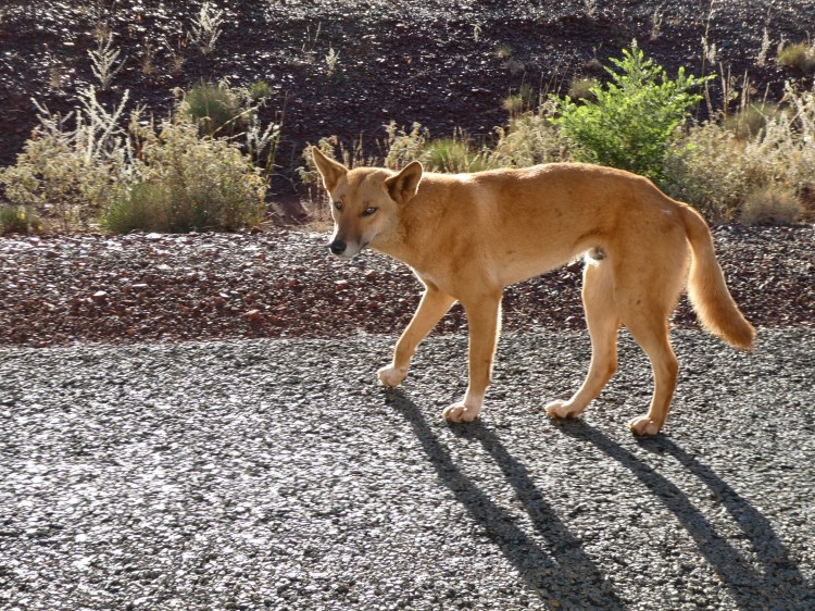
Then a detour to drop off our rubbish, top up the water and use the water to do a bag of essential washing. We saw a dingo on the road as we drove the final leg back to the campsite.
We enjoyed communal nibbles with our travelling companions prior to a late tea and a much later dinner and bed time due to this, but it was lovely to sit and relax under the awning that Al and Zita had put up for their four night stay.
We decided to se the closer areas to our campsite and walked down from our campsite to the Dales Gorge area.
Our first stop was at Circular pool lookout. This gave our first spectacular look into the deep, dark red gorges of Karijini. It afforded a spectacular look down into Circular Pool itself. This lovely pool, surrounded by dramatic cliffs is entered by walking along a shady bottom of the gorge. Sadly, this was the only view we would get of this pool as the walk is closed at the moment. There have been rockfalls and more large rocks are at risk of falling at any time.
We met one of the rangers here and had a bit of a chat. It seems that he spends a lot of his time policing the park rules. He visits here and check’s that no-one is down there putting themselves in danger.
Interestingly, the local traditional owners actually have their ceremonial land in another group’s area. They were moved off of here, formed firm bonds with the people from the area they moved to and were gifted some land of their own in that new area to use near Cane River. The ranger also gave us a bit of a heads up about birds to watch out for on the area. Apparently they see white winged fairy wrens near our campsite sometimes.
Three Ways lookout was the next stop. From here we could see where the three gorges meet.
Not much further along was the pathway down into the gorge. Trevor, Ev, Al and Craig took the rocky steps down into the gorge, while Zita and Erica took the rim of the gorge, looking down into the gorge to the lovely shady path and the pools down below.
The gorge offered mostly shady flat walking with some rock hopping. The path followed the floor of the gorge beside quiet pools and paperbarks.
Meanwhile I was enjoying the joys of the rim walk.
Aren’t these cliffs spectacular!
We met up at Fortescue falls where there is a lovely (cool) pool below the falls. Zita snd I had taken stairs down to the top of the pool. Trev and the others walked in to the bottom of the pool and then negotiated their way around it to meet us.
From here we went past the flying foxes in the trees to Beautiful fern pool. This was also cool, but Trev was ready to swim and took the plunge- even treating himself to a cool massage courtesy of the waterfall.
We walked back via the stairs and dropped in to see the campground host on our way past.
We have booked for Millstream national park (Stargazers campground) for one night after we leave Karijini. This will at least give us a brief look at it. After that we are planning to stay at a camp ground called “40 mile” which is almost 40 miles west of Karratha (at Gnorrea Point) and then Emu Creek Station on way to Exmouth.
By the time we get to Karratha, Thom and Laura should be on the ground in Oz and doing their time in quarantine in Darwin. Hooray. We were very mindful of them madly packing to leave the UK.
In the meantime we have received a photo of Sophia (3 months today). This leaves us with mixed feelings of joy, pride and sadness at being so far away. It will be wonderful to get back home and build up our relationship with her when we can.
We woke to another pea souper. So happy that didn’t happen earlier. We could see Craig and Ev beside us, but no further. It slowly lifted as we ate our breakfast and packed up.
We headed out towards Port Hedland, leaving our rubbish and recycling and using the other handy nearby facilities.
We had time for a bit of sightseeing in Port Hedland, and watched a big boat come in, noting the difference in height between the loaded and unloaded boats. The tugs were very busy as we enjoyed our cuppa.
We filled up at the prepay puma fuel in the industrial area as it was about 8c per litre cheaper than the others around town.
Trucks with 3 and 4 trailers (60m long) are all over the place. 2 out of 3 vehicles have Fluoro signage on the side (mine vehicles). We had to follow a wide load vehicle with huge metal structure and 3 others as we headed out of town.
Luckily they pulled over for a load check, allowing us an opportunity to get ahead of them. Karijini here we come.
We were reluctant to stop for lunch and have to overtake all those 60m long trucks again, but at about 1:30 we decided to pull over into the “two camels creek rest area” and were lucky enough to jag a table under shade. We boiled the jetboil and had a hot cuppa and wraps for our lunch with some of that delicious prized salad in them.
We started counting road trains that we passed and had 18 within the first 20 km of counting. It is just crazy! We are feeling for our fellow travellers who are towing. Those rigs sure blow you around on the road.
We dropped in at the visitors centre briefly (finding that a number of locations are currently closed) and then to the camp host to verify the number of campsite for the 3 of us. A lot of the sites are directly off of the road through the campground but we have a little road in that feeds into our 3 campsites (and we could have all squeezed onto one site) so we have heaps of space, even if there are not a lot of large trees.
On days like this long one (the second of two of over 500km) we are happy to have a set-up that is quick to pack up and not blown around too much.
The other two arrived just before sunset (hooray) and pulled in to their spacious parks. It has been a long drive for all of us. 545 km today. We have covered just over 1000km in two days that we were planning to do in five. We have missed out on visiting Millstream and still need to figure out whether we back track to there and add km to the next leg or settle with missing it.
We woke up to another foggy morning in Broome. That gives us 4 for the week when they supposedly only have about 20 per year! We felt very lucky to have had a clear day for the Horizontal Falls trip.
We had a few jobs to do in Broome before we got on our way. I finished the backlog of blogs so that I could start with a clean slate again.
We packed up the camper and checked out but still needed to do a bit of shopping and get fuel. We also pumped the tyres back up to hard road pressures ready for travelling on the black-top.
Fuel was 1.58.9/ litre at the Caltex in Broome and we added 89.53 litres.
We stopped at Sandfire roadhouse for an egg and bacon toasted sandwich along with dozens of caravans ( mostly heading north). There are a lot of vans on the road.
We travelled 500km from the hotel to our campsite on a rocky beach at Cape Kenaudren. We cannot believe how many others are here!! There must been over 200 campers altogether. At $32 for each campsite this is good takings for the council.
We managed to find a spot big enough for the 3 set ups together by following a side track and we are still hoping for one more reasonable moonrise viewing, although the optimal time for the staircase is past.
The track in off of the highway is about 10km long and we paid by phone to the council office at Newman (their preferred method)on a sketchy phone line before driving on in past a pretty inlet, and a beautiful sandy beach to our rocky beach which is mostly east facing.
We thought we were going to miss the others. Phone coverage was in and out and I was on a hilltop waving at Al and Zita as they drove past trying to tell them where to go. Luckily they saw me.
There are mud flats beyond the lethal spiky rocks, giving a great opportunity for the moon to do the staircase ripple effect. The beach is shallow and the tide goes out for ages.
Trevor found an octopus on the beach which kindly cooperated by spitting at him multiple times. How fantastic! There were also lots of sea cucumbers and crabs. Some of the rocks have heaps of shell attached and they crackle at you.
The rock is probably coral but looks almost volcanic. Some looks like mud, turning up on the corners of the section like mud flat does when drying, but it is as hard as stone.
Not the only strange thing here.
As we waited for the moon to rise we were treated to a terrific display. Trevor caught a bright glare in the sky which then burst even brighter, flashed, continued and then disappeared, but all of us saw multiple shooting stars. And then the huge orange moon rose above the mud flats and treated us to the splendour of another staircase. Sublime!!!
As the moon rose further and the tide came in we could see the water rushing in by the bright moonlight. It looked like a continuous forward surge. We had never seen anything like it. Quite surreal.
Add to this the fact that there had developed a continuous dripping from the roof of our camper as the condensation formed. The air was so humid that everything felt damp. The drying bathers got wetter!!!! The diary got damp.
We had a long and incredible day today. After over a year of planning we finally made it to the horizontal falls.
We were picked up early (5:30) from our hotel to head for the airport
From there we flew by seaplane to the base pontoon on the Talbot Bay near the horizontal falls.
Trevor was allocated the co-pilot seat on both the flights
The falls from the air
After swimming next to Grey Tawny sharks as they were fed (with snorkel and masks so we could see them through the cage) we had an excellent cooked breakfast.
We were whisked off to cruise through the river system nearby to admire the rock and learn about the mangroves and waters of the area.
It wasn’t long after we returned from that that we were again on the boat – this time to make the iconic trip through the horizontal falls. An amazing amount of water rushing through such a tiny opening as the tide rushed in! I didn’t take my camera on the boat ride. It wasn’t as scary as I expected, but it did need a powerful boat and skilled driver to manage the surging mass that is produced by the water rushing through the gap.
No sooner had we finished this than we were on the seaplane again heading for One Arm Point on the Dampier Peninsula. As we came in we could see the incredible camping shelter spots which would normally be in use at this time of year. With COVID this community is currently a closed community. Our bus went through town without stopping.
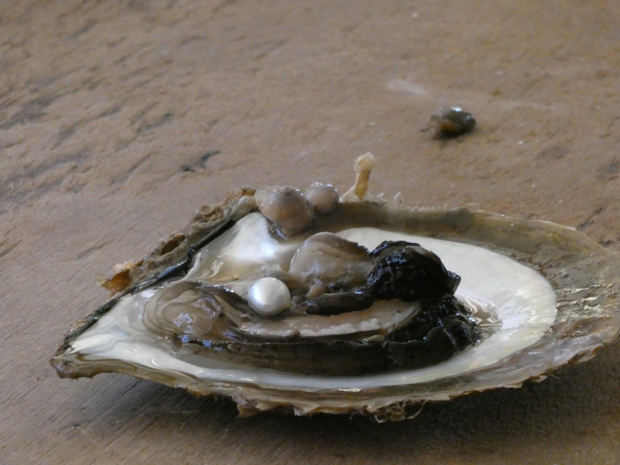
Our target was the Cygnet Bay pearl farm.
Here we had a tour of the farm, tracing through the production of a pearl and hearing about their interesting processes and learning about classing pearls.
We had a fairly rushed barramundi lunch (thought of you Thom) and hopped back on the bus. There was one more stop to be made.
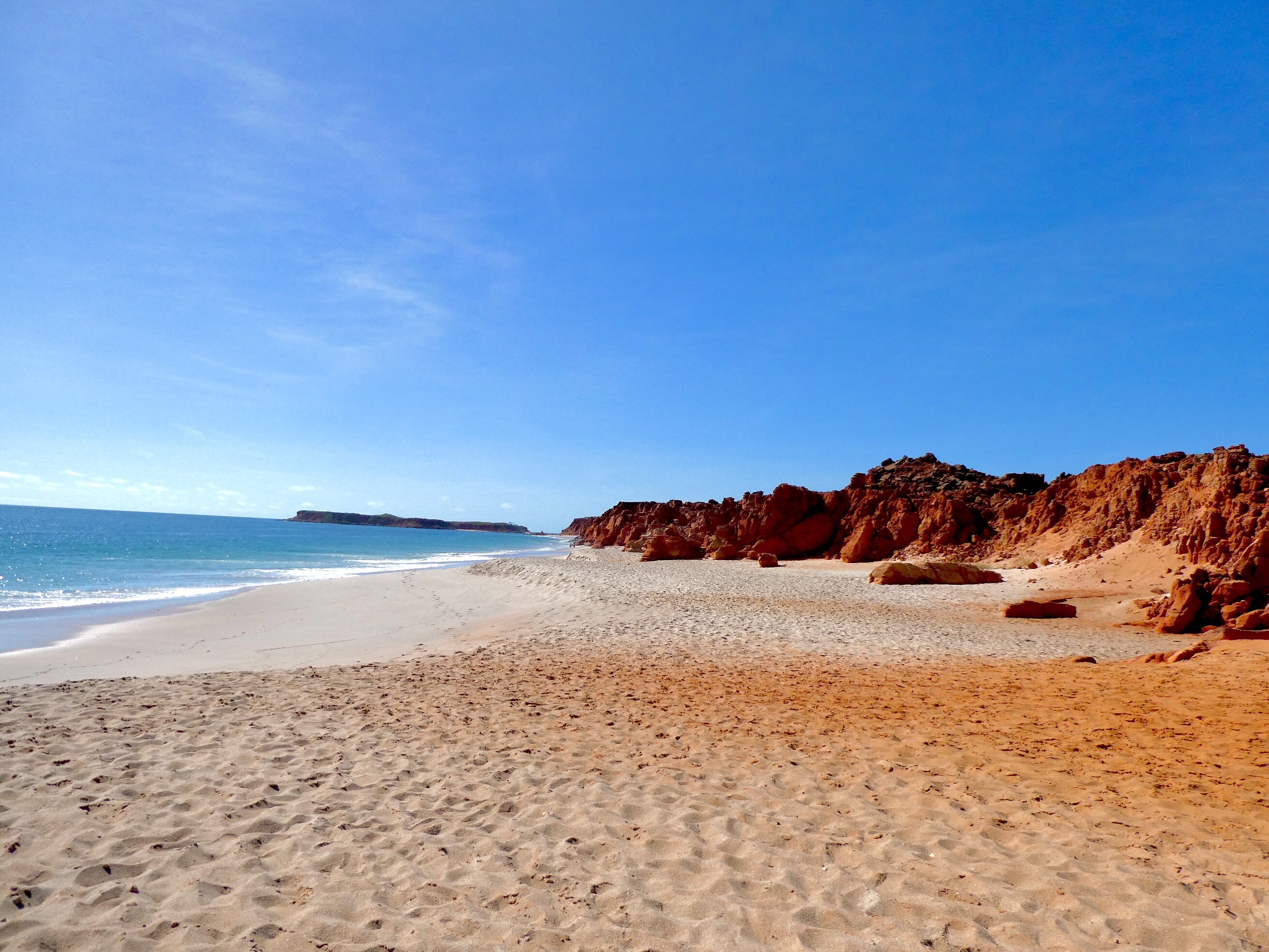
Koolaman (Cape Levique) has brick red cliffs towering over pristine white sand and clear blue water. Stunning.
Then it was back on the bus for the trip back to Broome.
Tomorrow we head off to the south, making our way towards Karijini and a whole new lot of discoveries.
We had a chance to see one last staircase before we left home. Best yet.