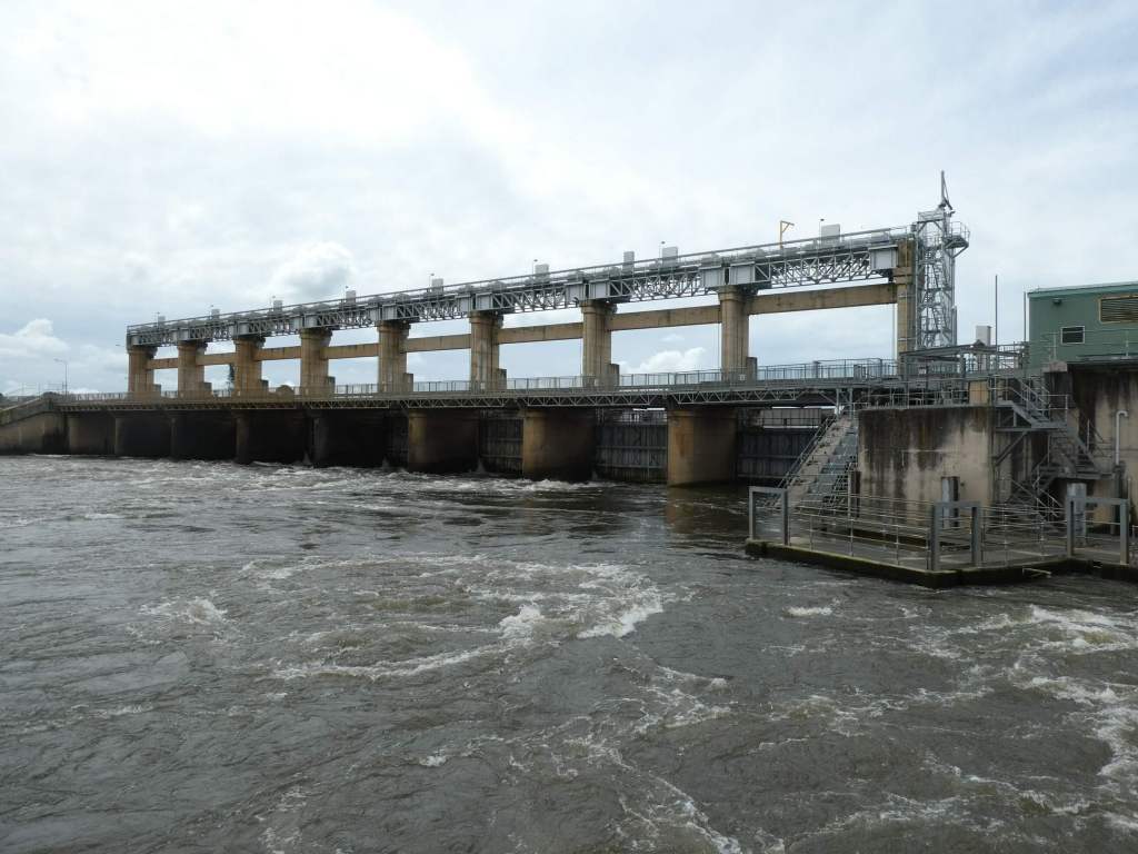
The Yarrawonga Weir was constructed between 1935 and 1939 and formed Lake Mulwala. The twin towns of Yarrawonga (on the Victorian side of the River Murray) and Mulwala (on the NSW side) are linked by a narrow bridge. Most of the facilities are on the Victorian side of the river. You can just imagine what it must have been like for towns like these when the borders were closed due to Covid.
In 1994 a fish elevator was also constructed here and, for the first time in 60 years, fish could again travel upstream from this point. This is electronically controlled.
The hydro-electric power station here (built in 1992) is unmanned and controlled remotely by staff at the AGL Hydro Mount Beauty control centre. It generates about 9 MegaWatts of power to the Victorian Grid.
17% of the Murray River’s annual flow is diverted from Lake Mulwala above the weir and flows into the Yarrawonga Main Channel and the Mulwala Canal. The weir can be used to control water releases and thus reduce the chance of flooding. The Mulwala Canal (constructed between 1935 and 1942) is the largest in the Southern Hemisphere (156km long) and carries water for irrigation across the Southern Riverina to the Edward River at Deniliquin. There is a hydro electricity station on this irrigation canal (the first one on an irrigation channel in Australia) near Berrigan that generates 2.5MW of power. That shows just how much water is going out of the river along this channel.
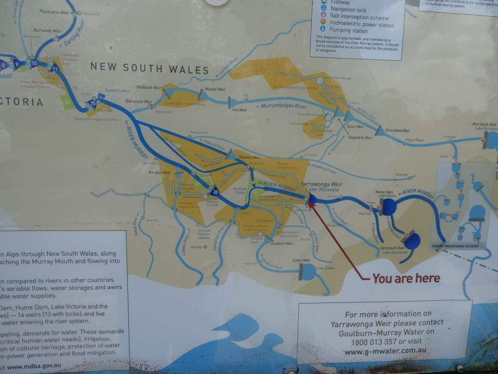
As you can see from the table below a large amount of irrigation goes to Pasture (mainly for dairy industry) but the next highest is to Cereals. This is largely rice irrigation in the NSW Murray Valley. Around a third of the volume pumped to the Mulwala Canal alone finally makes it to SA!

You can’t walk downstream on the Victorian side of the river, but you can cross the weir on foot or bike (it is closed to motor vehicles) and walk on the other side of the river. Since we had had little luck finding a decent walk in Victoria , we thought we would try interstate. It was a good choice. We walked over the weir, with the water surging and crashing noisily beneath our feet, and came out on the other side to a road. A short walk brought us to Gorman Park. This area of 110 Acres was purchased in the 1920s by a community group, and paths and tracks were put in only in 2014.
My knee was starting to give me trouble so I left Trevor to investigate the joys to come alone and turned back to slowly enjoy the vegetation and other views on my way back.


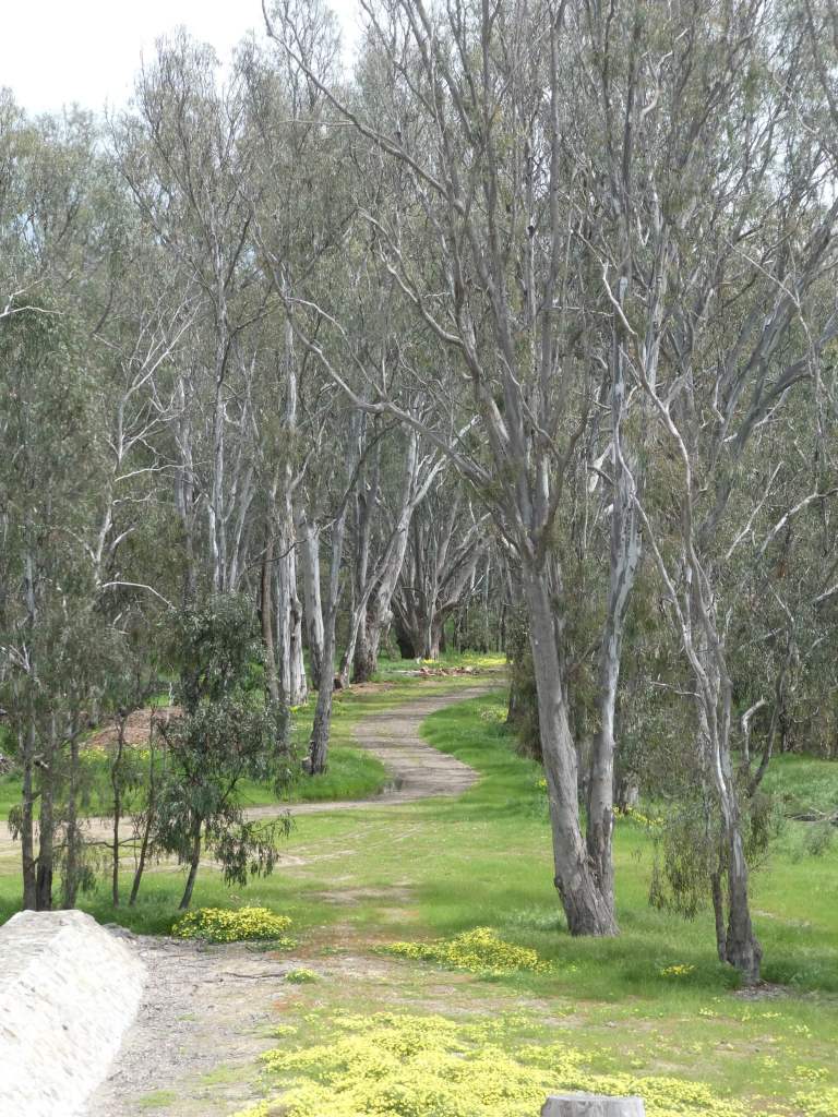


I took quite a while looking over the infrastructure and trying to figure out where the fish lift was and how it worked while I waited for Trevor to return. He ended up doing about 5km to my 2km, and found some delightful tracks to follow.

