
We had a big day ahead of us, so we were up in good time, but the Colwells were already gone when we surfaced. They really had a good early start!! We were a bit reluctant to be leaving Tozer’s, so I guess we did linger a little before we headed off.
We headed out from Tozers the back way and picked up fuel (55.07 litres at 158.1/litre = $87.07) and groceries at Jerramungup before heading onwards. We waved to Al and Zita as they drove through town past us, but they didn’t stop to say hi. They had a busy day ahead too.
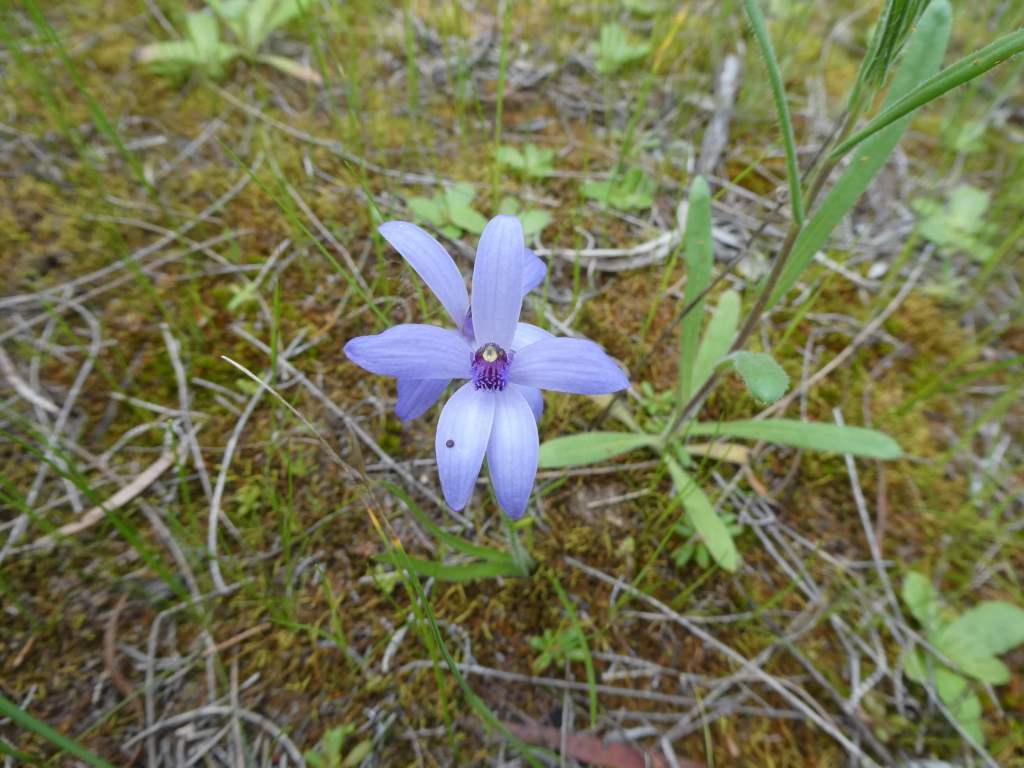
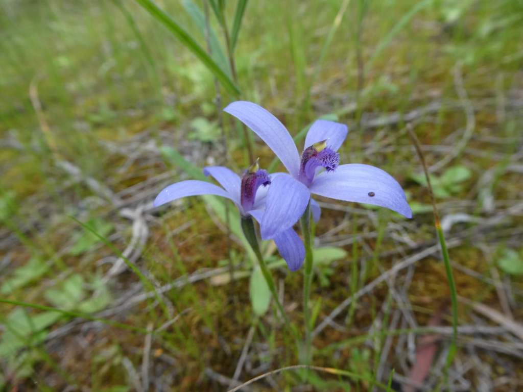
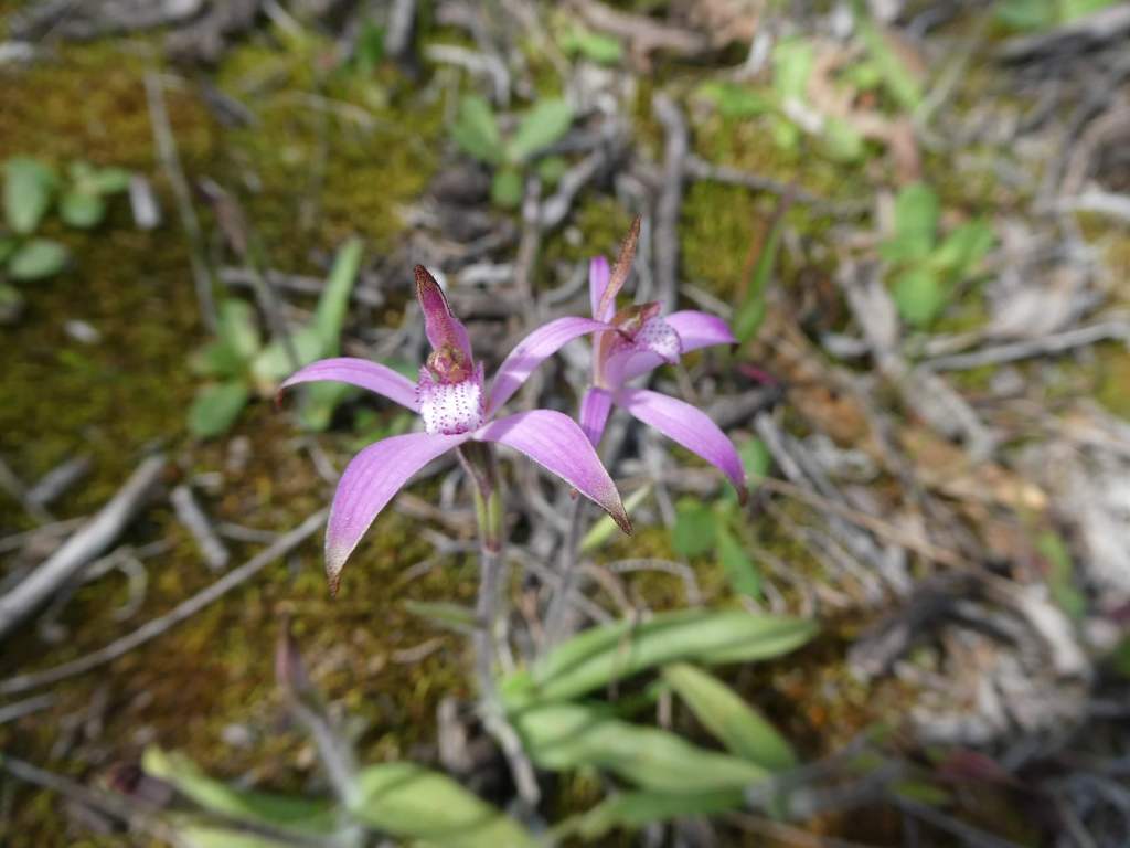
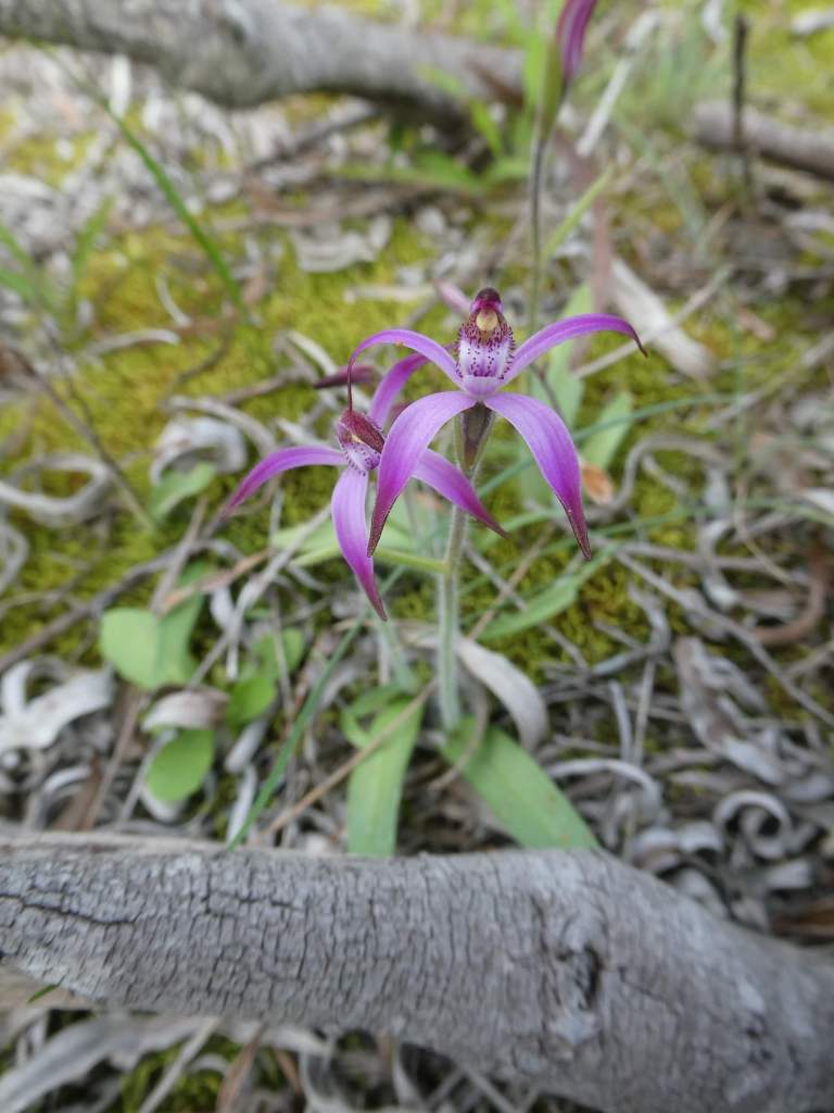
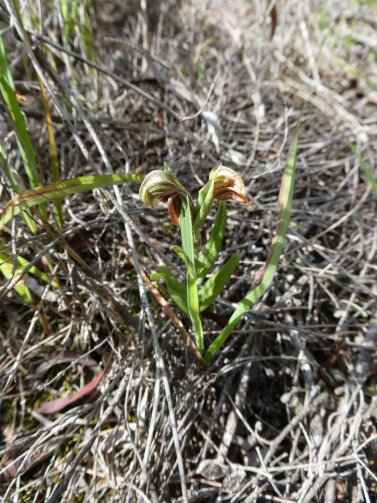
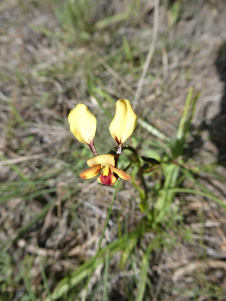
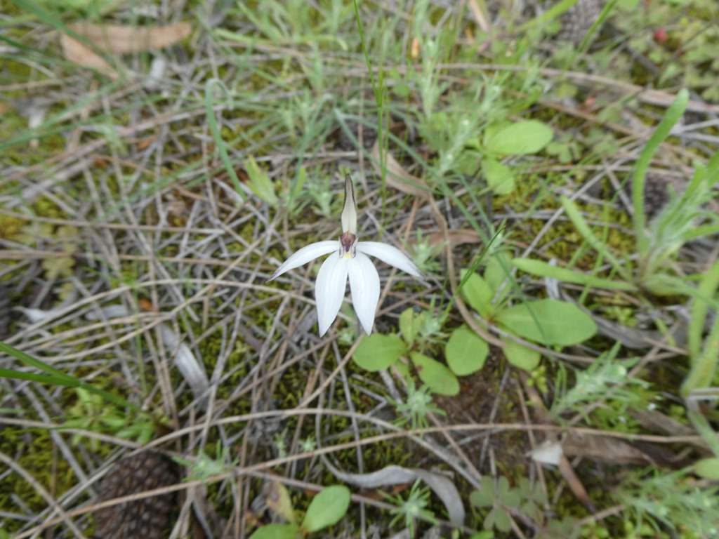
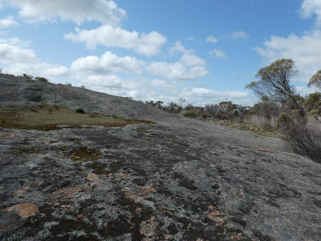
Just after we turned north at Ravensthorpe we were tempted in to take a look at Pallarup Rock and the nature reserve there on our way past, walking to the bare granite rock after having a little native orchid party (along with mosquitos) in the nature reserve grounds near the car park.
We drove on to Lake King, hoping that we might find more information about the road which goes from Lake King over to the main highway from Esperence to Norseman. We were hoping to take this road, as we haven’t driven it before and thought it might be a good route to take on the way home, rather than going via Esperence.
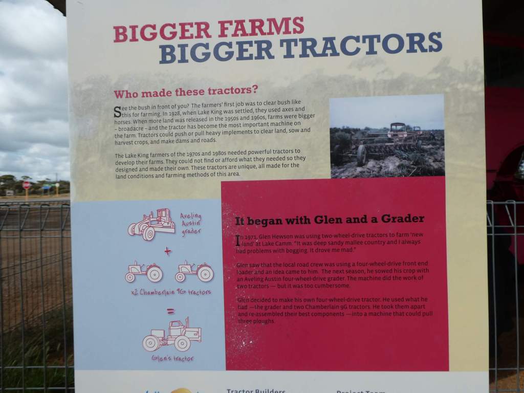
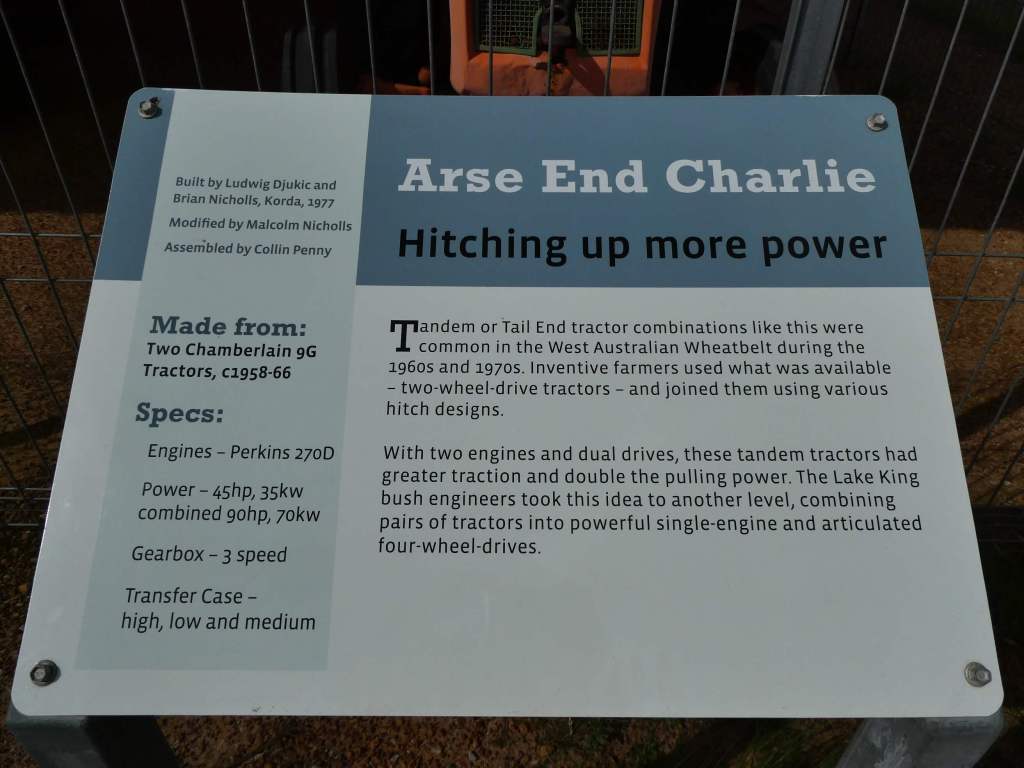
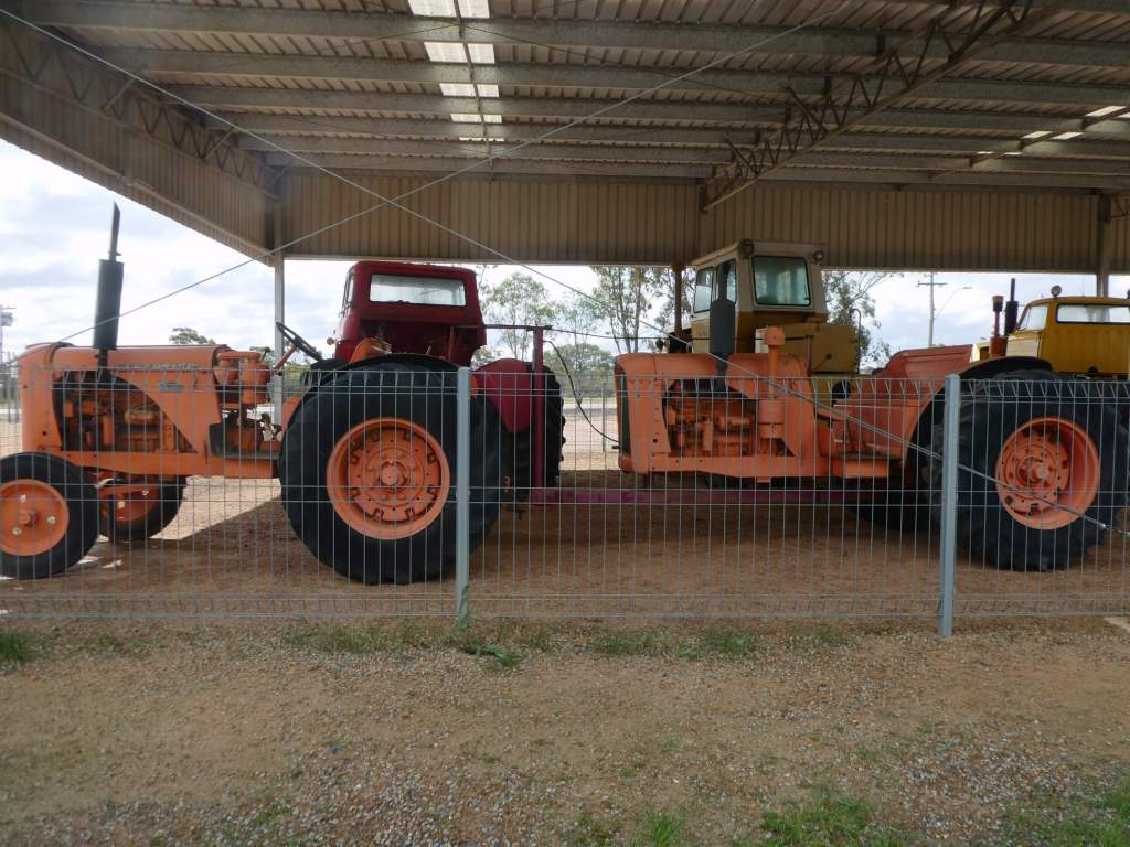
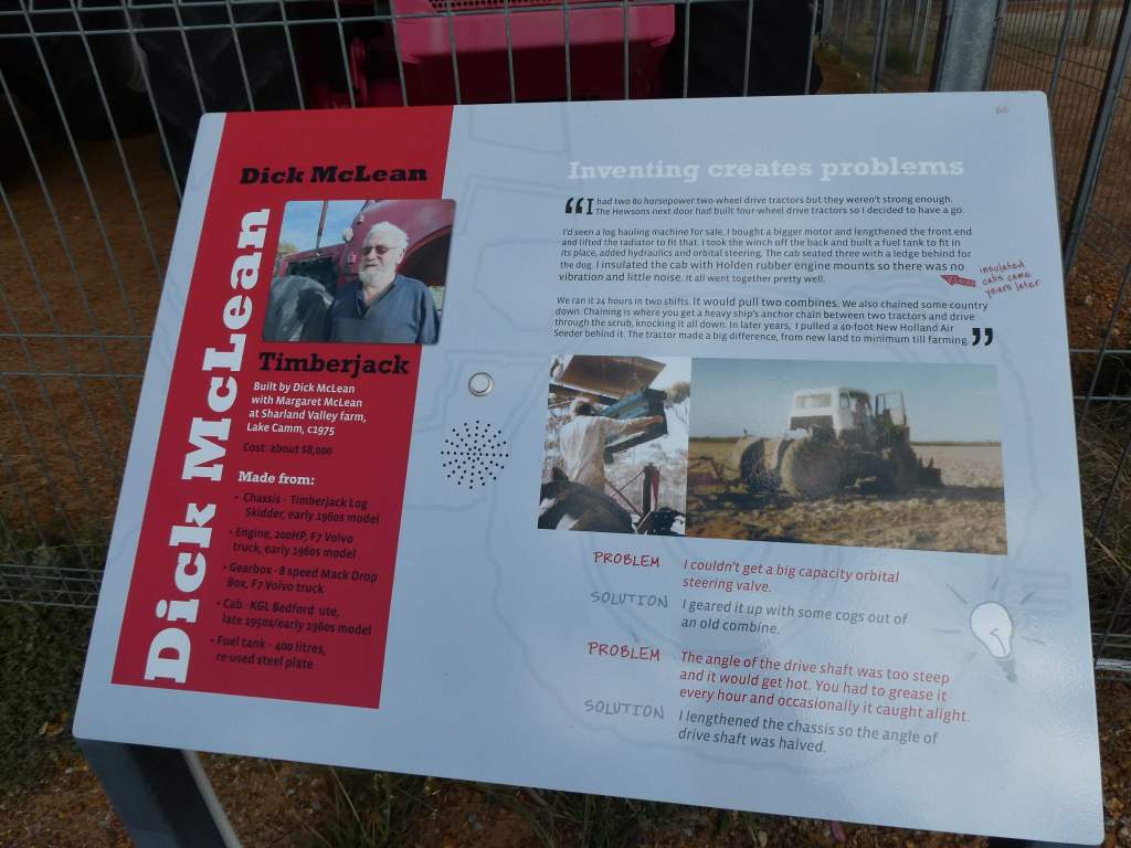
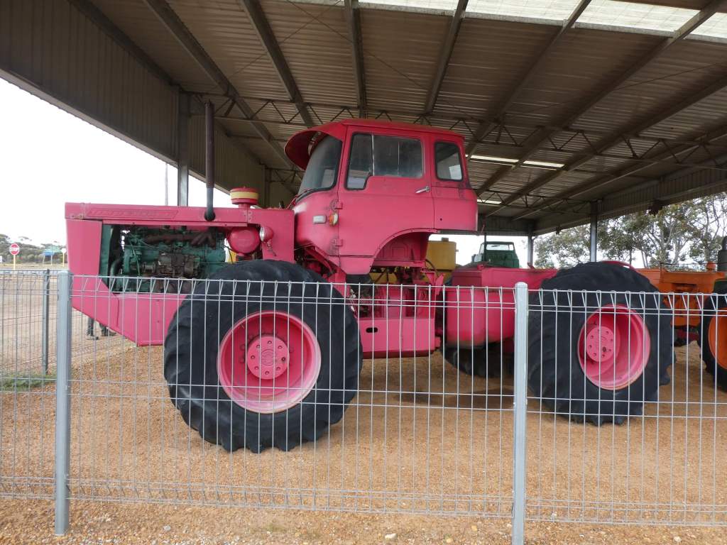
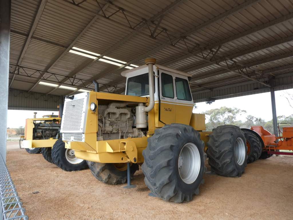
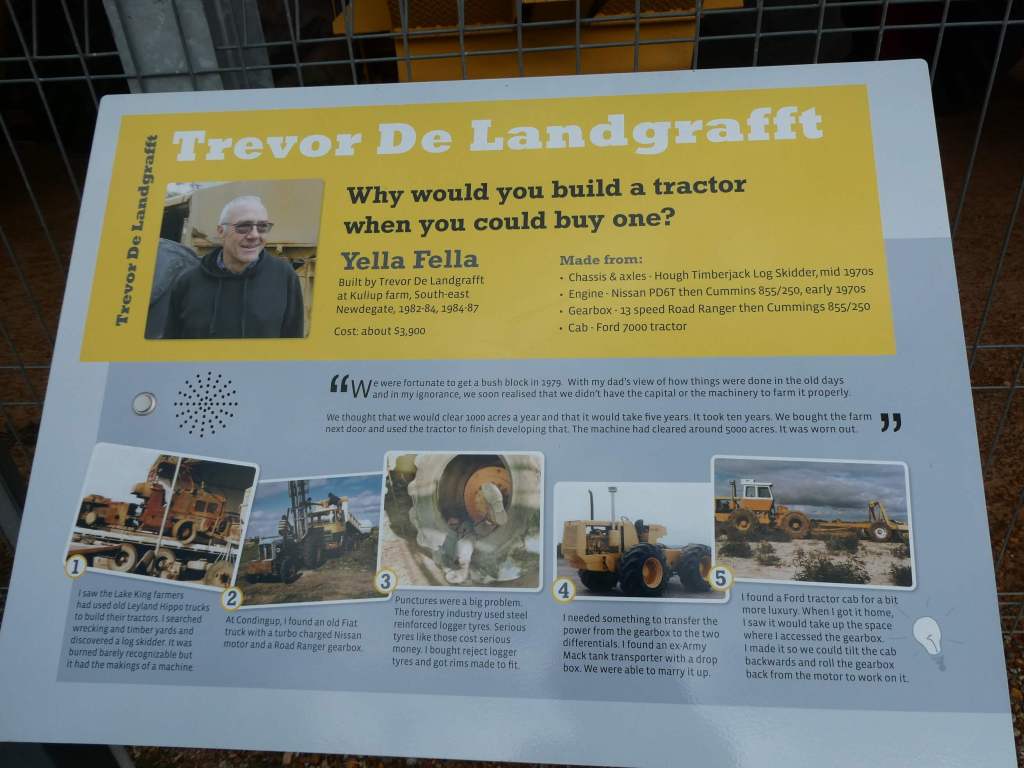
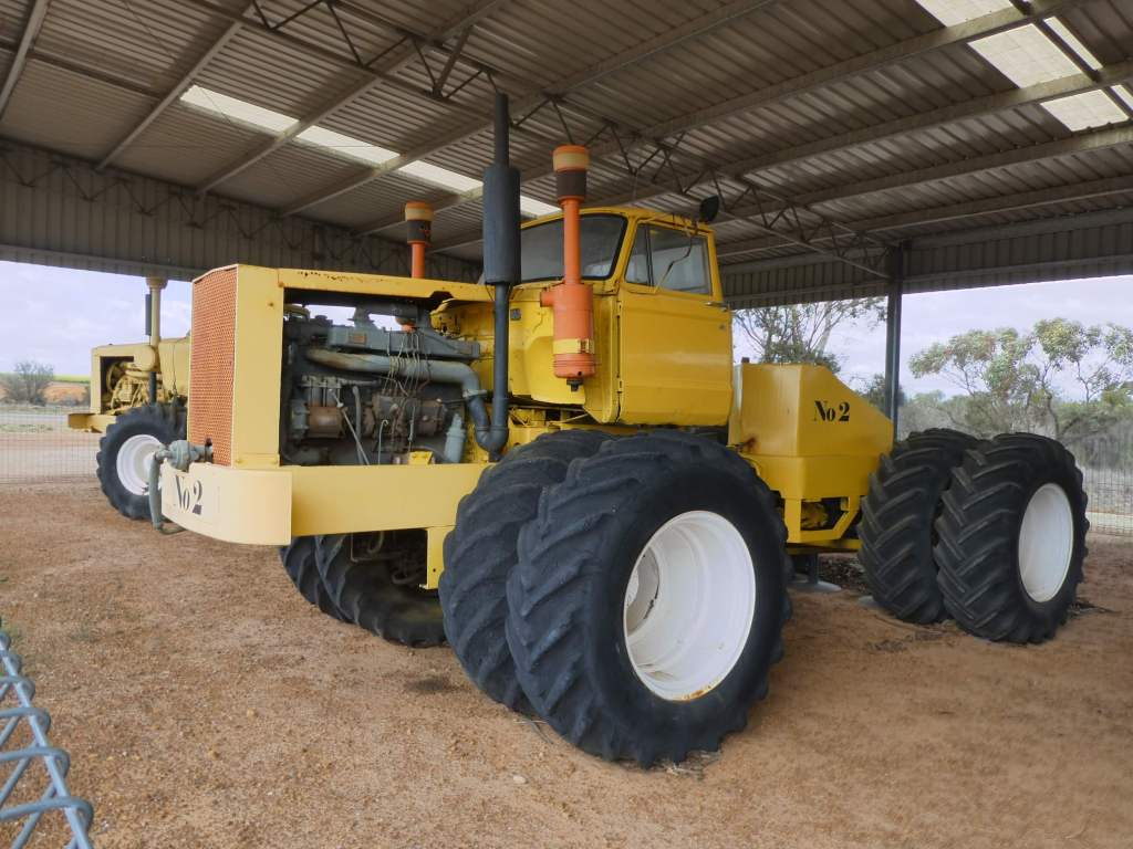
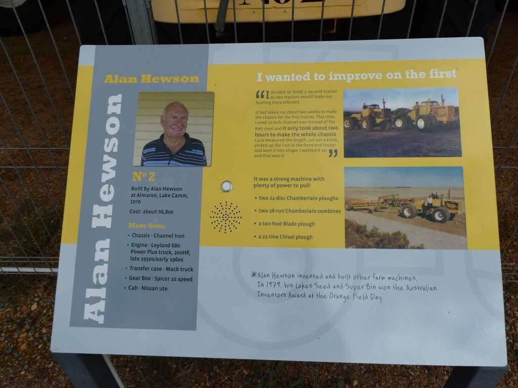
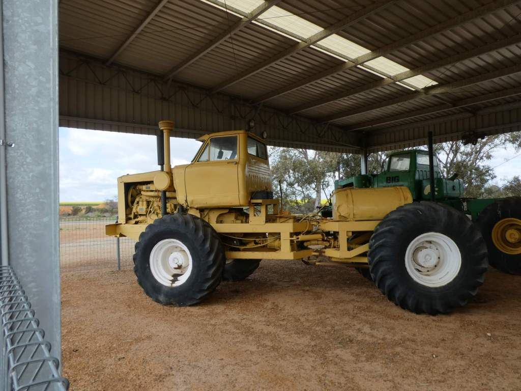
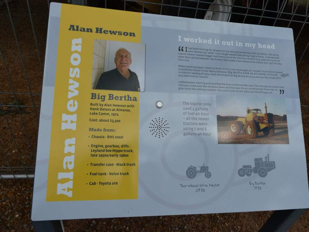
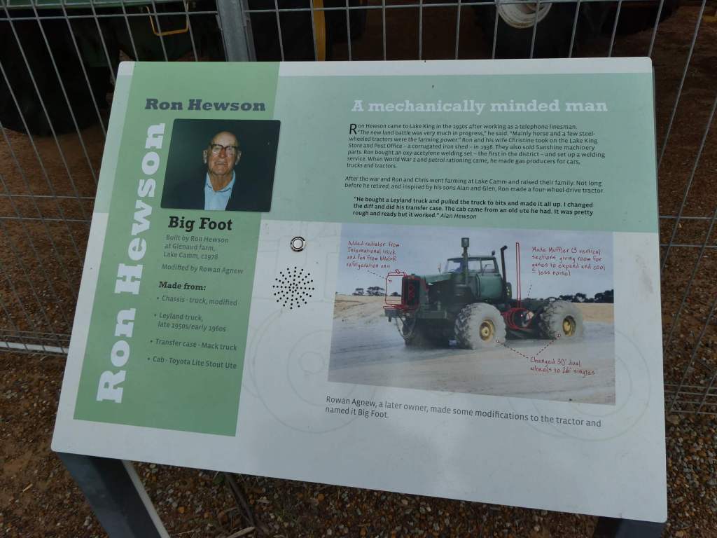
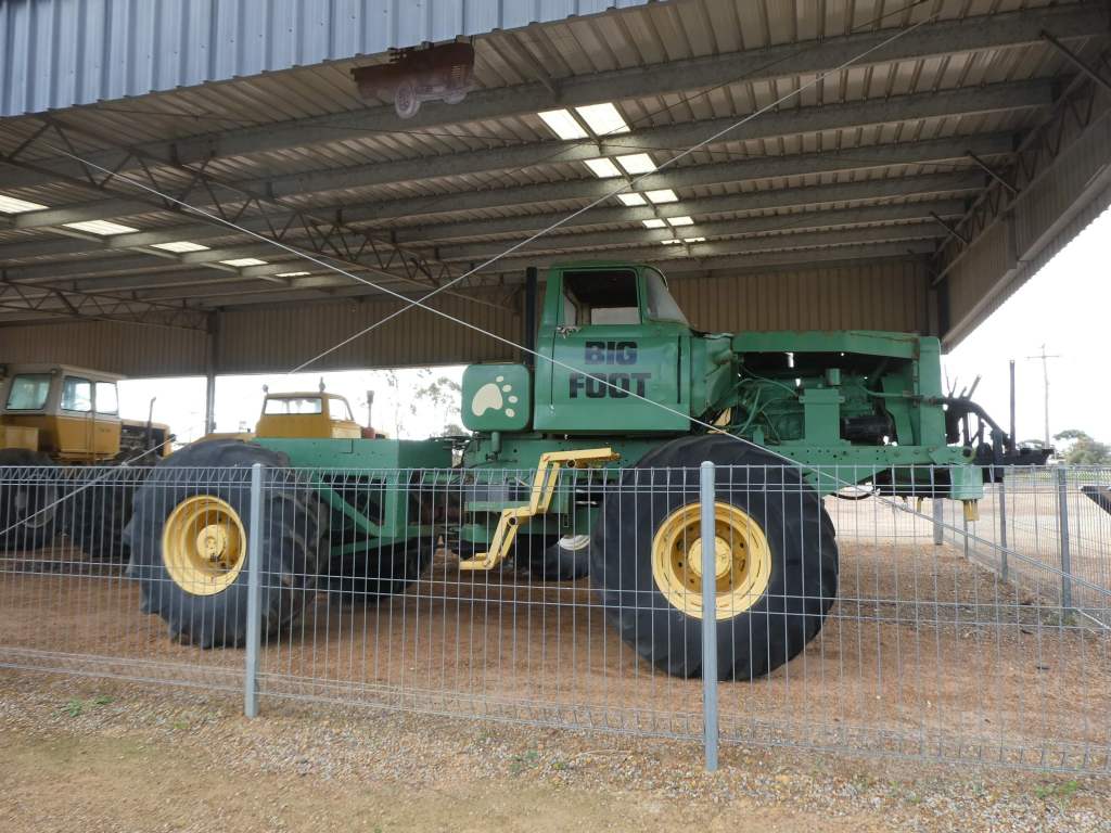
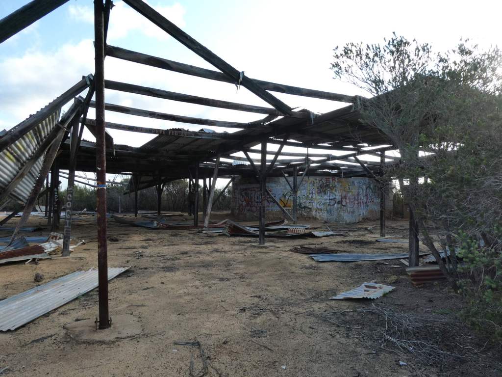
As we reached the corner in to Lake King we came across a little parking area with a display they were calling a Tractor Museum. This struck instant boredom into my heart, but Trevor was keen to go and have a bit of a look, so I conceded defeat and went along to read the signs. I am reluctant to let you know that I had to back-pedal in my opinion, as this was really well done and was actually a display of tractors made from bits melded together by some very tricky people. The farmers in this area were really short on money and needing larger tractors that could provide the pulling power that they needed. Take a look at what we found. It was really a fantastic demonstration of what intelligent and innovative people can do when they put their minds to it. For those of you not interested , I urge you to have a bit of a read and be struck with awe as I was. (I will never live it down).
We continued on to the little town of Lake King (with an excellent town toilet block where you can even have a hot shower!!) and made ourselves some lunch, stopping to eat it at a handy table before I headed over to the only shop to ask about the road. They were a little discouraging, not actually telling us not to take the road, but suggesting a better (longer) route and saying that the road may be impassable, but they were not sure, as they hadn’t heard anything in the last few days about it. This was not very helpful so we decided to think about it while we drove in the opposite direction to have a look at Lake King itself. We drove across a causeway through the middle of Lake King and stopped at the “lookout” to take a photo before heading back again. (not exciting)
By now we had decided to start on the road across and see how it went. The suggested turnoff was part way, so we thought we would go to there at least and then see what the road was like.
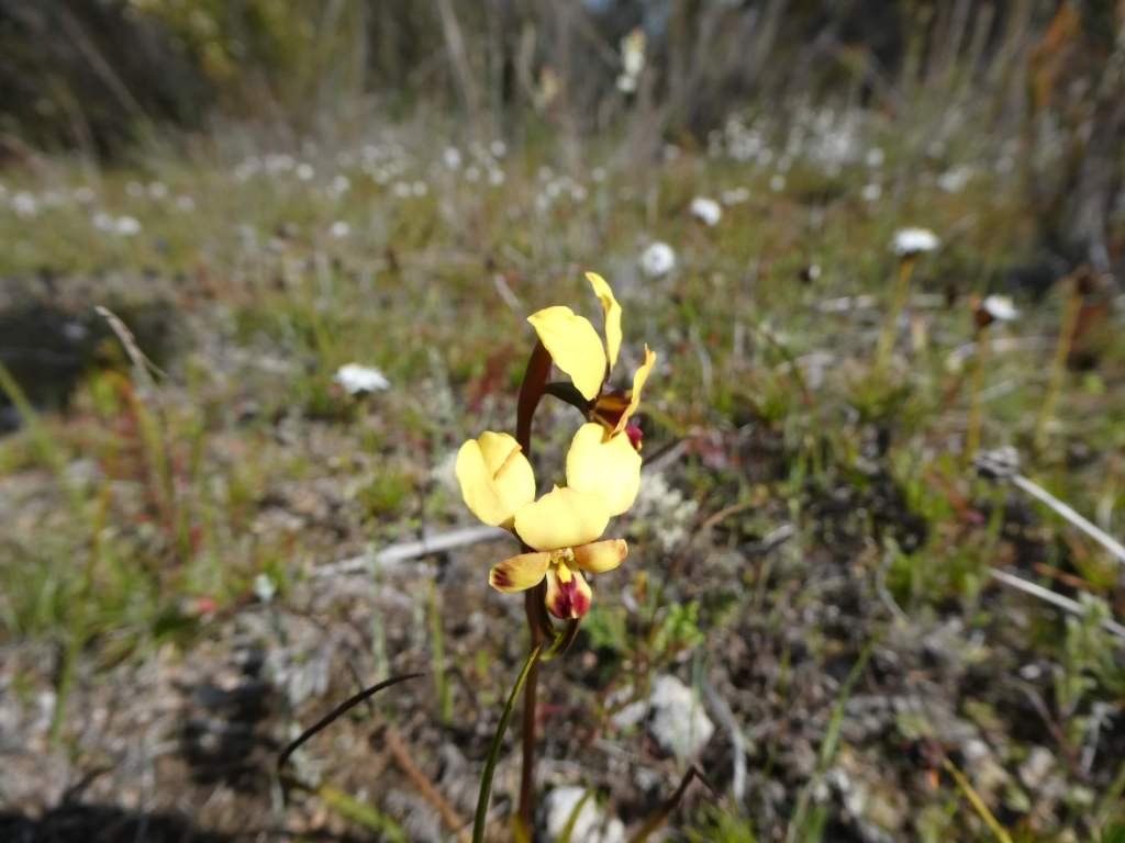
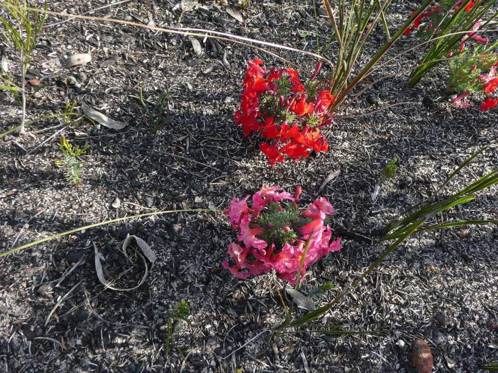
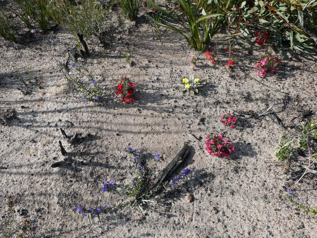
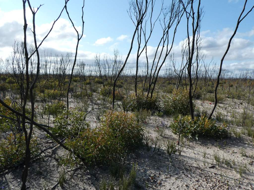
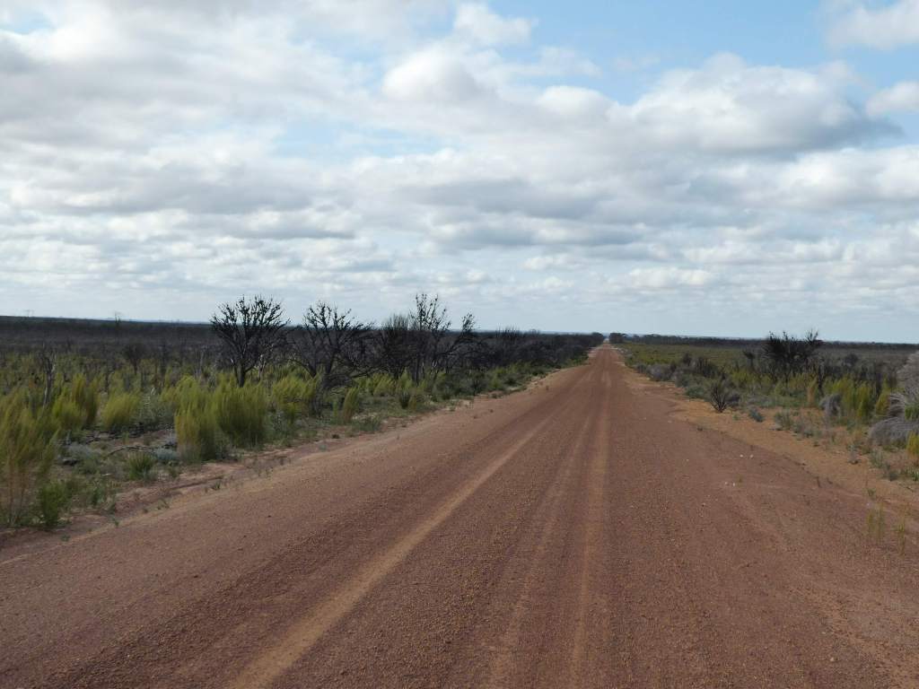
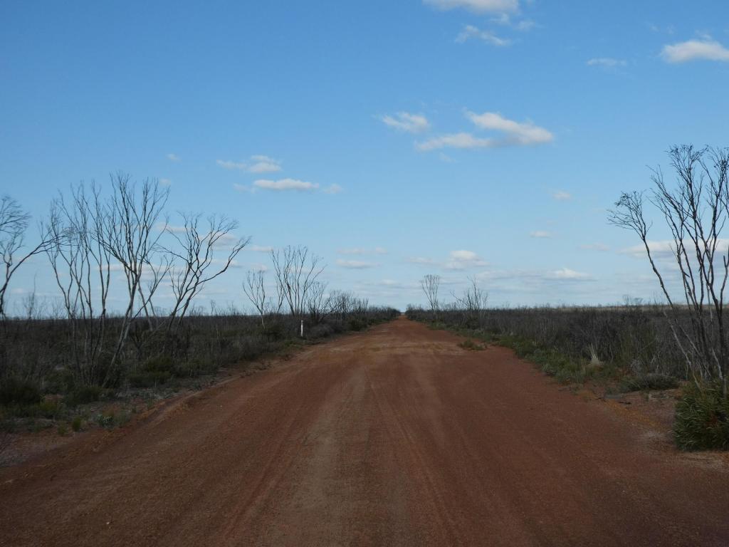
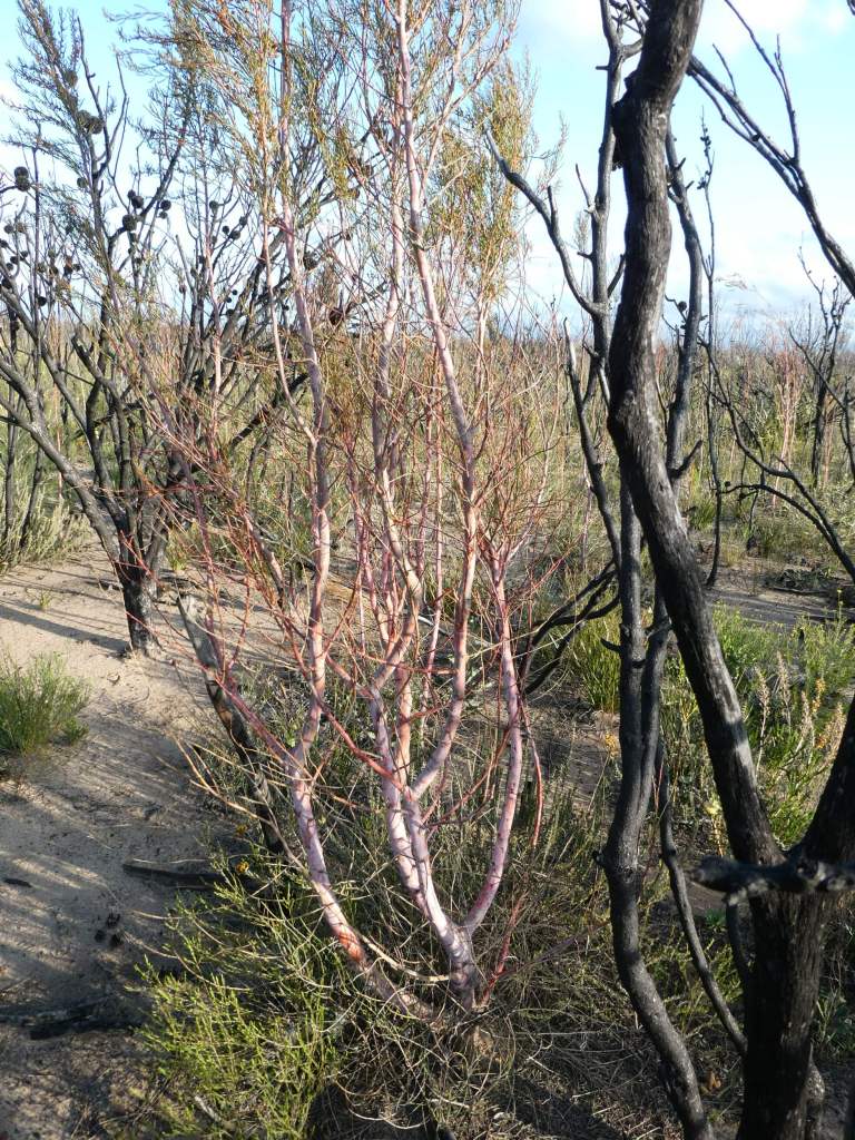
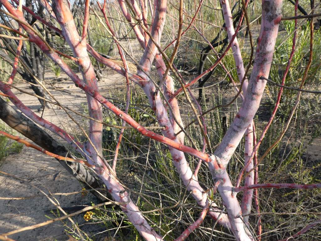
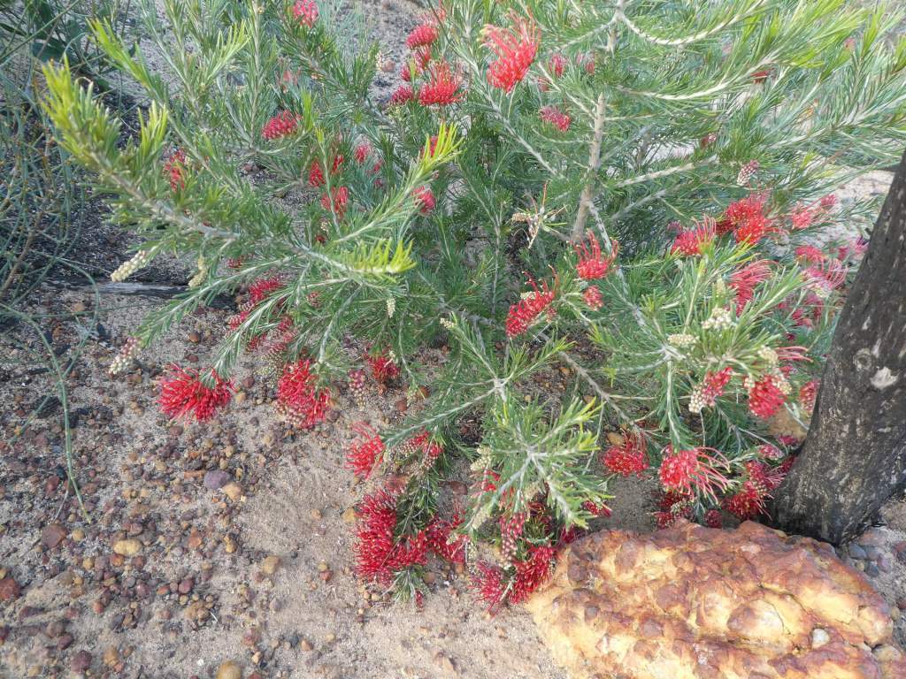
About 30km along the road we came to our decison point and the road didn’t look too bad, so we decided to go with our original thought and stick to the direct route across. The road was bad, but not awful. There were lots of sudden holes that we had to brake for unexpectedly, so the driver had to really be giving his best attention as he was getting tired, the wind was strong. There had been a big fire here at some stage, so the road was not a pretty one. Blackened tree trunks rose like spikes from vegetation about a metre high at most and there was a lot of bare ground where the undergrowth had been burnt and not recovered. There were still patches of colour and we stopped a number of times to take a look at the growth more closely.
The blackened and boring track.
As the day wore on and we started to get tired we noted an old tank on the map and hoped that we might find shelter there for the night. As we got closer we got more hopeful, as we saw that there was a large, high roof over the old tank, but then our hopes were dashed when we investigated more closely and found that the galv was loose or off, and the high wind was blowing it in a dangerous way and making a loud noise in the process (too loud to sleep through).
We opted to continue on our way once more. We could see the Peak Charles National Park ahead, with a campground shown and thought maybe we could stop in there if we could get to there and nothing else showed earlier. We were keeping a lookout on the side of the road for likely side tracks with shelter, but with the burnt countryside, patches of unburnt country were hard to find. We were getting heartily sick of the bumpy track, but happy that we had not yet been forced to turn back.
We ended up taking the extra 25km or so track (even worse) to get us to the Peak Charles camp ground.
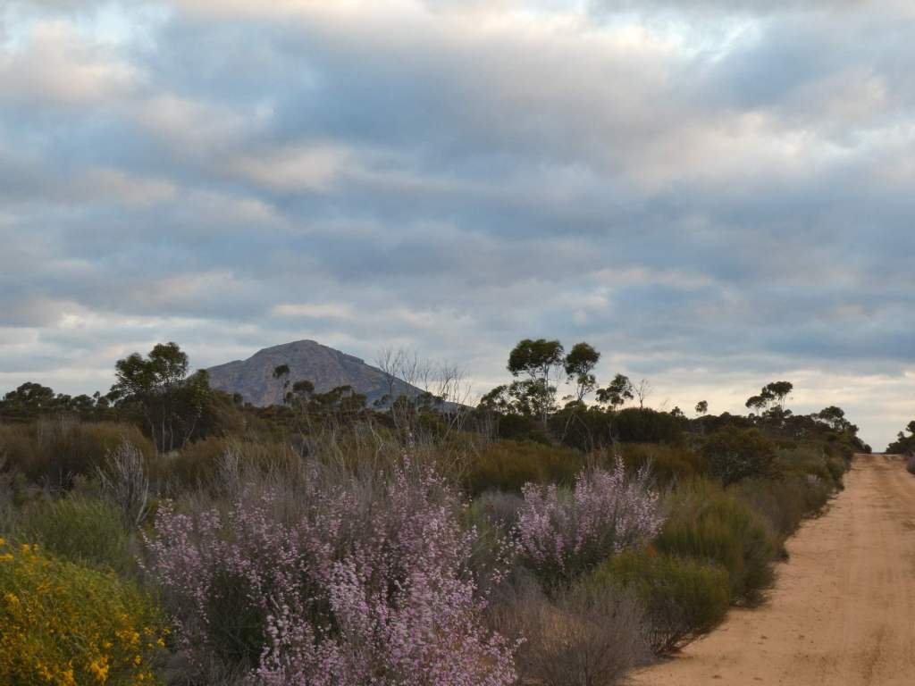
This is a tiny campground. There are about nine small marked camping spots around a central toilet and campfire area which sit under the shadow of the huge mountain. The wind was gusting still, and our small fire was blowing a lot until we just let it go out. We had a couple of fellow campers, one of whom came over briefly for a chat. We ate, and were tuckered out well and truly, so flopped into bed as soon as we could.
